
50 Q
3rd - 5th
15 Q
3rd - Uni

12 Q
4th - 6th
12 Q
4th - 6th

10 Q
3rd - 5th
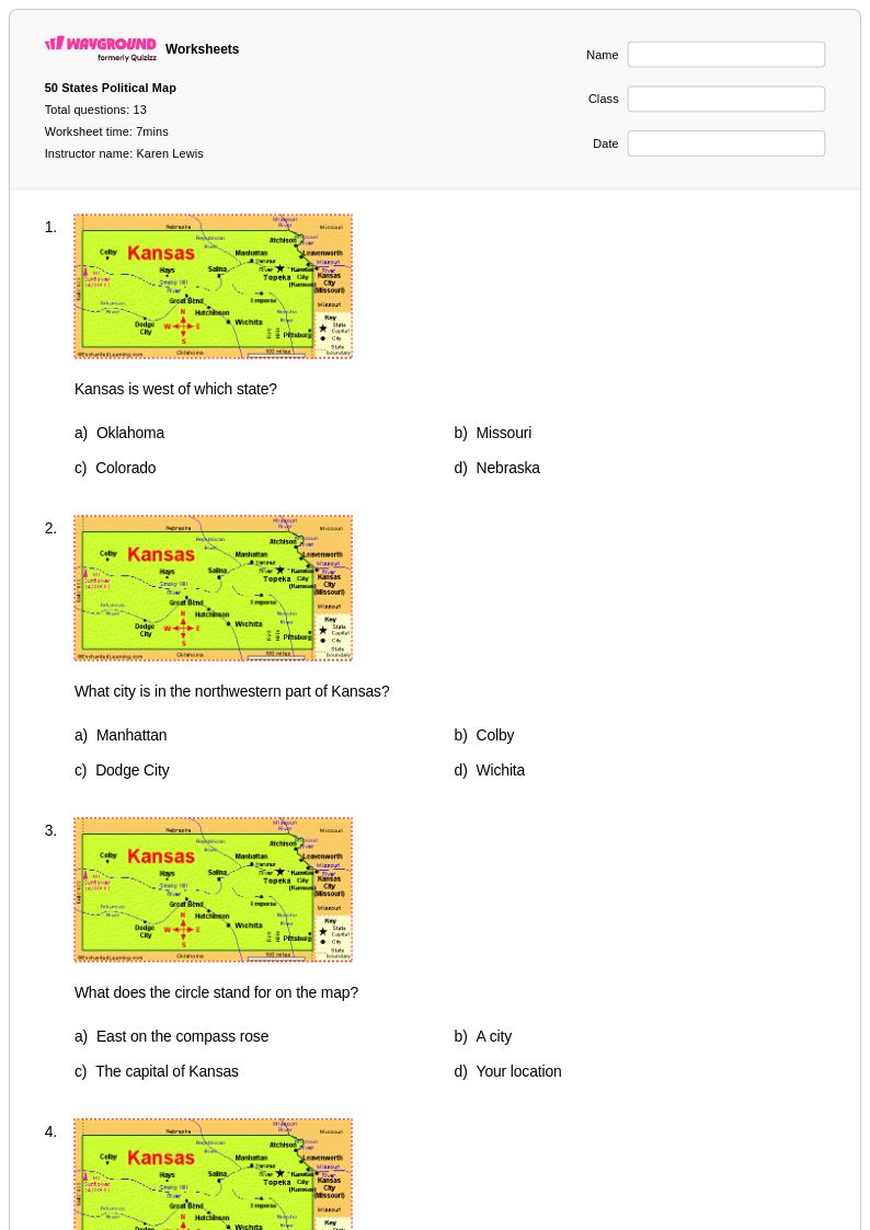
13 Q
4th
13 Q
4th
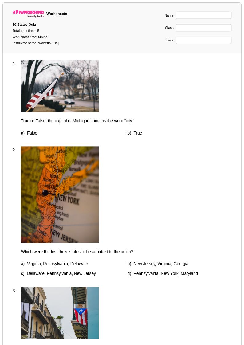
5 Q
2nd - 5th
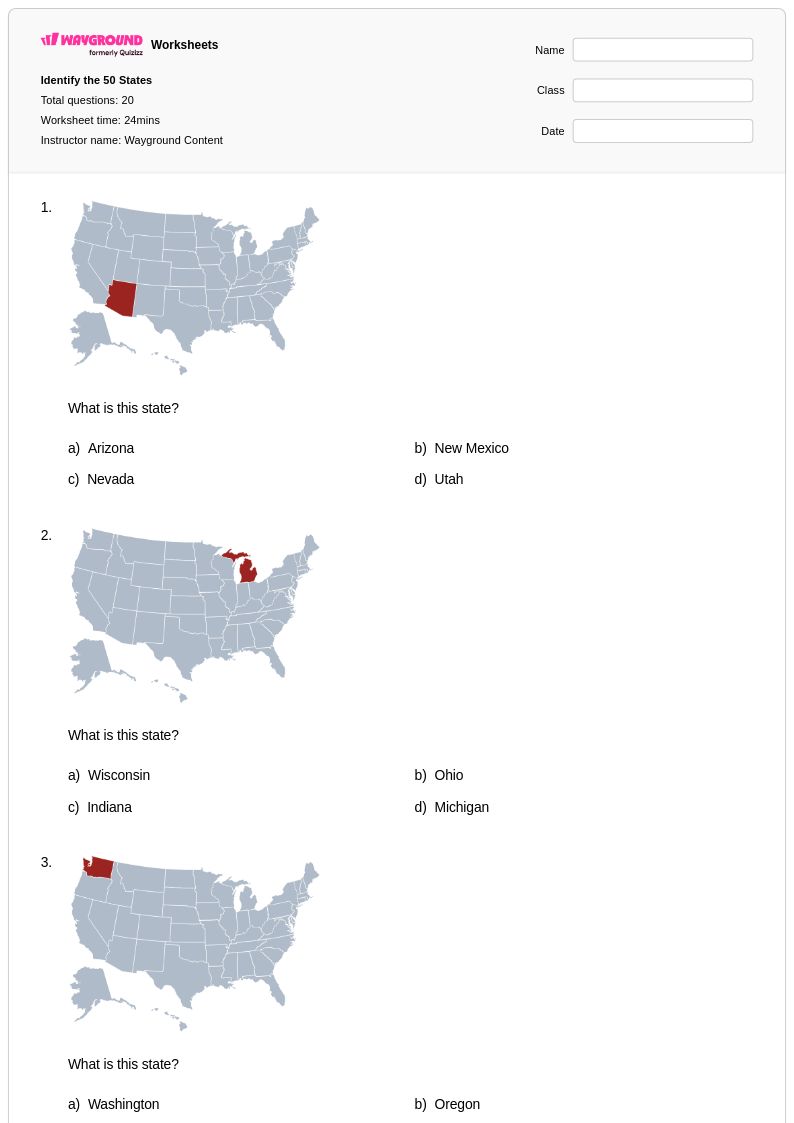
20 Q
3rd - Uni
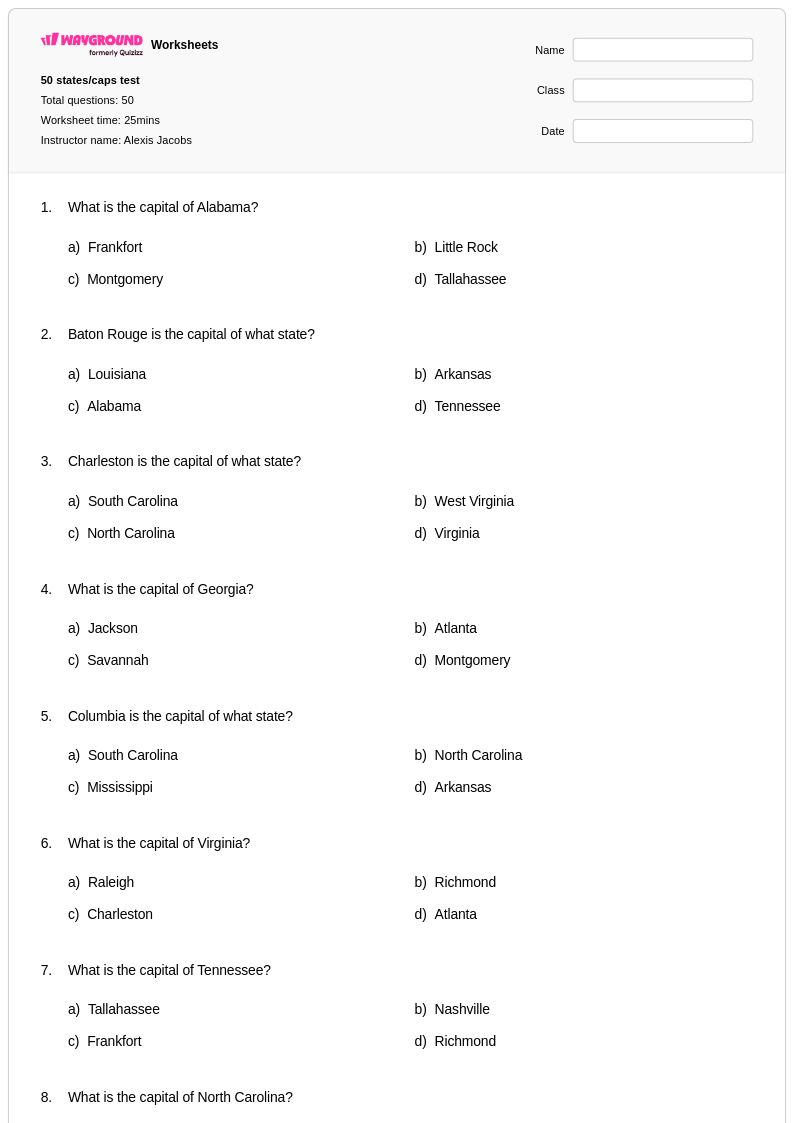
50 Q
3rd - 5th
12 Q
4th - 6th

12 Q
4th - 6th
9 Q
3rd - 8th
20 Q
4th - 6th
50 Q
2nd - 5th
50 Q
4th
11 Q
4th
15 Q
3rd - 5th
15 Q
3rd - 5th
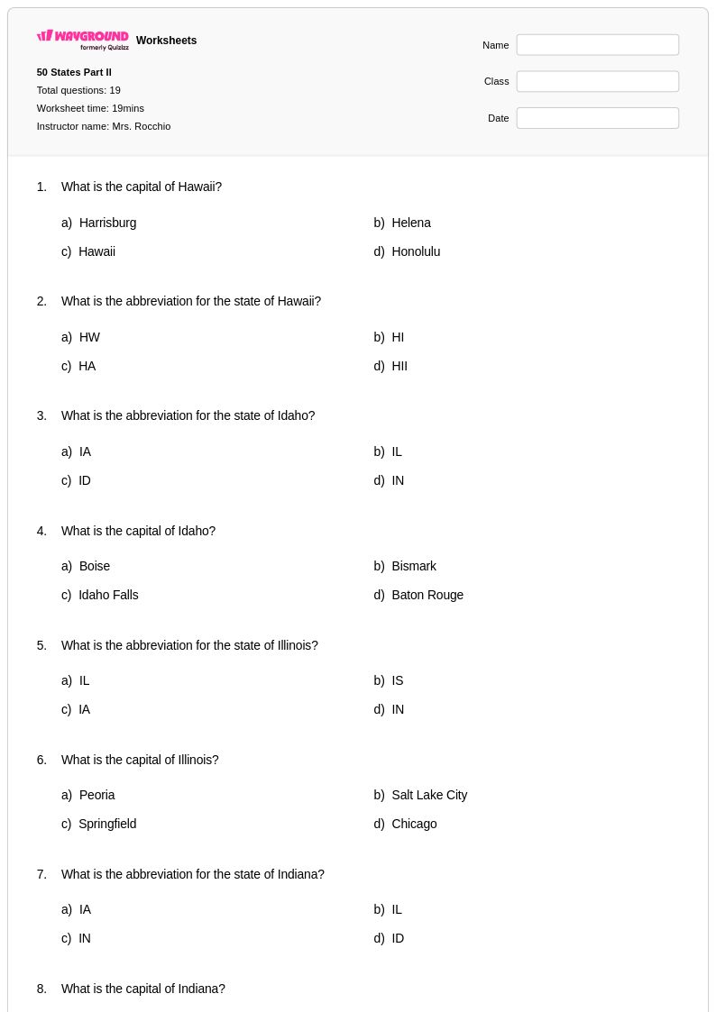
19 Q
4th
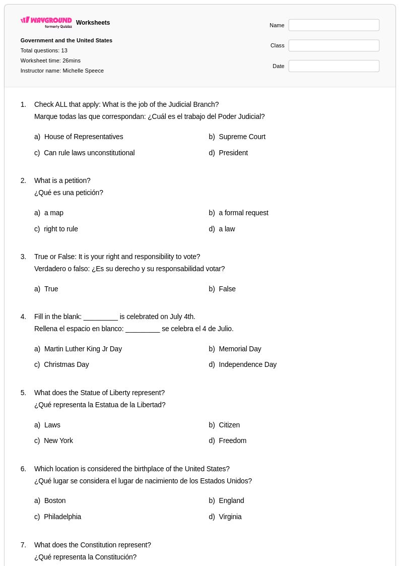
13 Q
4th
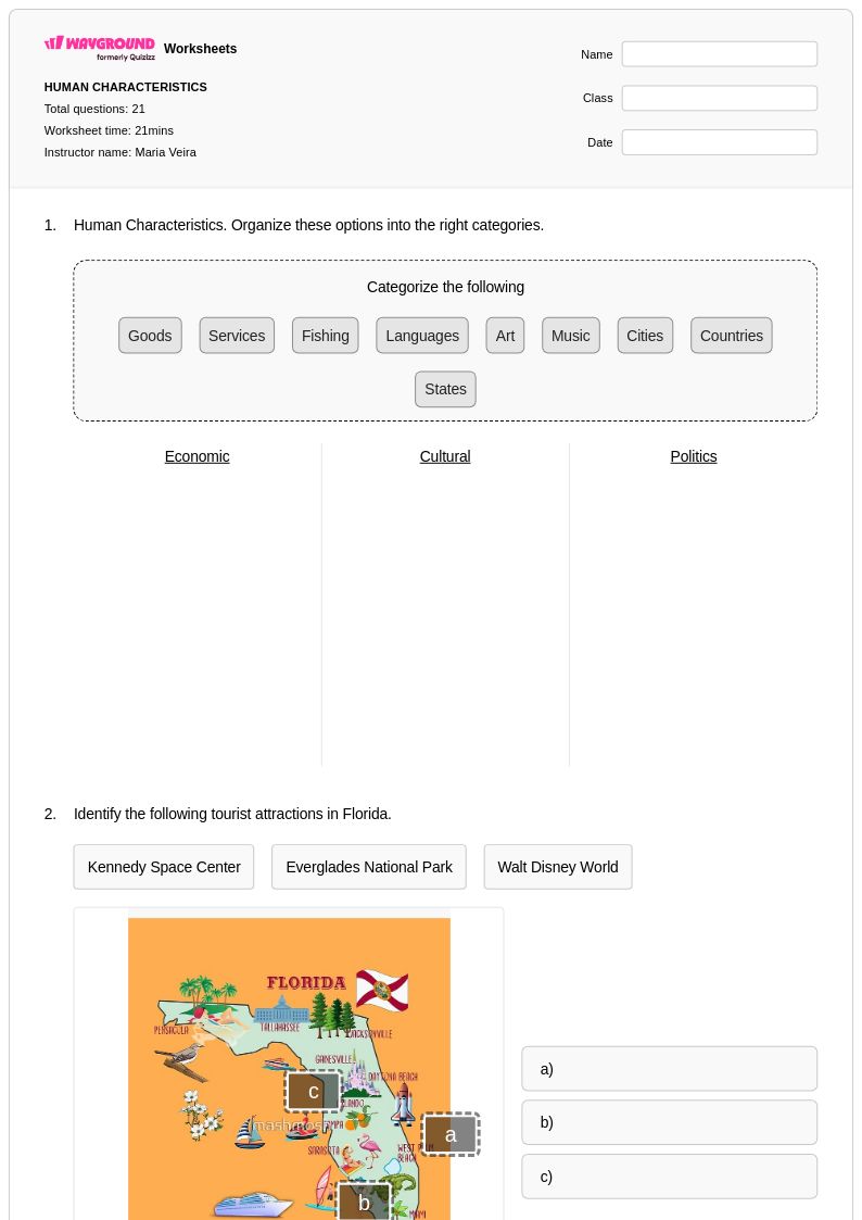
21 Q
4th
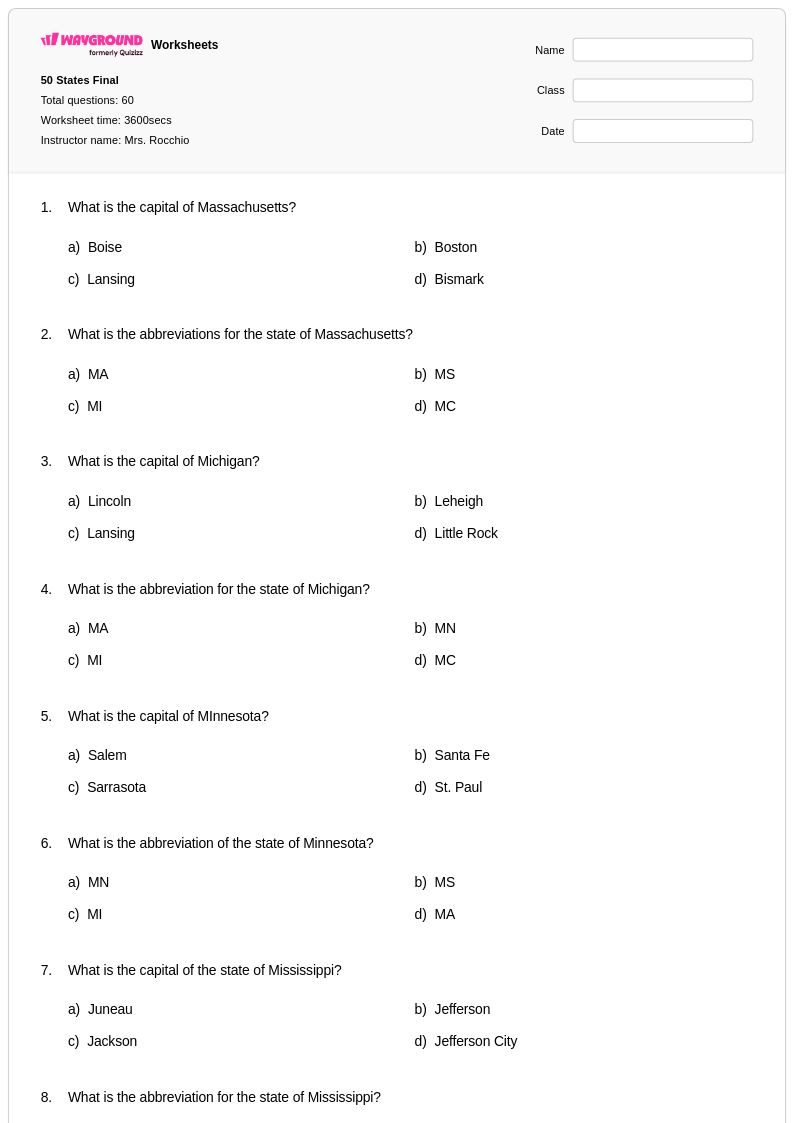
60 Q
4th
50 Q
4th
Explore Other Subject Worksheets for class 4
Explore printable 50 States worksheets for Class 4
Class 4 students develop essential geographic literacy through comprehensive 50 States worksheets available through Wayground (formerly Quizizz), designed to build foundational knowledge of American geography. These expertly crafted resources strengthen critical skills including state identification, capital recognition, regional classification, and spatial reasoning while introducing students to key geographic concepts such as physical features, climate patterns, and cultural characteristics across the United States. The collection includes diverse practice problems that challenge students to locate states on maps, match capitals with their corresponding states, and explore the unique attributes that define each region, with complete answer keys provided to support independent learning and self-assessment. These free printable resources offer engaging formats that transform geographic learning into interactive experiences, helping fourth-grade students develop the spatial awareness and factual knowledge essential for understanding their nation's diverse landscape.
Wayground (formerly Quizizz) empowers educators with millions of teacher-created 50 States worksheets specifically aligned with Class 4 geography standards, providing robust search and filtering capabilities that enable quick identification of resources matching specific learning objectives and skill levels. The platform's differentiation tools allow teachers to customize content complexity, ensuring appropriate challenge levels for diverse learners while supporting both remediation for struggling students and enrichment opportunities for advanced geographic thinkers. These versatile resources are available in both printable PDF formats for traditional classroom use and digital formats for technology-integrated instruction, giving educators flexibility in delivery methods while maintaining consistent quality and standards alignment. The comprehensive collection supports strategic lesson planning by offering varied question types, visual elements, and assessment formats that facilitate ongoing skill practice, formative evaluation, and targeted intervention in geographic knowledge development.
FAQs
How do I teach students all 50 states and capitals?
What worksheets help students practice identifying states on a map?
What are common mistakes students make when learning the 50 states?
How can I differentiate 50 states instruction for students at different levels?
How do I use 50 States worksheets from Wayground in my classroom?
How do I help students who keep mixing up state capitals?