Free Printable Climate Zones Worksheets for Class 6
Class 6 climate zones worksheets from Wayground help students explore Earth's major climate regions through engaging printables, practice problems, and comprehensive answer keys for effective geography learning.
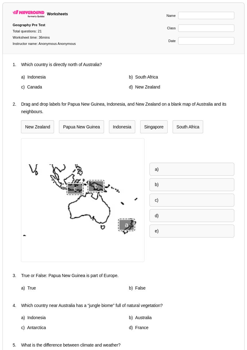
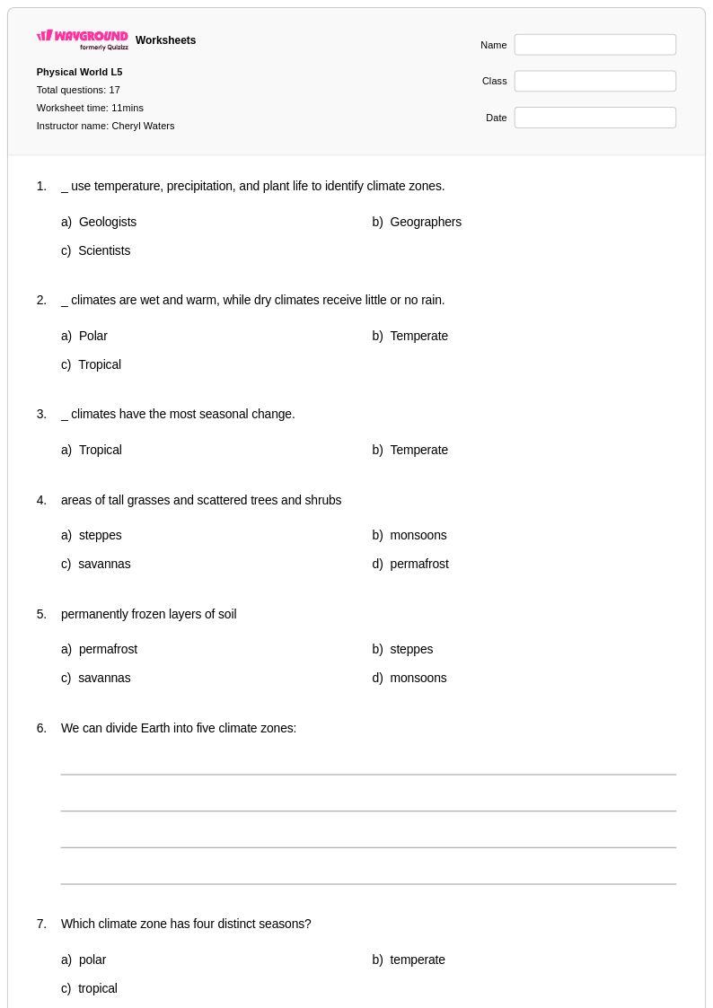
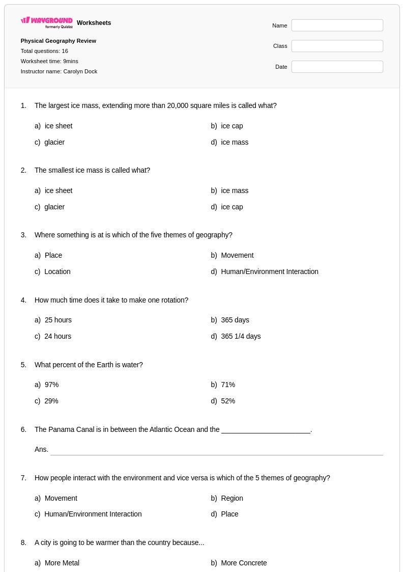
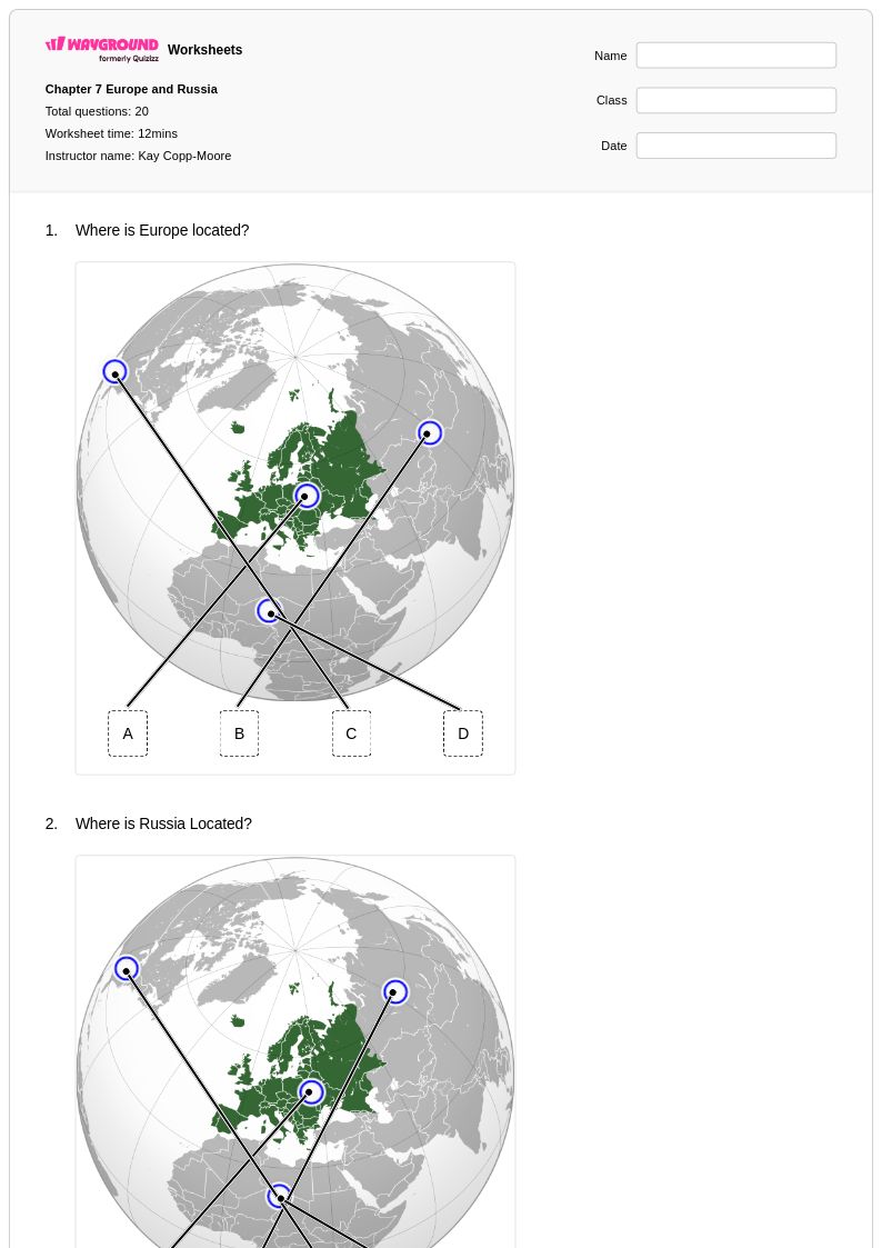
Explore printable Climate Zones worksheets for Class 6
Climate zones worksheets for Class 6 students available through Wayground (formerly Quizizz) provide comprehensive educational resources that help young geographers understand the fundamental patterns of Earth's climate systems. These carefully designed worksheets guide sixth-grade learners through the identification and characteristics of major climate zones, including tropical, temperate, polar, and arid regions, while strengthening critical thinking skills about how latitude, altitude, and geographic features influence weather patterns. Students engage with practice problems that require them to analyze climate data, interpret maps, and make connections between climate zones and human settlement patterns. Each worksheet comes with a detailed answer key to support independent learning, and these free printables offer educators flexible options for both classroom instruction and homework assignments that reinforce essential geographic concepts.
Wayground (formerly Quizizz) empowers teachers with access to millions of educator-created climate zone resources that streamline lesson planning and differentiate instruction for diverse learning needs. The platform's robust search and filtering capabilities allow educators to quickly locate worksheets aligned with specific standards and grade-level expectations, while customization tools enable teachers to modify content for remediation or enrichment purposes. These versatile materials are available in both printable pdf format and interactive digital versions, giving instructors the flexibility to adapt their teaching approach based on classroom technology and student preferences. Teachers can efficiently organize skill practice sessions, assess student understanding of climate zone concepts, and provide targeted support through the platform's comprehensive collection of differentiated worksheets that address varying ability levels and learning styles within the Class 6 classroom.
FAQs
How do I teach climate zones to middle school students?
Start by grounding students in the three major climate zone categories — tropical, temperate, and polar — before introducing subcategories like arid and continental. Use latitude and solar energy as the anchoring explanation, then layer in geographic factors like elevation, ocean currents, and mountain ranges to show why climate varies even within the same latitude band. Climate graphs and world maps are especially effective tools for building visual understanding of how temperature and precipitation patterns define each zone.
What activities help students practice identifying climate zones?
The most effective practice activities ask students to classify regions using real temperature and precipitation data rather than simply memorizing zone names. Climate graph analysis, map labeling tasks, and data-interpretation exercises that connect geographic features to climate outcomes all build the analytical skills students need. These tasks mirror the kinds of reasoning students encounter on standardized assessments and reinforce the ability to apply zone criteria flexibly across unfamiliar examples.
What mistakes do students commonly make when classifying climate zones?
The most common error is treating latitude as the only determinant of climate, which leads students to misclassify coastal, high-altitude, or rain-shadow regions that do not fit the expected pattern for their latitude. Students also frequently confuse weather with climate, applying short-term conditions to long-term zone classifications. A targeted misconception is conflating arid and polar climates as both being 'cold and dry,' when the underlying causes and temperature profiles are quite different.
How do climate zones worksheets connect to human geography topics?
Climate zones directly shape where and how humans settle, which makes them a natural bridge between physical and human geography. Worksheets that ask students to analyze relationships between climate characteristics and settlement patterns, agricultural practices, or population density help students see climate as a driver of human decision-making rather than an isolated physical concept. This cross-disciplinary framing also strengthens reading and data analysis skills in a geographic context.
How do I use Wayground's climate zones worksheets in my classroom?
Wayground's climate zones worksheets are available as downloadable printable PDFs for traditional classroom use and in digital formats for technology-integrated instruction, giving teachers flexibility to assign them as independent practice, guided review, or homework. Teachers can also host worksheets directly as a quiz on Wayground, allowing students to complete work online while the platform tracks responses. Each worksheet includes a complete answer key, which supports self-paced study, peer review, or efficient teacher grading.
How can I differentiate climate zones instruction for students at different skill levels?
For students who need support, reduce the complexity of data sets used in classification tasks and focus on the three broad zone categories before introducing subcategories. For advanced learners, introduce climate anomalies caused by ocean currents or orographic lift and ask students to explain deviations from expected patterns. On Wayground, teachers can apply accommodations such as reduced answer choices, extended time, and read-aloud support to individual students, making it straightforward to address varied needs without disrupting the rest of the class.