Free Printable Northeast States Worksheets for Class 4
Explore Wayground's free Class 4 Northeast States geography worksheets and printables that help students master regional knowledge through engaging practice problems and comprehensive answer keys in downloadable PDF format.
Explore printable Northeast States worksheets for Class 4
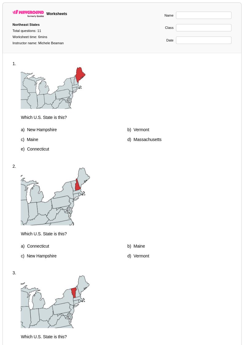
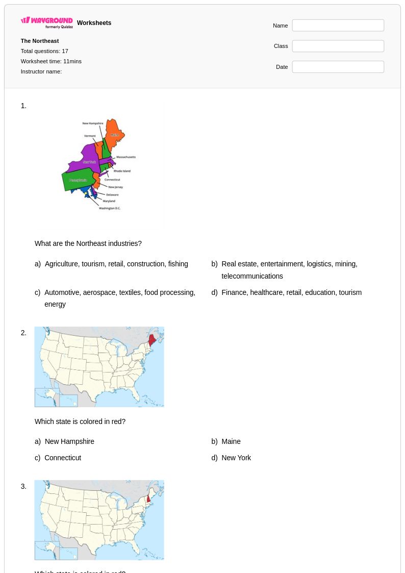
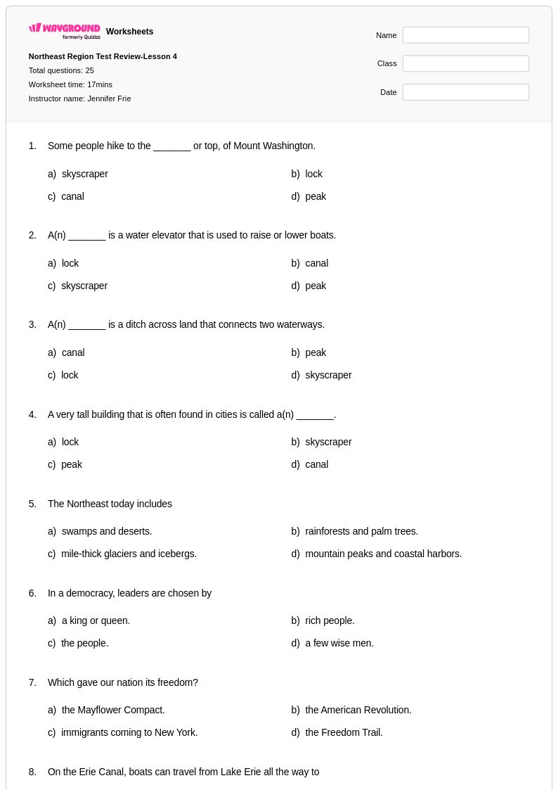
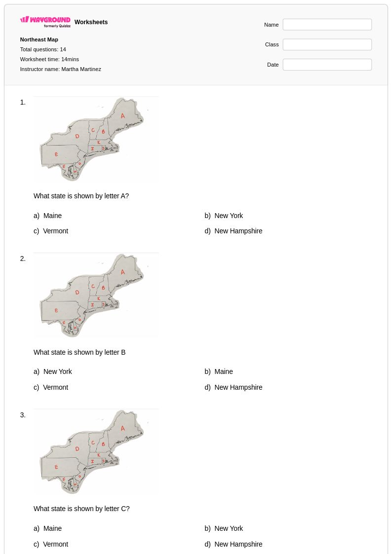
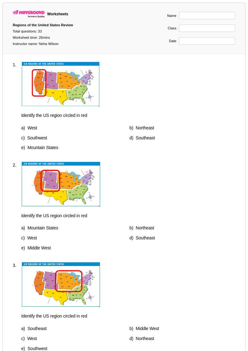
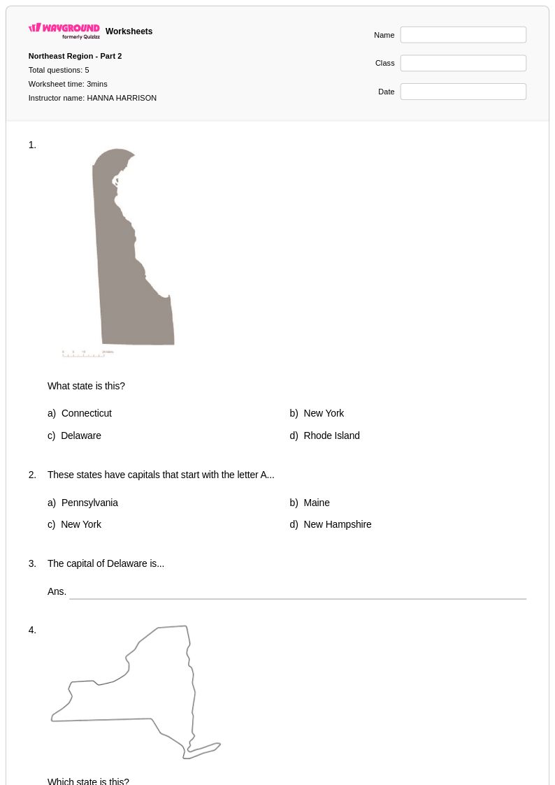
Class 4 Northeast States worksheets available through Wayground (formerly Quizizz) provide comprehensive coverage of the northeastern region's geography, helping students master essential map skills, state identification, and regional characteristics. These carefully designed printables strengthen students' ability to locate and identify the eleven Northeast states, understand their capitals, major cities, and distinctive geographical features including mountain ranges, rivers, and coastal areas. The worksheet collection includes practice problems that challenge fourth graders to analyze regional climate patterns, natural resources, and economic activities while building foundational knowledge about state boundaries and relative locations. Each worksheet comes with a complete answer key and is available as a free pdf download, making it easy for educators to incorporate targeted geography practice into their social studies curriculum.
Wayground's extensive library of teacher-created Northeast States resources supports educators with millions of high-quality materials designed specifically for Class 4 geography instruction. The platform's robust search and filtering capabilities allow teachers to quickly locate worksheets that align with state social studies standards and match their students' specific learning needs. These differentiation tools enable educators to customize content for various skill levels, providing both remediation support for struggling learners and enrichment opportunities for advanced students. The flexible format options, including printable pdf versions and digital interactive materials, accommodate diverse classroom environments and teaching styles. Teachers can seamlessly integrate these resources into lesson planning, use them for skill-building practice sessions, or deploy them as assessment tools to gauge student understanding of Northeast regional geography concepts.
FAQs
How do I teach the Northeast states to elementary or middle school students?
Teaching the Northeast states is most effective when you anchor instruction in spatial reasoning — start with a blank regional map and have students locate and label each state before introducing capitals and geographic features. Layering content progressively, from physical geography to historical significance to economic activity, helps students build a coherent mental model of the region rather than memorizing disconnected facts. Connecting landmarks like the Appalachian Mountains or the Great Lakes to settlement and trade patterns gives students a framework for understanding why the Northeast developed the way it did.
What exercises help students practice identifying the Northeast states and their capitals?
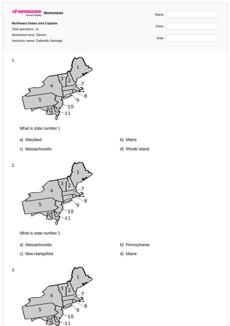
Map labeling exercises are the most effective practice format for the Northeast states because they require active recall rather than recognition. Students benefit from repeated exposure through fill-in-the-blank state and capital matching, blank map activities where they locate states from memory, and cumulative review that reintroduces previously learned states alongside new ones. Rotating between different exercise types across multiple sessions builds both fluency and retention for a region where many state boundaries are small and closely clustered.
What do students commonly get wrong when learning the Northeast states?
The most frequent errors involve the six New England states — Maine, Vermont, New Hampshire, Massachusetts, Rhode Island, and Connecticut — because their borders are compact and their relative positions are easy to confuse. Students also commonly misplace Pennsylvania and New York, underestimating how far west these states extend. Confusing state names with city names (e.g., New York the state vs. New York City) is another persistent misconception that benefits from explicit instruction and visual reinforcement.
How do I use Northeast States worksheets in my classroom?
Northeast States worksheets on Wayground are available as printable PDFs for traditional classroom use and in digital formats for technology-integrated environments, including the option to host them as a quiz on Wayground. Printable versions work well for independent practice, map labeling activities, and homework assignments, while digital formats allow for immediate feedback during class. All worksheets include complete answer keys, making them practical for self-paced work, peer review, or teacher-led correction. Wayground also supports student-level accommodations such as read aloud, extended time, and reduced answer choices, which can be applied individually so all learners can access the same geographic content.
How do I differentiate Northeast States instruction for students at different skill levels?
For students who are still developing map literacy, reduce the cognitive load by starting with a word bank and a partially labeled map before moving to full recall tasks. More advanced students can extend their learning by analyzing how geographic features like the Atlantic coastline or the Appalachian range influenced historical migration, industrialization, and trade across the Northeast. On Wayground, teachers can apply individual accommodations — including reduced answer choices and read aloud — to specific students without disrupting the experience for the rest of the class, making differentiation manageable within a single assignment.
How do Northeast States worksheets connect to broader social studies standards?
Northeast States geography is a foundational component of U.S. regional geography standards and connects directly to content in U.S. history, civics, and economics. Understanding state locations, capitals, and geographic features supports map reading skills that appear across grade levels and standardized assessments. The Northeast's historical role in early American settlement, the Industrial Revolution, and immigration also makes it a natural entry point for interdisciplinary connections to history and culture coursework.