Free Printable Virginia Regions Worksheets for Class 4
Class 4 Virginia Regions worksheets and printables help students explore the Commonwealth's diverse geographical areas through engaging practice problems, free PDF activities, and comprehensive answer keys for effective social studies learning.
Explore printable Virginia Regions worksheets for Class 4
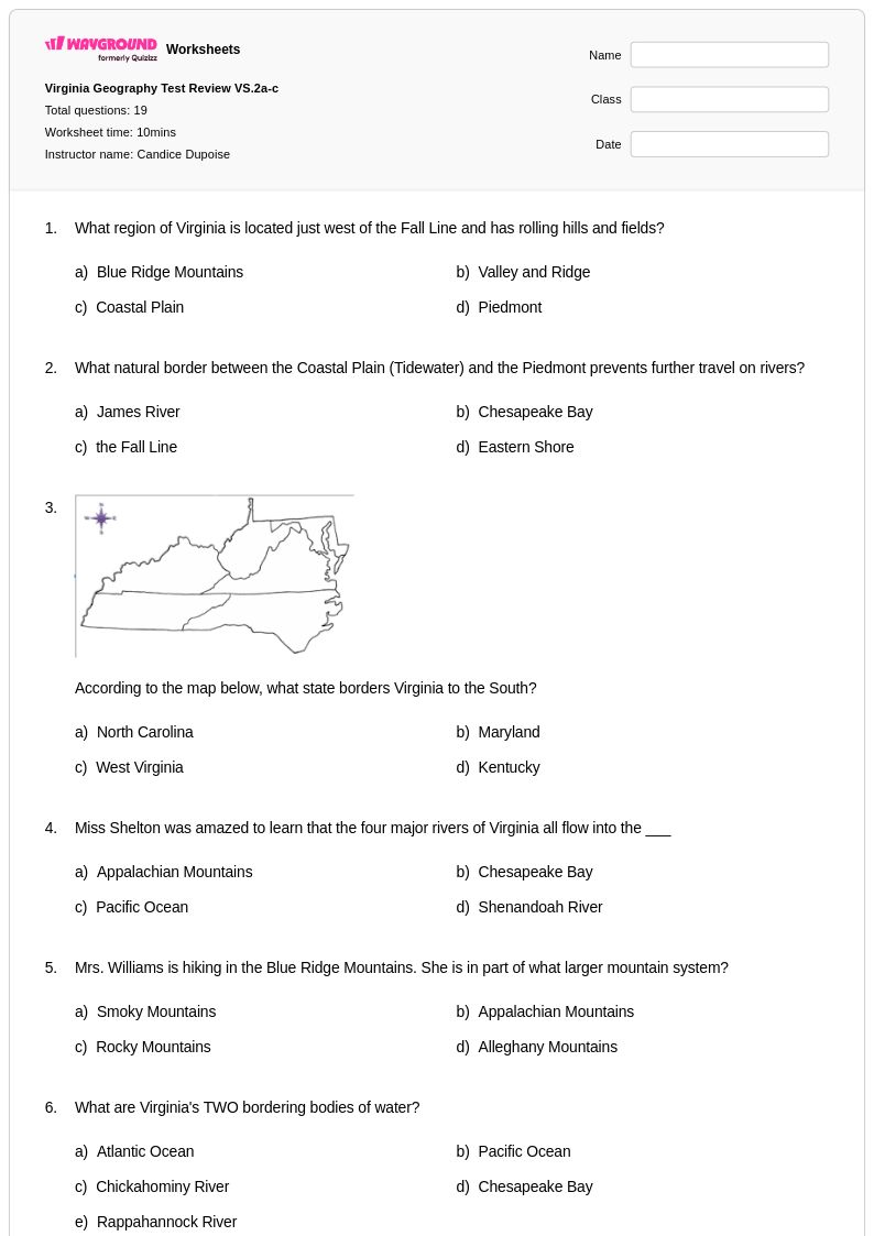
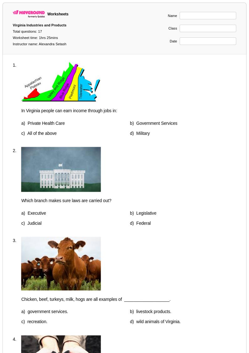
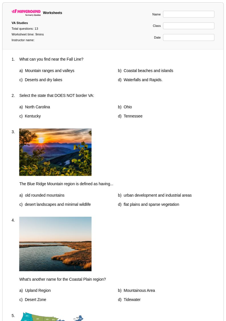
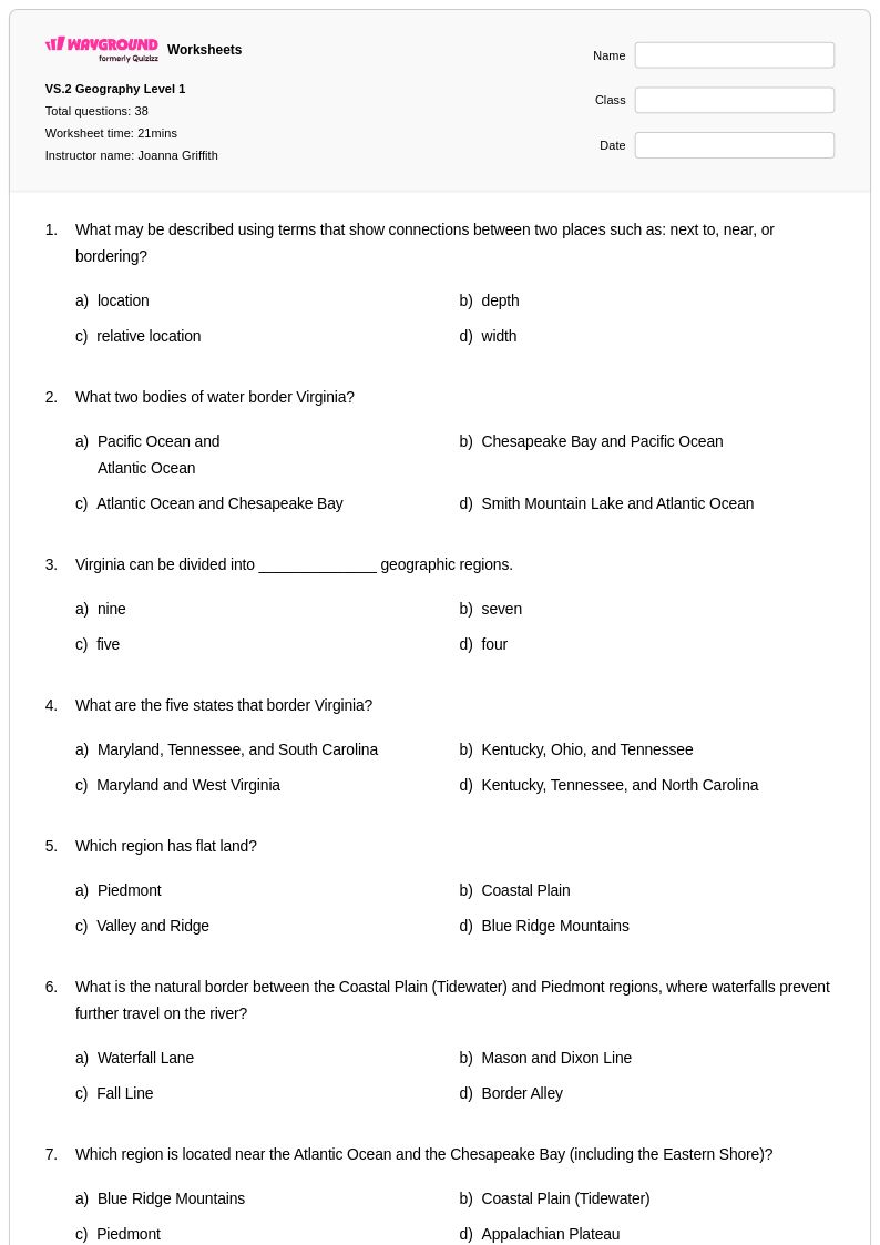
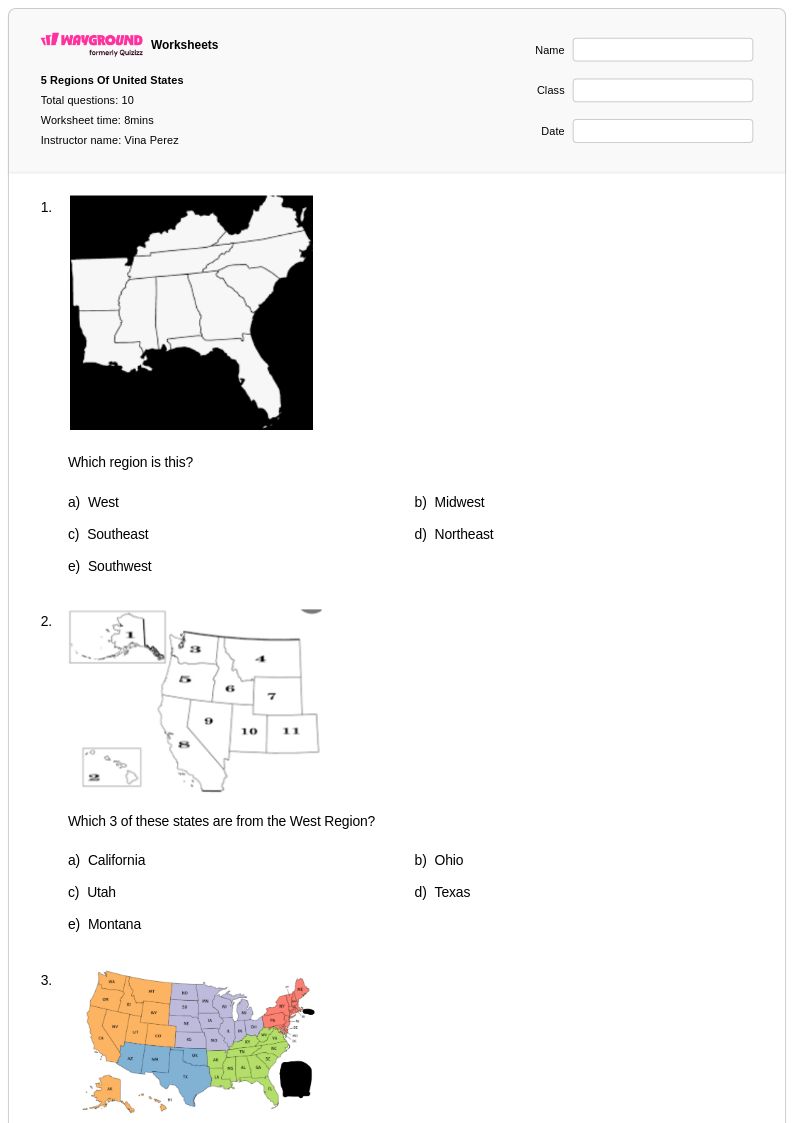
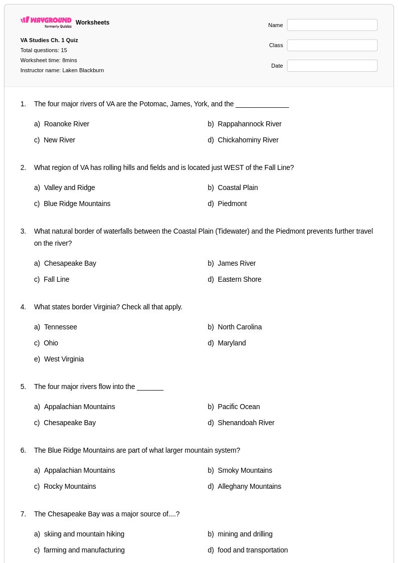
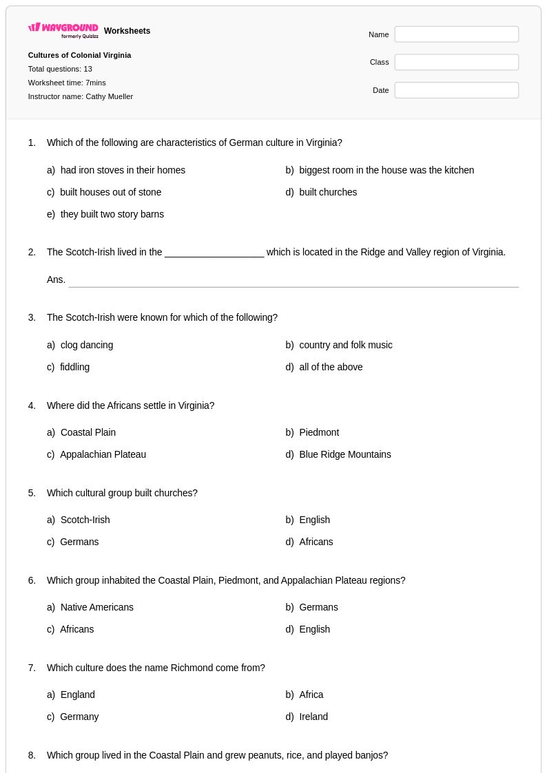
Virginia Regions worksheets for Class 4 students available through Wayground (formerly Quizizz) provide comprehensive coverage of the Commonwealth's five distinct geographic regions: the Coastal Plain, Piedmont, Blue Ridge Mountains, Valley and Ridge, and Appalachian Plateau. These educational resources strengthen students' ability to identify regional boundaries, compare physical characteristics such as elevation and landforms, and understand how geographic features influence human settlement patterns and economic activities throughout Virginia. The collection includes practice problems that guide fourth graders through mapping exercises, regional comparison charts, and analysis activities that connect geographic concepts to Virginia's history and culture. Teachers can access complete answer keys and downloadable pdf versions of these free printables, making classroom implementation and student assessment seamless and efficient.
Wayground (formerly Quizizz) supports educators with an extensive library of millions of teacher-created resources specifically designed for Virginia geography instruction at the Class 4 level. The platform's advanced search and filtering capabilities allow teachers to locate worksheets aligned with Virginia Standards of Learning and customize content to match diverse learning needs within their classrooms. These differentiation tools enable instructors to provide appropriate remediation for struggling students while offering enrichment opportunities for advanced learners exploring Virginia's regional characteristics in greater depth. Available in both printable and digital formats including downloadable pdfs, these worksheet collections facilitate flexible lesson planning and provide targeted skill practice that reinforces essential geographic concepts throughout the academic year.
FAQs
How do I teach Virginia's five geographic regions to elementary or middle school students?
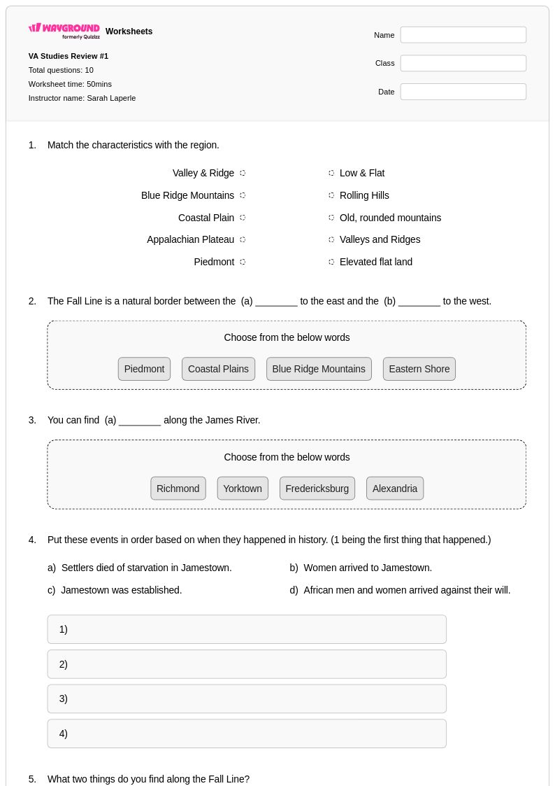
Start by anchoring each region to a memorable physical feature — the flat wetlands of the Coastal Plain (Tidewater), the rolling hills of the Piedmont, the forested ridges of the Blue Ridge Mountains, the parallel valleys of the Valley and Ridge, and the rugged plateau of the Appalachian region. From there, build outward to how each region's landforms shaped settlement patterns, economic activity, and natural resources. Using labeled maps alongside region comparison charts helps students visualize how geography transitions from east to west across the Commonwealth.
What exercises help students practice identifying Virginia's geographic regions?
Map labeling activities — where students identify and color each of Virginia's five regions — are among the most effective practice tools because they build spatial literacy alongside content knowledge. Pairing these with characteristic-matching tasks, where students connect landforms, climate features, and economic activities to each region, reinforces comprehension beyond simple memorization. Short constructed-response prompts asking students to explain how physical geography influences human settlement in a specific region push deeper analytical thinking.
What mistakes do students commonly make when learning about Virginia's regions?
A frequent error is conflating the Blue Ridge Mountains with the Valley and Ridge region — students often treat all mountainous terrain in western Virginia as a single undifferentiated area. Another common misconception is assuming the Coastal Plain is entirely flat and uniform, when in fact it includes significant river systems and tidal wetlands that shape both its geography and its historical settlement. Students also tend to oversimplify economic activity by region, not recognizing that industries like agriculture and tourism can span multiple regions for different geographic reasons.
How can I use Virginia Regions worksheets to differentiate instruction for mixed-ability classrooms?
Virginia Regions worksheets on Wayground support differentiation through built-in accommodation tools that can be applied at the individual student level. Teachers can enable reduced answer choices for students who need lower cognitive load, turn on Read Aloud for struggling readers, or grant extended time on a per-student basis — all without alerting the rest of the class. These settings are reusable across sessions, making it practical to maintain consistent accommodations for IEP or 504 students throughout a geography unit.
How do I use Virginia Regions worksheets from Wayground in my classroom?
Virginia Regions worksheets on Wayground are available as printable PDFs for traditional classroom use and in digital formats for technology-integrated or hybrid environments. Teachers can assign digital versions directly to students and optionally host them as a quiz through the Wayground platform for built-in scoring and progress tracking. All worksheets include answer keys, reducing prep time and making them easy to use for independent practice, guided instruction, or assessment review.
How do Virginia's geographic regions connect to economic activities students need to understand?
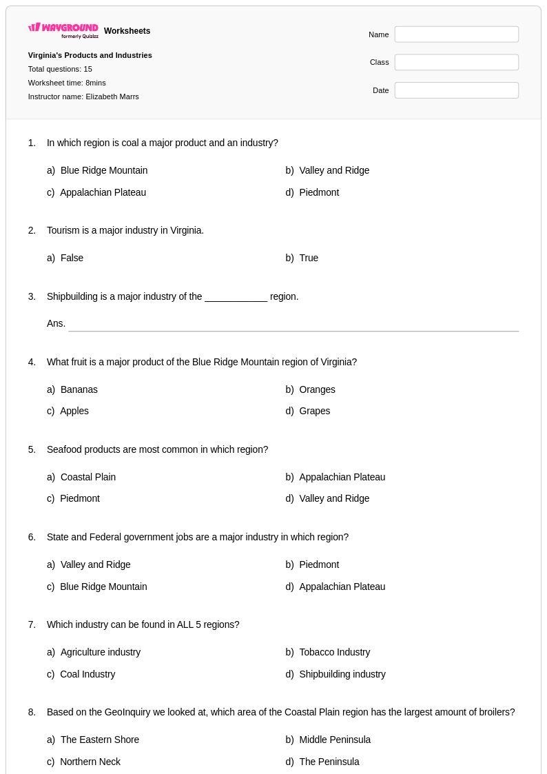
Each of Virginia's five regions has historically supported distinct economic activities tied directly to its physical geography. The Coastal Plain's rivers and Chesapeake Bay proximity drove early colonial trade and fishing industries, while the Piedmont's fertile soil supported agriculture and later manufacturing. The Blue Ridge, Valley and Ridge, and Appalachian Plateau regions are associated with timber, mining, and tourism — connections students need to understand not just as facts, but as examples of how physical geography shapes human economic decisions.