wayground logo

Free Printable Worksheets

NEW

Font size

S
M
L
XL
Worksheets

Study Guide/Review: Follow the Flow

Total questions: 61

Worksheet time: 43mins

Name
Class
Date
1.
The start of a river is called the what?
a)
River summit
b)
River source
c)
River start
d)
River mouth
2.
A river starts very small before getting larger. What is the name given to a small river that joins a larger river?
a)
Confluence
b)
Tribunal
c)
Tributary
d)
Joiner
3.
A waterfall is most likely to be found closer to what part of the river?
a)
River mouth
b)
River source
4.
The area that contains a river system is called a what?
a)
Drain Bassoon
b)
Drainage Basinet
c)
Drainage Basin
d)
Drain Basalt
5.
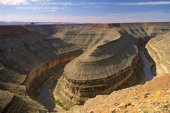
A meander is best described as ...
a)
A straight section of the river.
b)
A winding section of a lake.
c)
A section of the river that joins another river.
d)
A winding section of a river.
6.
When the bends of a Meander get close enough they can join, creating a new river path. What is left is called ...
a)
An oxback lake
b)
An oxen lake
c)
An oxcart lake
d)
An oxbow lake
7.
The point where the river meets an ocean or lake is called the ...
a)
River Source
b)
River Mouth
c)
River Head
d)
River Section
8.
Extra water that has not soaked into the soil is called...
a)
rain
b)
run-off
c)
absorption
9.
A river usually ends at an ocean or a body of water connected to an ocean.
a)
True
b)
False
10.
Watersheds are located only in mountainous areas with high rainfall
a)
True
b)
False
11.
What do you call the land that water flows across, under, and through on its way to a body of water?
a)
Tributary
b)
River system
c)
Headwaters
d)
Watershed
12.
What do you call an area of higher ground that separates watersheds?
a)
River
b)
Divide
c)
Tributary
d)
Flood Plain
13.
True or false: a divide is always a mountain
a)
True
b)
False
14.
Which region does the picture represent?
a)
Appalachian Plateau
b)
Piedmont
c)
Valley and Ridge
d)
Coastal Plains
15.
Jada's family is driving over rolling hills. Which region are they in?
a)
Coastal Plains
b)
Piedmont
c)
Blue Ridge Mountains
d)
Appalachian Plateau
16.
Which region includes the Eastern Shore?
a)
Coastal Plain
b)
Piedmont
c)
Blue Ridge Mountains
d)
Valley and Ridge
17.
What province is the furthest west in Virginia?
a)
Chesapeake Bay
b)
Blue Ridge
c)
Valley & Ridge
d)
Appalachian Plateau
18.
What is the oldest province in Virginia?
a)
Coastal Plain
b)
Piedmont
c)
Blue Ridge
d)
Appalachian Plateau
19.
What is the youngest province in Virginia?
a)
Coastal Plain
b)
Piedmont
c)
Blue Ridge
d)
Appalachian Plateau
20.
Which province is known for its karst topography?
a)
Piedmont
b)
Coastal Plain
c)
Valley & Ridge
d)
Blue Ridge
21.
What is the fossil fuel found in the Appalachian Plateau Province?
a)
Coal
b)
Oil
c)
Natural Gas
d)
Uranium
22.
Humus is.....
a)
the dead parts of plants and animals in soil.
b)
A food we eat with pretzels.
c)
The tiny particles inside of soil
d)
The roots that come off of a plant and live in soil.
23.
Which is an UNTRUE statement about the water table?
a)
flooding is more likely when it is high
b)
wells may run dry when it is low
c)
water tables are always at the same height
d)
lakes are formed where the water table meets the surface
24.

What makes up the borders of a watershed?

a)

Rivers and streams

b)

Roadways

c)

State/Country lines

d)

Ridges/high elevation

25.

How does flooding affect the water table?

a)

It makes it higher

b)

It makes it lower

26.
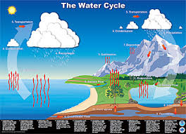
What part of the water cycle does this picture show?
a)
condensation
b)
precipitation
c)
evaporation
27.
Which is the opposite of condensation?
a)
runoff
b)
evaporation
c)
precipitation
d)
transpiration
28.
Which best explains why runoff is important?
a)
It returns water to other locations on Earth
b)
It increases the chance of flooding
c)
It makes evaporation occur faster
d)
It increases condensation
29.
What is it called when WATER is FORMED from an LIQUID to a WATER VAPOR Oor an [GAS]?
a)
EVAPORATION
b)
PRECIPITATION
c)
TRANSPIRATION
30.
What is it called when plants give off water vapor as a waste product?
a)
condensation
b)
evaporation
c)
sublimation
d)
transpiration
31.
During which stage do clouds form?
a)
condensation
b)
evaporation
c)
precipitation
32.
what does the #4 show in the diagram?
a)
condensation
b)
evaporation
c)
precipitation
d)
run off
33.
Impermeable materials...
a)
have an abundance of pores.
b)
let water in.
c)
have little to no pores.
34.
The boundary between the zone of aeration and the zone of saturation is called the...
a)
well
b)
recharge zone
c)
the water table
d)
watershed
35.
A hole dug into an aquifer to reach groundwater is called... 
a)
an aquitard/aquiclude
b)
a well
c)
a recharge zone
d)
a water table
36.
Which well(s) end(s) in a saturated zone?
a)
1 and 2
b)
1 only
c)
4 and 5
d)
1,3 and 5
37.
What is the water that fills the cracks and spaces in underground soil and rock layers called?
a)
Groundwater
b)
Water Table
c)
Precipitation
d)
Snow
38.
An underground layer of rock or sediment that holds water?
a)
Reservoir
b)
Aquifer
c)
Groundwater
d)
Watershed
39.
What is a chracteristic of karst topography
a)
sinking streams
b)
sinkholes
c)
caves
d)
all of the above
40.
When does groundwater become surface water?
a)
when rock at Earth's surface has high porosity
b)
when the zone of saturation is lowered
c)
when a new lake or stream is formed
d)
when the water table intersects Earth's surface
41.

What is formed when the water table intersects the surface of the land?

a)

aquifer

b)

geyser

c)

spring

d)

aquiclude

42.

What causes water to form this pattern around a well?

a)

excessive precipitation

b)

excessive runoff

c)

using the well on a regular basis

d)

digging a hole in the ground surrounding the well

43.
The materials that make up Aquifers A and B are
a)
permeable
b)
impermeable
44.
Karst topography includes underground caverns. Where in VA would this landscape be found?
a)
Piedmont 
b)
Coastal Plain
c)
Valley and Ridge
d)
Blue Ridge
45.

What type of rock is common in the cavernous region and is the rock needed to create Karst topography because it can be dissolved by the weak acid of Carbon Dioxide dissolved in water

a)

Sandstone

b)

Granite

c)

Basalt

d)

Limestone

46.
A depression or hole formed when the roof of a cave collapses
a)
Cavern
b)
Cave
c)
Sinkhole
d)
Bedrock
47.
What is the area underground where there is not any water?
a)
Zone of Saturation
b)
Zone of Aeration
c)
Water
48.

Where are most springs found?

a)

near the coastline

b)

starting in the mountains where land has a steep gradient

c)

in an aquifer

d)

near a geyser

49.

Which letter has the lowest velocity?

a)

A

b)

B

50.

Which letter is there more deposition occurring?

a)

A

b)

B

51.

Which letter has the most erosion occurring?

a)

A

b)

B

52.
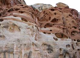
What is weathering?
a)
the break down of rock
b)
the transport of sediment
c)
a type of climate
d)
the aging of rock
53.
Where do deltas form?
a)
in desert areas
b)
on the banks of rivers
c)
at river mouths
d)
in valleys formed by glaciers
54.
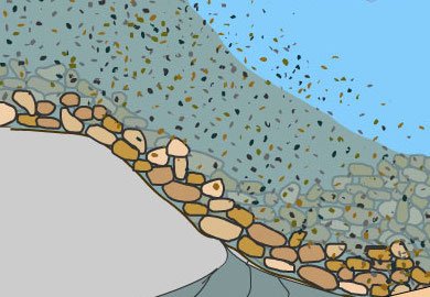
The process by which sediments settle out of water or wind
a)
deposition
b)
cementation
c)
weathering
d)
erosion
55.
The process by which running water, wind, or ice carry away bits of broken-up rock
a)
weathering
b)
sedimentation
c)
erosion
d)
cementation
56.
Which of these things cause weathering?
a)
Wind
b)
Water
c)
Ice
d)
All of these
57.

The three major particles sizes found in soil are........

a)

minerals, nutrients, crystals

b)

gravel, humus, loam

c)

sand, silt, clay

58.
Which geographic region of Virginia has the least impact on the water quality of the Chesapeake Bay?
a)
Coastal Plain
b)
Piedmont
c)
Blue Ridge Mountains
d)
Appalachian Plateau
59.
Which watershed do we live in?
a)
York
b)
James
c)
Roanoke
d)
Potomac Shenandoah
60.
Which watersheds empty into the Gulf of Mexico?
a)
Big Sandy and James
b)
Big Sandy and Tennessee
c)
Roanoke and Chowan
d)
Chowan and New
61.

Which watersheds empty into the North Carolina Sounds?

a)

Roanoke and Chowan

b)

James and Roanoke

c)

New and Tennessee

d)

York and Chowan