wayground logo

Free Printable Worksheets

Font size

S
M
L
XL
Worksheets

Weathering/Erosion/Deposition/Glaciers/GroundWater

Total questions: 60

Worksheet time: 31mins

Name
Class
Date
1.
Bobby observed that a metal trash can was covered with rust.  What type of weathering caused the rust on the trash can?
a)
Mechanical weathering 
b)
Wind weathering
c)
Chemical weathering
d)
Erosion weathering
2.
What is likely to cause cracks on the sidewalk?
a)
Repeated freezing and thawing of water
b)
Tree roots or plant roots growing bigger
c)
Both and A and B
d)
Neither A or B 
3.
What human activities can increase the rate of weathering?
a)
Increasing the amount of acid rain
b)
Paving over large portions of land
c)
All of the other answers. 
d)
Strip mining and agriculture
4.
Which type of climate would cause the greatest rate of weathering?
a)
Cold and dry
b)
Cold and humid (wet)
c)
Warm and humid (wet)
d)
Warm and dry
5.
The surfaces of old concrete statues are often covered with small holes or pits. Which of these MOST LIKELY causes these holes or pits?
a)
The concrete becomes pitted as water freezes in small cracks in the statue.
b)
The concrete is chipped away by sand particles blown by strong winds
c)
The concrete is chemically weathered by acid rain.
d)
Long exposure to sunlight causes the pits to form.
6.
When Joe saw the Rocky Mountains for the first time, he exclaimed, "These mountains are much younger than ours back East!" Which feature supports his conclusion that the Rockies were relatively young mountains?
a)
Their sedimentary layers are still exposed
b)
They have rounded tops
c)
They have sharp peaks
d)
Weathering has not yet hardened the rock
7.
Why does water have a high specific heat index?
a)
It requires a great amount of energy for water to become hot. 
b)
It takes water little energy to get hot.
c)
Water changes temperature very easily. 
d)
Water warms up fast when heated by the sun. 
8.

The ability of water to move upward, against gravity, through small openings.

a)

specific heat index

b)

properties of water

c)

capillary action

d)

surface tension

9.
Water takes a long time to cool off. 
a)
specific heat index
b)
capillary action
c)
adhesion
d)
cohesion
10.
If porosity is low then permeability is ______________.
a)
low
b)
high
11.
The ___________________ the grain size, the faster the water will move through the soil.
a)
more mixed
b)
smaller
c)
larger
12.
Well sorted soil...
a)
has low porosity
b)
has low pore space
c)
has high porosity
d)
means water will move through slowly
13.
Which container has the lowest porosity?
a)
A
b)
B
c)
C
d)
A and B
14.
Sand sediments are usually more permeable than silt sediments because sand grains are...
a)
larger
b)
smoother
c)
rounder
d)
more soluble
15.
Which diagram represents the soil with the greatest permeability?
a)
Choice 1
b)
Choice 2
c)
Choice 3
d)
Choice 4
16.

What is the relationship between soil type/particle size and permiability (as shown by the bar graph below)?

a)

The larger the particle size, the slower the permeability rate

b)

The smaller the particle size, the faster the permeability rate

c)

There is no relationship between particle size and permeability

d)

The larger the particle size, the faster the permeability rate

17.
Impermeable materials...
a)
have an abundance of pores.
b)
let water in.
c)
have little to no pores.
18.
Which should have the greatest capillarity based on sediment size?
a)
A
b)
B
c)
C
d)
D
19.
Poorly sorted soil...
a)
has low porosity
b)
has high porosity
c)
has high pore space
d)
means water will move through quickly
20.
What variable is the same between all three containers?
a)
Porosity
b)
Permeability
c)
Capillarity
d)
Infiltration Rate
21.

Any area of land where precipitation collects and drains into a common outlet, such as a river, bay, or ocean.

a)

Divide

b)

Water Table

c)

Done of Saturation

d)

Watershed

22.

A ridge or other topographical feature that separates two side by side watersheds.

a)

divide

b)

zone of depression

c)

tributary

d)

aquifer

23.

Water held underground in the soil or in pores and holes in rocks.

a)

porosity

b)

tributary

c)

divide

d)

groundwater

24.

The level at the top of the zone of saturation; below this the ground is saturated with water.

a)

zone of aeration

b)

zone of saturation

c)

the water table

d)

the soil layer

25.

A body of permeable rock which can contain, or transmit, groundwater.

a)

water table

b)

aquifer

c)

tributary

d)

watershed

26.

Area underground where gaps in soil and rock are filled with both air and water.

a)

zone of saturation

b)

zone of aeration

c)

water shed

d)

tributary

27.

What is the process by which precipitation falls on land and trickles into the ground to become groundwater?

a)

Infiltration

b)

Zone of Saturation

c)

Zone of Aeration

d)

Water Table

28.

What is the region below Earth's surface where materials are moist, but pores contain mostly air?

a)

Infiltration

b)

Zone of Saturation

c)

Zone of Aeration

d)

Water Table

29.

What is an explosive hot spring in which water is heated past its boiling point, causing it to vaporize?

a)

Spring

b)

Hot Spring

c)

Geyser

d)

Well

30.

What is a depression in the ground caused by the collapse of a cave or by the direct dissolution of limestone by acidic water?

a)

Cave

b)

Stalactite

c)

Stalagmite

d)

Karst Topography

e)

Sinkhole

31.

What layer does #9 represent in the diagram?

a)

Zone of Aeration

b)

Water Table

c)

Zone of Saturation

32.

What layer does #10 represent in the diagram?

a)

Zone of Aeration

b)

Water Table

c)

Zone of Saturation

33.

What layer does #11 represent in the diagram?

a)

Zone of Aeration

b)

Water Table

c)

Zone of Saturation

34.

What are the two types of water a raindrop could become after it falls on land?

a)

Groundwater

b)

Runoff

c)

Water Vapor

d)

Walk Off Water

35.

What type of glacier forms in a mountainous area?

a)

Alpine

b)

continental

c)

till

d)

moraine

36.

unsorted rock material deposited directly by ice as it melts

a)

glacial drift

b)

stratified drift

c)

till

d)

glacier

37.

What type of glacier covers huge areas of land?

a)

alpine

b)

continental

c)

till

d)

moraine

38.

What are jagged ridges that form on mountains called?

a)

U0shaped valleys

b)

cirques

c)

aretes

d)

horns

39.

which type of moraine forms along each side of a glacier?

a)

medial moraine

b)

lateral moraine

c)

ground moraine

d)

terminal moraine

40.
A glacier is __________
a)
series of frozen lakes that line up parallel to one another 
b)
series of frozen seas that rest in the interior of continents 
c)
o  large body of ice that does not move across the earth's surface 
d)
large body of ice and snow that shows evidence of movement 
41.
_____ is rock debris embedded in base of ice create polishing, grooves and striations.
a)
Plucking
b)
Abrasion
c)
Weathering
d)
Erosion
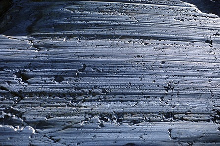
42.
_____ are parallel scratch marks on bedrock
a)
Plucking
b)
Abrasion
c)
Straitions
d)
Till
43.
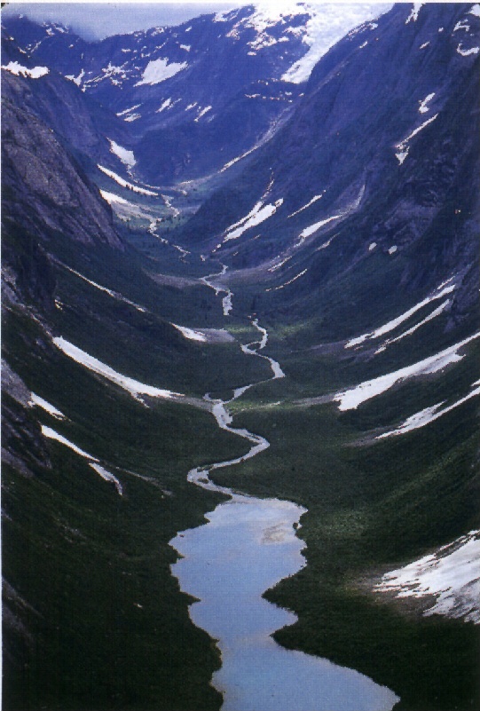
A _____ glacier carves a V-shaped valley into a U-shaped valley.
a)
Valley
b)
Continental
c)
Mountain
d)
Plain
44.
A _____ is a glacially carved valley flooded by the sea.
a)
volcano
b)
moraine
c)
out-wash bason
d)
fjiord
45.
_____ are are lines deposited at bottom or along sides of glaciers.
a)
Eskers
b)
Till
c)
Erratics
d)
Moraines
46.
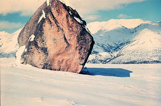
_____ are enormous boulders transported and deposited by glaciers, often far from their source region.
a)
Till
b)
Erratics
c)
Moraines
d)
Fjords
47.
A _____ is a meandering narrow ridge formed when water, flowing in a tunnel underneath a melting glacier, deposited sediment
a)
erratic
b)
moraine
c)
esker
d)
fjords
48.
A _____ are depressions formed as stranded ice blocks melt in outwash.
a)
erratics
b)
eskers
c)
kettles
d)
drumlin
49.
What is a bowl-shaped depression formed by glacial erosion?
a)
cirque
b)
arrete
c)
ice pack
d)
kettle
50.

What are two kinds of wind erosion?

a)

Physical and chemical

b)

Deflation and abrasion

51.

What process forms caves and sinkholes?

a)

Formed by the chemical dissolution of underground rock by the flow of acidic water. If erosion weakens a layer of limestone below the ground, it may collapse and form a sinkhole

b)

Limestone erodes away forming a stream

c)

The oxbow weakens forming a sinkhole

52.

What picture represents a meander?

a)
b)
c)
53.

Which image represents an oxbow?

a)
b)
c)
54.
Which way do sand dunes move?
a)
up & down
b)
to the west
c)
toward the sea
d)
in the direction of the wind
55.
What is the steep side of a dune called?
a)
slip face
b)
slip
c)
slope
d)
saltation
56.
rock and soil move down a hill SLOWLY
a)
mudflow
b)
mass movement
c)
creep
d)
rock fall
57.

From which direction is the wind blowing?

a)

from left to right

b)

from right to left

58.

Which side of the picture is the windward side of the sand dune?

a)

right

b)

left

59.
Small, elongated hills left behind by glaciers, look like a half-buried egg.
a)
Grabens
b)
Drumlins
c)
Esker
d)
Delta
60.

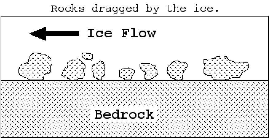
In which direction did the glacier move?

a)

from right to left

b)

Left to right