
 Worksheets
Maps
Total questions: 129
Worksheet time: 4hrs 45mins


_________ show the Earth as a SPHERE.
Maps
Globes
Compass rose

_________________ show the Earth as FLAT.
Maps
Globes
Compass rose

This is the:
Map
Scale
Key

It is an area of land almost completely surrounded by water.
Island
Peninsula
Continent

________________ maps show information like the capital cities.
Political
Physical

_____________ maps show information like the mountains and rivers.
Political
Physical

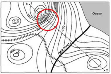
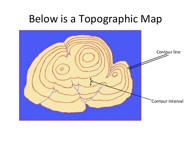

Which of the type of map is this?
Physical map
Political map
Road map
Useless map
Why do political maps change and physical maps don't?
Physical maps are updated more frequently than political maps.
Everytime there is an election, the physical map has to change.
Because if a country invades another country, the borders change.
Everytime there is an election, the political map changes.
What might you find on a historical map?
Mountains, lakes, and rivers
Height of elevation
A compass rose
Information about a battle between armies
If you're having trouble finding out what the symbols on the map represent, where could you look?
The back of the map
The map legend
The title of the map
The compass rose
What is an example of a label you could find on a political map?
The name of the country
The symbol that shows which way north is
A line of latitude
A line of longitude
If you were looking at a map of the world and wanted to find the exact location of a country, what would you look for?
The map legend
Lines of latitude and longitude
Symbols
The map key
What can you find on nearly every map?
Borders of countries
Lines of elevation
Symbols representing natural resources
The location of Starbucks
A map's scale indicates that 1 cm equals 10 km. Two cities are 8 cm apart. How far apart are they in real life?
10 km
8 km
80 km
800 km




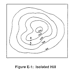


What is half of a sphere?
part sphere
half sphere
Hemisphere
Sphere and half


What geographic tool uses organizations and institutions to collect data about the Earth?
globe
satellite imagery
GPS
GIS
What geographic tool uses satellites to take pictures of the Earth?
globe
map
satellite imagery
GIS
What geographic tool uses at least four satellites to provide locations on the Earth?
globe
map
satellite imagery
GPS
What geographic tool is limited because it cannot show streets and small towns?
globe
map
satellite imagery
GPS
Which geographic tool is a space-based global navigation satellite system?
globe
GPS
GIS
map
What do the initial GIS stand for?
Geological Information System
Geographical Information System
Graphing Information System
Geological Intelligence System
What do the initials GPS stand for?
Geographical Positioning System
Geographical Political System
Global Positioning System
Global Political System
What historical invention made maps available to the public?
wall carvings
printing press
animal skins
atlas
Early mapmakers tried to make their maps more accurate by using the--
rocks and trees
sun and stars
seasons
animal skins
How is a globe more accurate than a map?
a globe is a 3 dimensional model of the Earth, but a map is flat
a globe can show streets and roads, but a map cannot
a globe can show all of the continents at once, but a map cannot
a globe can be used to navigate from one town to another, but a map cannot

What type of cartographer tool is this?
Digital Satellite Image
Aerial Photography
A location that tells you where something is located in relation to something else.
Absolute
Relative
A location that tells you exactly where you are.
Absolute
Relative

What type of cartographer tool is this?
Digital Satellite Image
Aerial Photograph
Map
Down from Easton Town Center is an example of which type of location?
Absolute
Relative
The coordinates of South Africa are 30 S and 22 E. Are the coordinates an example of absolute or relative location?
Absolute
Relative

What type of map is this?
Climate
Physical
Political
Vegetation

What type of map is this?
Political
Physical
Climate
Topographic

This map of Africa showing the various types of vegetation would be which category of map?
General Purpose
Special Purpose




the degree to which the result of a measurement, calculation, or specification conforms to the correct value or a standard
accuracy
degree
distort
navigate
projection
the number of people or things in a given area or space
density
degree
distort
navigate
projection
a unit of measurement used to measure where a location is on earth
accuracy
degree
distort
navigate
projection
giving a false impression of features on a flat map when trying to project a globe upon it
accuracy
degree
distort
navigate
projection
plan and direct the route or of a ship, aircraft, or other forms of transportation, especially by using instruments or maps
accuracy
degree
distort
navigate
projection
a method for representing part of the surface of the earth or a celestial sphere on a plane surface
accuracy
degree
distort
navigate
projection
the process of conveying information by some means that we can see
latitude
longitude
minutes
seconds
visualize
an angle which ranges from 0° at the Equator to 90° (North or South) at the poles also known as parallels; run east–west as circles parallel to the equator
latitude
longitude
minutes
seconds
degree
a measurement ranging from 0° at the Prime Meridian to +180° eastward and −180° westward. It is used to denote the location of a place on Earth east or west of the Prime Meridian.
latitude
longitude
minutes
seconds
degree
a sixtieth of a degree of angular measurement
latitude
longitude
minutes
seconds
degree
a sixtieth of a minute of angular distance
latitude
longitude
minutes
seconds
degree
a solid geometrical figure similar in shape to a sphere, as an ellipsoid.
cylinder
globe
spheroid
South Pole
North Pole
The very top of the earth where all of the lines of longitude meet
cylinder
globe
spheroid
South Pole
North Pole
very bottom of the earth where all of the lines of longitude meet
Equator
Prime Meridian
spheroid
South Pole
North Pole
a person who draws or produces maps
cartographer
geographer
stenographer
photographer
An imaginary line that follow the Curve of the Earth.
Maps ProjectionS
Maps
Globes
Great Circle Route
What do we call Cartographers
Make Maps
Map Maker
Globe Makers
2-D Makers
what map is often used for map of the poles
Cylindrical Projection
Planar/Azimuthal Projection
Conic Projection
Robinson Projection
It displays true direction and useful for sea navigation
Planar/Azimuthal Projection
Robinson Projection
Conic Projection
Cylindrical/Mercator Projection
The surface projection onto a map formed into a cone
Robinson Projection
Cylindrical Projection
Conic Projection
Planar Projection
Polar areas that appea flattened on the map
Robinson Projection
Winkle Triple Projection
Goode's Projection
Conic Projection
Resembles a globe that has been cut apart and laid flat
Robinson Projection
Planar Projection
Goode's Projection
Winkle Triple Projection
Earth's landmasses distance between land features are generally distorted
Cylindrical projection
Goode's Projection
Winkle Triple Projection
Robinson Projection
Shows location a topography or shape of the Earth's land feature
Cartographer
Thematic Maps
Physical Maps
Political Maps
What type of projection shaped like a peeled orange layed on the paper flat
Robinson Projection
Winkle Triple Projection
Goode's Projection
Conic Projection
Most Distortion at the North and South Poles
Polar Projection
Mercator Projection
Robinson Projection
Goode's Projection
Most Accurate at the equator
Robinson Projection
Mercator Projection
Polar Projection
Goode’s Projection
Used mostly in classrooms one of the most accurate maps
Goode's Projection
Polar Projection
Mercator Projection
Robinson Projection
Size and shape are accurate at the center of the map
Goode's Projection
Polar Projection
Mercator Projection
Robinson Projection
What Projection used for Sea Captains use it for navigation at sea
Mercator Projection
Polar Projection
Robinson Projection
Goode's Projection


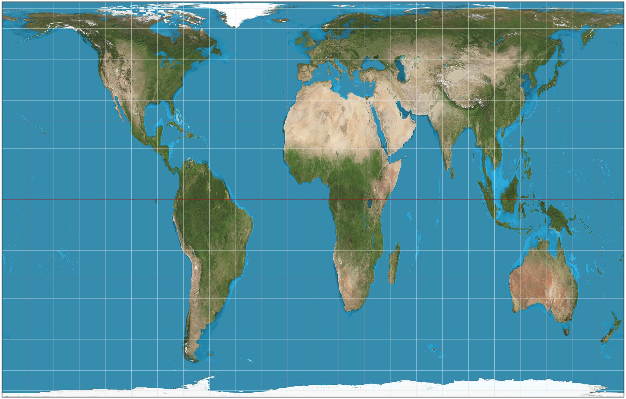
Who would be most likely to use this projection?
Ship Captains
Pilots
Meteorologists
Teachers
Why does distortion occur on every map?
Cartographers are politically biased.
GIS technology encourages errors.
The 3D world cannot be accurately converted to 2D
Why does Google maps use the Mercator projection?
Direction is easier to navigate on the grid system
The size and shape of continents is more accurate.
It is easy to calculate mileage
Because all of the Earth can be seen on the Mercator

