
 Worksheets
Grade 4-Social Science Quiz Bee- Final Round
Total questions: 60
Worksheet time: 49mins

What continent is this?
Africa
South America
Australia
Eurasia
How many countries are on the continent of North America?
50
3
7
21
How many states are in the United States?
3
50
47
5

What ocean lies directly north of Europe?
Arctic
Pacific


Which of these are mountains?
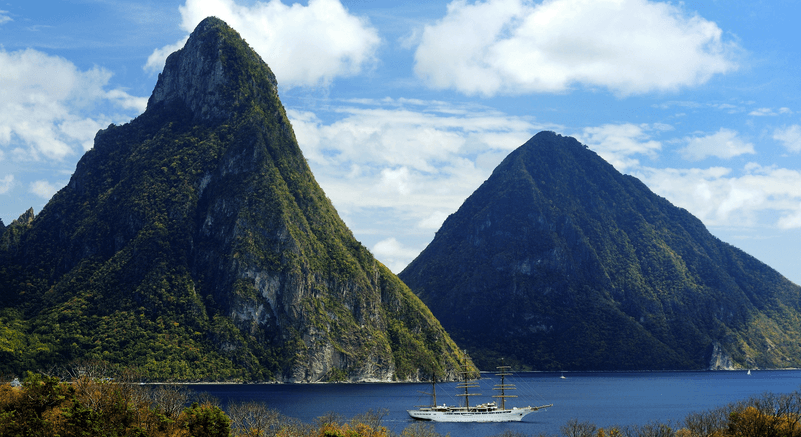
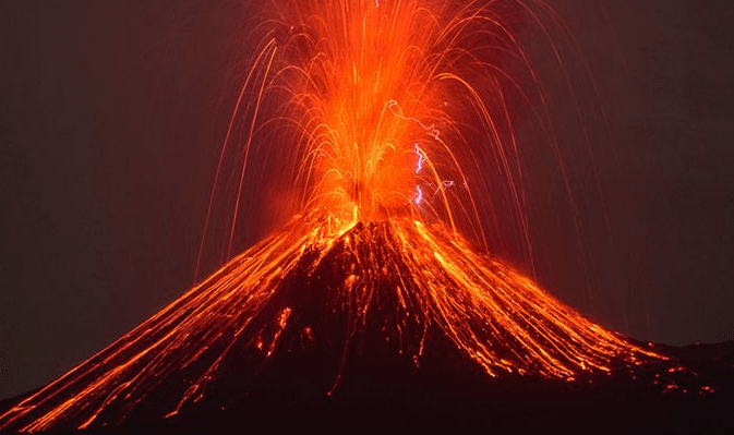
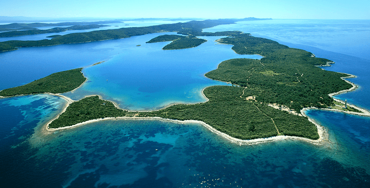

A triangular landform where a river empties into another body of water.
Landform
Canyon
Delta
Valley
This landform has a severe lack of water.


Which ocean is NOT connected to a North American Drainage Basin?
Atlantic
Pacific
Arctic
Indian

What is the name of this type of drainage pattern?
Trellis Drainage Pattern
Dendritic Drainage Pattern
Which of these are Natural Landform Changes?
Deposition
Glaciation
Land Reclamation
Plate Tectonics (Earthquakes)
Mining
In what ways are rocks eroded and sand deposited? SC.6.E.6.1
Rocks are eroded by the wind as sand. Sand is deposited by abrasion.
Rocks are eroded by abrasion. Sand is deposited by the wind as dunes.
Rocks are eroded by tiny particles moving downward. Sand is deposited by erosion as dunes.
Rocks are eroded by water and wind. Sand is deposited by more water and wind.

What is the gold continent?
North America
South America
Europe
Asia
What is the green continent?
North America
South America
Europe
Asia

What is a harbor?
a long body of water that flows across land
a large body of salt water
a sheltered area where ships can anchor safely
a very high piece of land
A piece of flat land with rich soil is called
hillside
valley
plain
Which is Asia's largest country?
Nepal
India
China
Iran
What is the name of the largest desert in Asia?
Sahara desert
Gobi desert
What is the name of the highest mountain in Asia?
Manaslu
Mount Everest
Cho oyu
Where is Egypt located?
South America
North America
Africa
Australia

How many states are in the United States?
13
50
25
100

Pacific ocean
Indian ocean
Asian ocean
Southern ocean
Which continent is the largest?
Asia
Africa
Antarctica
Australia

What direction goes in the yellow box?
North
South
East
West

The hotel is ____________ of the zoo.
North
South
West
East
What continent is the UAE part of?
Asia
Europe


The mountains differ from the hills in terms of ___________.
Elevation
Slope
Aspect
None of the above
An important mountain range in Europe is:
The Andes
The Alps
The Rockies
None of the above
Mauna Kea, an undersea mountain is located in:
Atlantic ocean
Pacific ocean
Arctic ocean
Indian ocean
Which of the following are examples of Young Fold Mountains?
The Aravalli's
The Himalayas
The Alps
Both b and c
Which of the following is/are an examples of Old Fold Mountains?
The Aravalli's
The Appalachians
The Ural
All of these
The Rhine Valley in Europe and Vosages mountain in Europe are examples of:
Young Fold Mountains
Old Fold Mountains
Block Mountains
Volcanic Mountains
Mt. Kilimanjaro of Africa and Mt. Fujiyama of Japan are examples of:
Young Fold Mountains
Old Fold Mountains
Block Mountains
Volcanic Mountains
Which of the following statements are true?
- A hill is a land surface higher than the local area.
- The steep hill with an elevation of more than 600 meters is termed as mountain.
Only 1
Only 2
Both 1 and 2
None of the above
A plateau may have one or more sides with steep slopes.
True
False
A flat-topped table land standing above the surrounding area
Gorge
Plateau
Horsts
Graben
The oldest plateau in India is:
Malwa Plateau
Chotanagpur Plateau
Deccan Plateau
Mewar Plateau
Hundru falls is in:
Chotanagpur Plateau
Deccan Plateau
Mewar Plateau
Malwa Plateau
The highest waterfall of India is:
Shimsha falls
Hogenakkal Falls
Coutallam Falls
Jog Falls
Jog Falls are in Karnataka Plateau.
True
False

Plains are not more than 200 meters above mean sea level.
False
True
Most of the plains are formed by rivers and their tributaries.
True
False

