wayground logo

Free Printable Worksheets

Font size

S
M
L
XL
Worksheets

ORIENTEERING

Total questions: 30

Worksheet time: 44mins
Name
Class
Date
1.
Crossing territory using a map and compass is known as...
a)
orienting the map
b)
orienteering
c)
orientation
d)
orientational
2.
In which European country did the sport originate?
a)
Norway
b)
Russia
c)
Sweden
d)
Valley Forge
3.
On an orienteering map, how are changes in elevation shown?
a)
colors
b)
contour lines
c)
in the key
d)
with numbers
4.
Other than "by foot" which is not a way to complete an orienteering course?
a)
in a canoe
b)
riding a bike
c)
riding a horse
d)
while skiing
5.
To navigate an orienteering course, you will need...
a)
a tour guide
b)
a written set of directions
c)
a GPS
d)
a topographic map and a compass
6.
One key to successful navigation of an orienteering course is to know...
a)
the location of the next control
b)
the sun's position overhead
c)
your latitude and longitude 
d)
where you are on the map
7.
A compass will always be oriented to the...
a)
north
b)
south
c)
east
d)
west
8.
The colors of the controls are...
a)
red/white/blue
b)
orange and white
c)
gold and black
d)
orange and green
9.
How do you show you visited a control?
a)
you punch a spot on the control card
b)
you shout "I'm here" for all to hear
c)
you take a slip of paper with the number on it
d)
you write your initials on the control
10.
Matching the map's orientation to the features you see around you is...
a)
not a wise thing to do
b)
a waste of time while orienteering
c)
orienting the map
d)
not helpful
11.
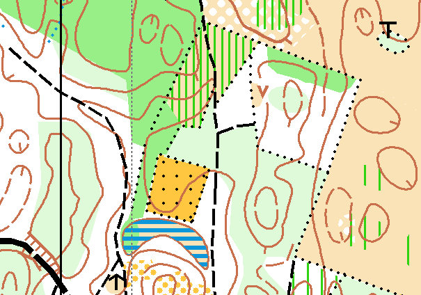
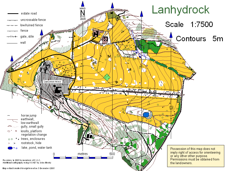
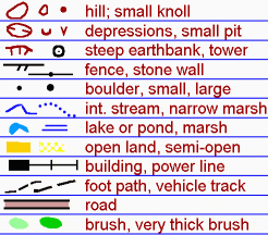
The color of streams, rivers, lakes on an orienteering map is...
a)
brown
b)
yellow
c)
green
d)
blue
12.
Orienteers consider this color their "friend" because it is the color of open, passable fields.
a)
yellow
b)
black
c)
brown
d)
dark green
13.
Where would you look on an orienteering map to learn the meanings of the symbols?
a)
the title
b)
the contour lines
c)
the key or legend
d)
the credits
14.
This map symbol marks the end of a course 
a)
triangle
b)
circle
c)
star
d)
double circle
15.
What do contour lines show?
a)
map features
b)
elevation
c)
roads
d)
bridges
16.
What color are contour lines that show land's relief features?
a)
brown
b)
black
c)
red
d)
green
17.
Buildings, walls, fences are in what color on an orienteering map?
a)
black
b)
green
c)
brown
d)
yellow
18.
If you see dark green on the map, what should you do?
a)
plow through it
b)
avoid it
19.
The numbers and letters that identify a control are called...
a)
control identity
b)
control code
c)
control image
d)
control name
20.
When you turn the map so its features match what you see, it is called...
a)
orienting the map
b)
orienteering
c)
punching
d)
thumbing
21.
When doing an orienteering event, you should never...
a)
shout out loud
b)
leave your partner
22.
What map part measures distance?
a)
legend
b)
key
c)
scale
d)
compass
23.
If contour lines are close together on the map for an area nearby, what can you expect to see?
a)
flat land
b)
a steep incline
c)
trees
d)
water features
24.

The object of orienteering is to locate a series of ________ in order.

a)

Flags

b)

Markers

c)

Control Points

d)

Teams

25.

In an orienteering race...

a)

Each participant starts at a different time and everyone follows the same course

b)

You need to collect the predetermined number of points as quickly as possible

c)

You are not penalized for not passing through all points and not completing the whole course

d)

At the arranged time, all the participants must meet at the finish line

26.

What shape is the indication for the start of a course?

a)

circle

b)

triangle

c)

double circle

d)

squar

27.

Which arrow indicates North on a compass

a)

Don't know, have to take the Orienteering MB first

b)

The stationary arrow at the top of the compass

c)

That red one

d)

The Magnetically North attracted Arrow (red)

28.

How many points are there on a compass

a)

0

b)

4

c)

12

d)

16

29.

On a compass what do we call the instrument that points north?

a)

Dial

b)

Needle

c)

North Line

d)

Line

30.

When using a compass how should you hold it

a)

Straight up and down

b)

As close to the ground as possible

c)

Level and balanced in your hand with it parallel to the ground

d)

Level and balanced in your hand with it perpendicular to the ground