
Font size
 Worksheets
Physical Geography & Principles of Geography
Total questions: 85
Worksheet time: 58mins
What is one of the five themes of Geography?
Region
Solar System
Oceanic
Continental
What map feature can help you determine the approximate distance between two locations?
map scale
key
title
distance calculator
A flat drawing that shows all or part of the Earth's surface
latitude
globe
map
Geographers use which of the following in efforts to organize , represent, and reexamine human and environmental patterns?
geospatial data
satellite technologies
geographic systems (GIS)
All of the above
Using a map, requires one to
glance quickly
focus on details
peak at the pictures
enjoy the graphics and pictures displayed
Size and location from an aerial view can determine
how well one can see images
one's perspective
accuracy of labeling an image
All the above

What is the Northern Hemisphere?
It is the half of Earth that is south of the Equator. New Zealand and Most Pacific Islands in Oceania.
It is geographical term for the half of Earth which les west of prime meridian. Greenwich, London, United Kindom
It is the top half of the Earth that is North the Equator.

What is the Southern hemisphere?
It is the half of Earth that is south of the Equator. New Zealand and Most Pacific Islands in Oceania.
It is east of the prime meridian and west on the antemeridian. Afro-Eurosia and Australia.
It is geographical term for the half of Earth which les west of prime meridian. Greenwich, London, United Kindom

What is the Eastern hemisphere?
It is the top half of the Earth that is North the Equator.
It is geographical term for the half of Earth which les west of prime meridian. Greenwich, London, United Kindom
It is east of the prime meridian and west on the antemeridian. Afro-Eurosia and Australia.

What is Geography?
Is the study the origin, formation and evolution of the Earth
Is the study of the world, its people, and the landscapes they create.
Studies the structure of living beings and their vital processes

Why geography is a science?
Because look at data, or information, that they gather about places.
Because it is based on the observation of nature and experimentation to explain the phenomena related to life.
Because aims to understand the evolution of the planet and its inhabitants

Why geography is a Social Science?
Because studies and exposes, according to certain principles and methods, the events and facts that belong to the past tense
Because is a field that studies people and the relationship among them.
Because study of human societies.
Imaginary east-west circles parallel to the Equator are called ______________________ lines.
meridians
latitude
longitude
straight
A round model of the earth that shows the continents and oceans in their true shapes:______________________.
sphere
projection
globe
map
Halfway between the North and the South poles, the _____________________ circles the globe horizontally at 0 degrees.
equator
ocean
prime meridian
One of the most common map projections, which distorts the size of the continents and the overall geometry of the planet:______________________________________.
Mollweide projection
Robinson projection
Mercator projection
Latitude and longitude lines help geographers identify
absolute location
the depths of oceans
the Earth’s distance from the sun.
the heights of mountains.
Which theme would geographers use to study the consequences of peoples’ actions?
Projection
Location
Movement
Human Environment Interaction
The disadvantage of a globe is that:
It is not practical enough
It does not show enough detail
It is too big to fit into a pocket
All of the above
How would you describe the human features of a place?
You might discuss the moon and stars and how they interact with earth.
You might say that a place is hilly and hot or cold.
You might discuss how many people live there, what types of work they do, and what they do for fun.
You would discuss chemicals and chemical reactions.
The study of the Earth is called ________________________.
Geology
Geography
Geographer
Geometry
A misrepresentation of the true shape or a change in the accuracy of a shape: ______________.
projection
scale
equivalent
distortion
The study of the Earth is called ________________________.
Geology
Geography
Geographer
Geometry
One of the four compass points: north, south, east, and west: _________________________.
Cardinal directions
Legend
Intermediate directions
Key
The imaginary line that circles the globe from north to south at 0 degrees: _________________.
Prime meridian
parallels
equator
meridians
The disadvantage of a globe is that:
It is not practical enough
It does not show enough detail
It is too big to fit into a pocket
All of the above

Mercator projection
Mollweide projection
Robinson projection
A globe is more accurate than a map because a globe can show
The true shapes of continents and oceans.
City streets
A distorted view of the Earth.
A particular region in lots of detail.
The most accurate way to show the Earth’s continents and bodies of water is with a
Mercator projection
globe
Robinson projection
conformal map
A person who studies the Earth: ___________________________.
Cartographer
Geographer
Geologist
Calligrapher

Robinson projection
Mercator projection
Molleweide projection
Which theme helps geographers understand cultural changes?
Human Environment Interaction
Regions
the Hour Glass theme
Movement
The largest continent
Europe
Australia
Africa
Asia
Huge land mass
Country
County
City
Continent
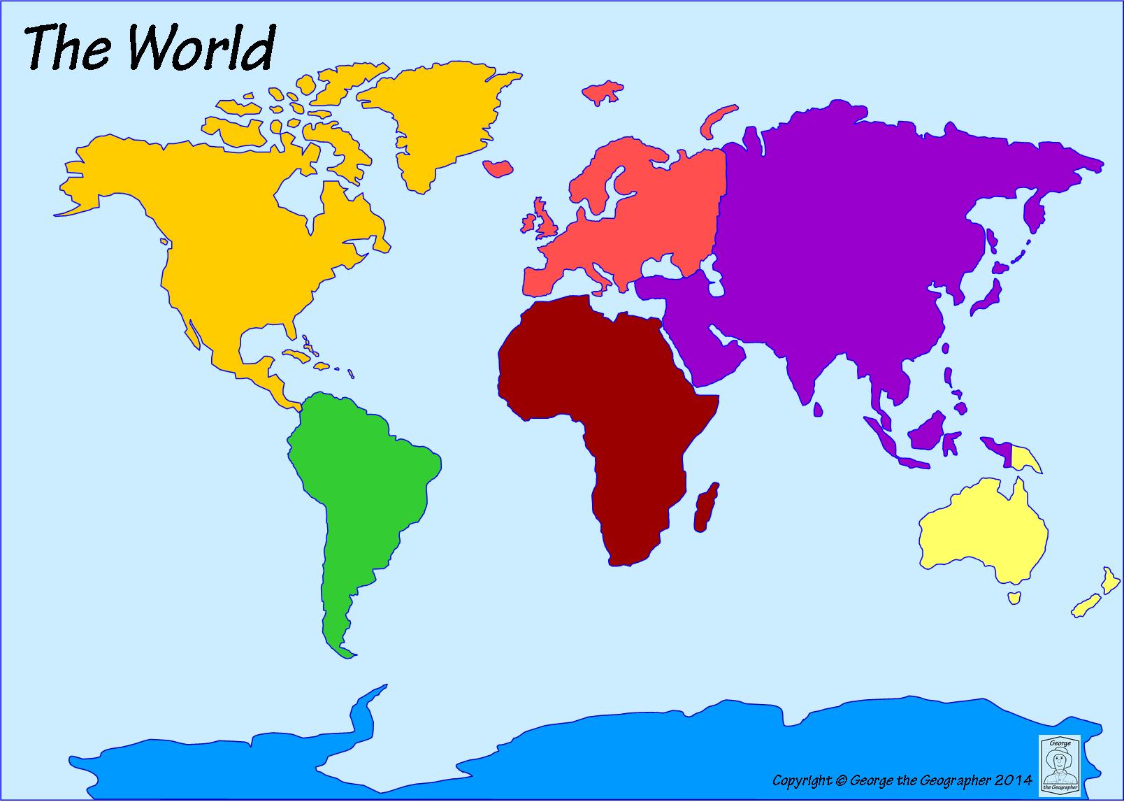
What is the name of the dark yellow continent?
South America
North America
Asia
Africa
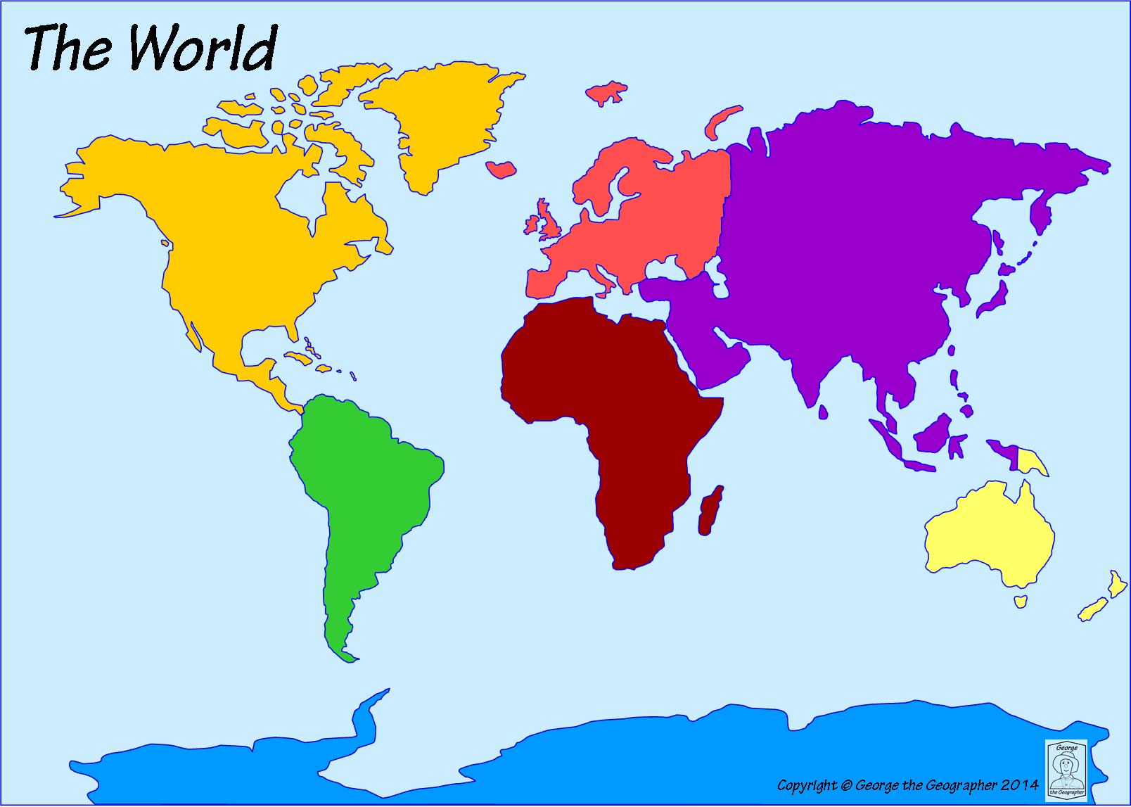
What continent is directly south of North America?
Australia
Europe
Africa
South America
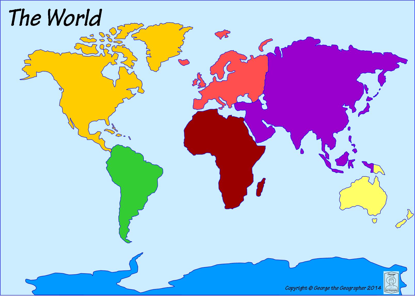
Which ocean is located off the east coast of North America?
Pacific Ocean
Atlantic Ocean
Indian Ocean
Southern Ocean
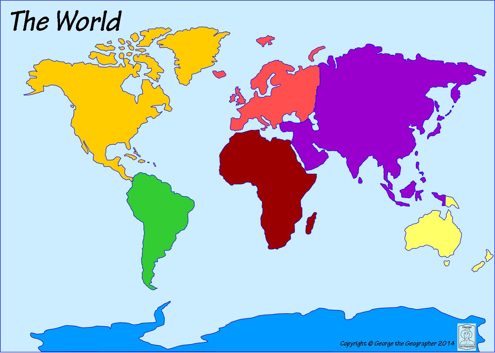
Which continent is located west of Asia?
Europe
Antarctica
Australia
South America
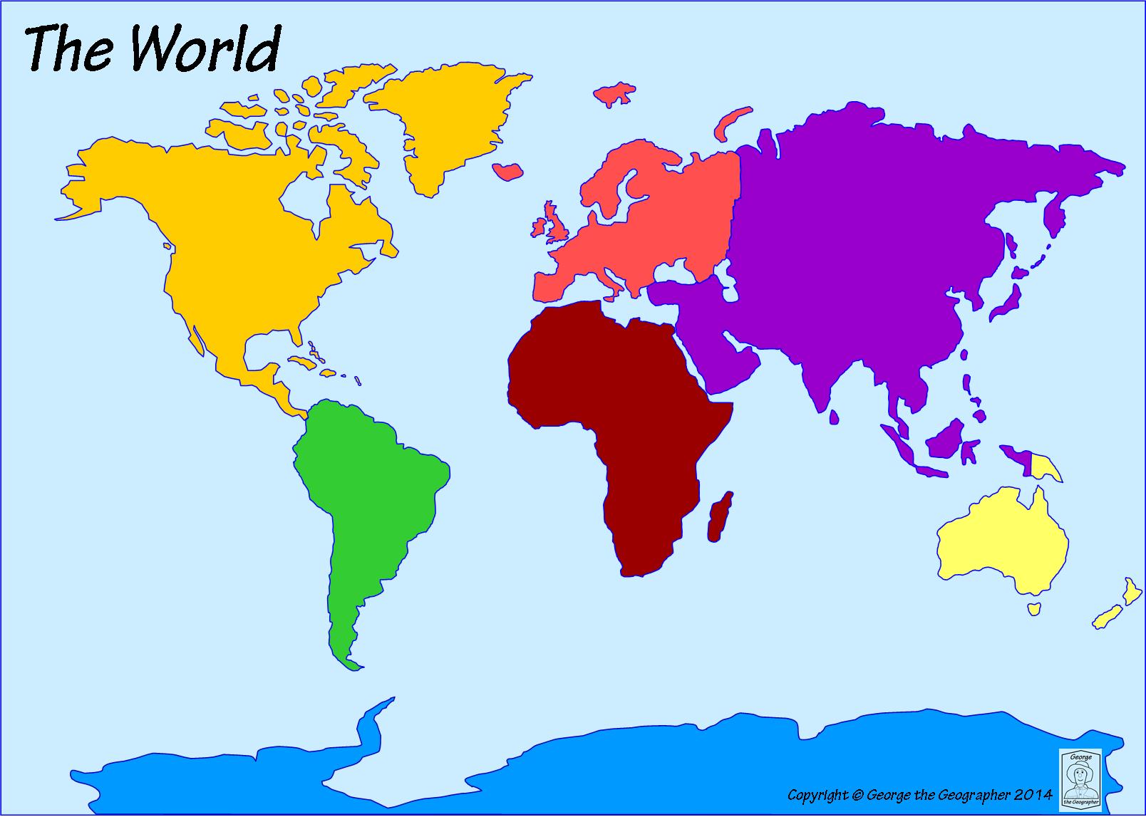
Which ocean is the farthest north?
Indian Ocean
Southern Ocean
Arctic Ocean
Atlantic Ocean
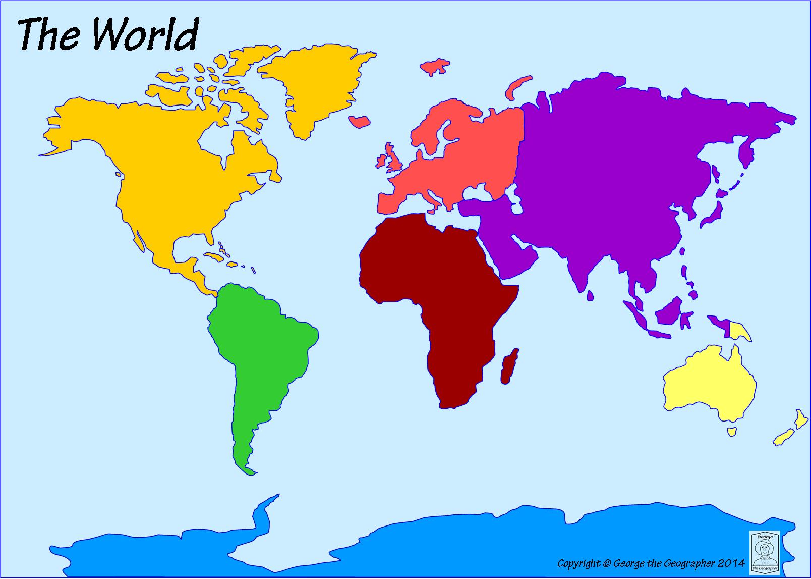
What is the name of the most southern continent?
Australia
Africa
Asia
Antarctica
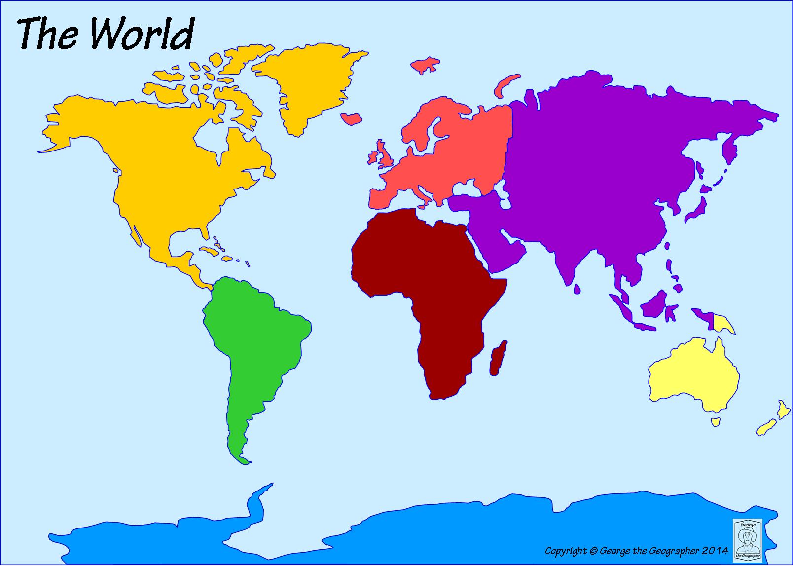
Which ocean is located to the east of Africa and to the west of Australia?
Atlantic Ocean
Indian Ocean
Pacific Ocean
Arctic Ocean
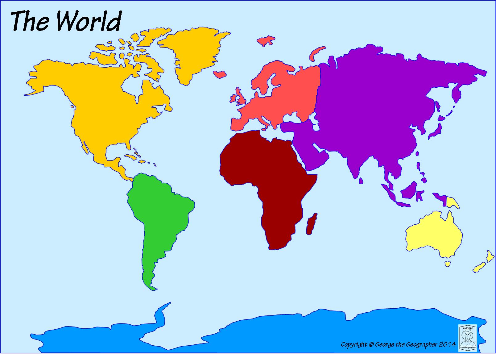
Which continent is to the east of the Indian Ocean and to the west of the Atlantic Ocean?
Africa
Europe
North America
Asia
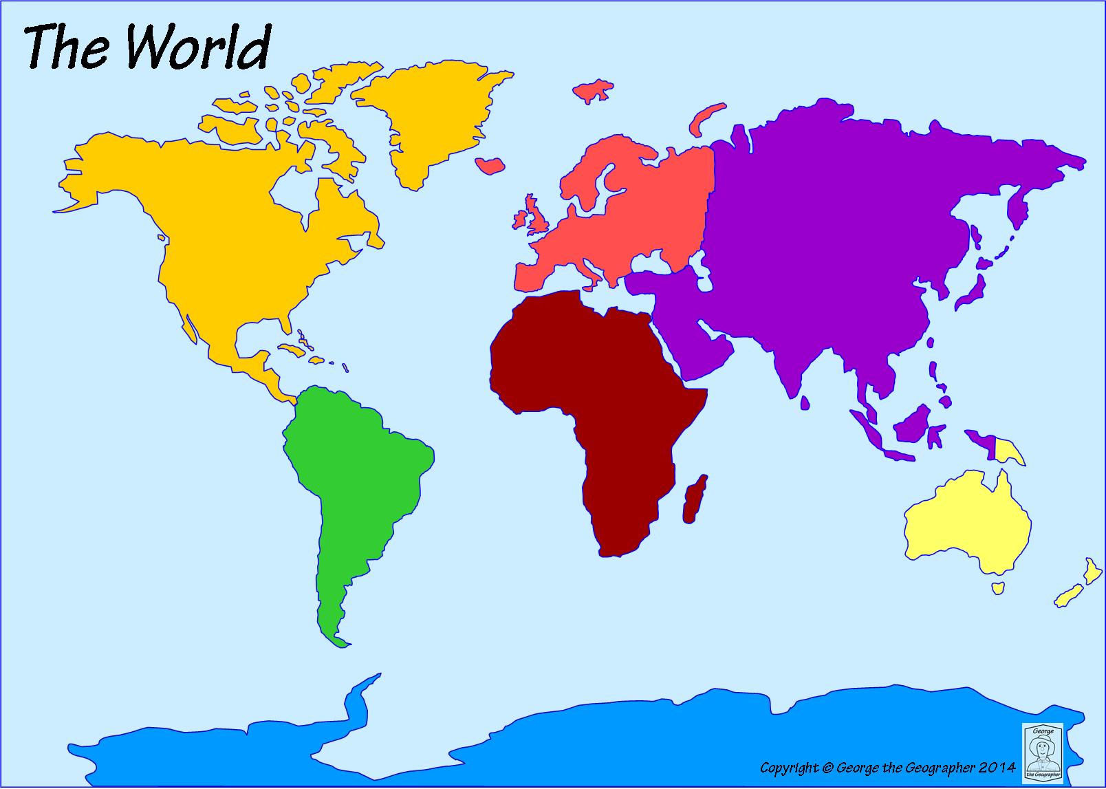
Which ocean is located off the west coast of North America. It is the LARGEST ocean.
Atlantic Ocean
Pacific Ocean
Arctic Ocean
Southern Ocean
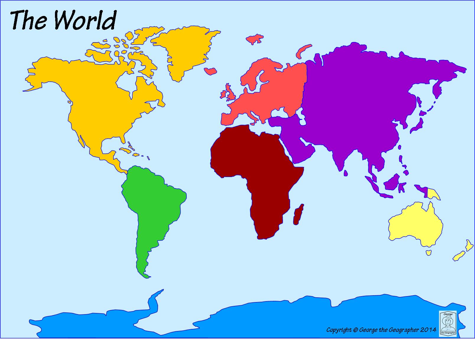
Which continent is an island continent?
Europe
North America
Antarctica
Australia
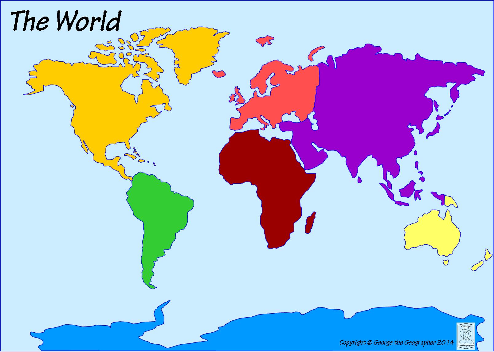
The United States of America is a country located on which continent?
South America
Europe
Africa
North America
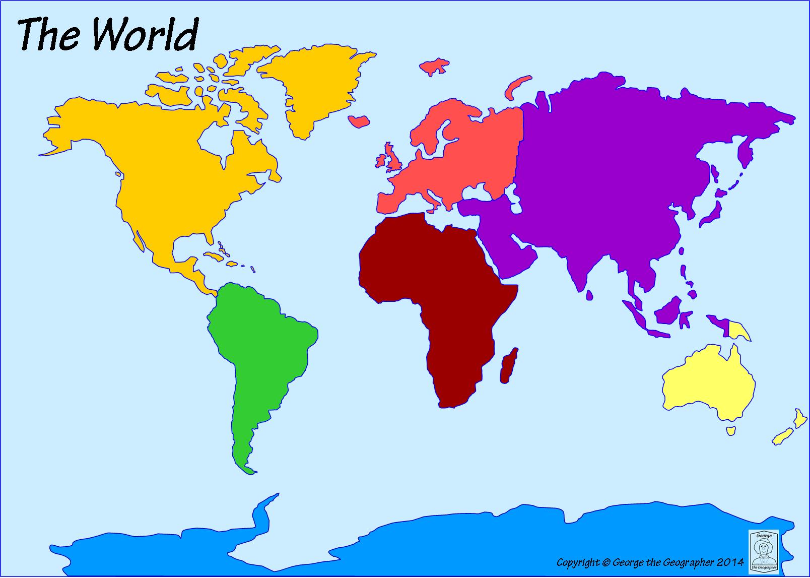
Which ocean is the most southern ocean?
Atlantic
Pacific
Southern
Arctic
The capital city of the United States is ...
Washington DC
New York
Tallahassee
London

We will need to examine a lot more _____ before we can make any conclusions.
Data
Source
Export
Approach
The infographic should be trustworthy with reliable sources.
Focus on one central idea
Research facts and figures
Creativity
Organization
An information that is presented in a graphic visual form.
Image
Text
Infographics
Graphics

Who is the mascot of McDonald's?
happy meal Hank
Ronald McDonald
donald the duck
mc-y dee

WHAT BURGER IS THIS?
JEFF
BIG MAC
CHEESE BURGER
SMOOTHIE

what are these??
nuggets
mcnuggets
nuggs
fries
cheeseburger

what are these???
nuggets
coke
cheeseburger
fries
McDonalds Logo is what?
The Golden Chicken
The Golden Ark
The Golden Arches
The Golden Mac
McDonalds most famous burger is?
The Big Stack
The Big Whopper
The Big Sean
The Big Mac

which is a nickname for it?
Micky D'S
burger king
TraSh
Biology class
Where was the first Starbucks?
Austin, Texas
Atlanta, Georgia
Detroit, Michigan
Seattle, Washington
What star bucks drink was made first
Latte
Frappuccino
What year was starbucks created in?
1971
2001
1983
1970
True or false: Starbucks is the largest coffee retailer in the world
True
False
In the beginning, Starbucks only sold ...............................
coffee
coffee beans
Howard got good experience from his business trip to ....................
Italy
France
When Howard came back to USA, the owners .................... his new ideas.
accepted
rejected
Howard was born and raised in
poverty
richness

True or False: "The GPS says 33. N and 84. W" is an example of relative location.
True
False

if you cross a time zone line going east you must.....
subtract an hour from your watch
add an hour to your watch

What time zone would California be in?
Pacific Time
Mountain Time
Western Time
Eastern Time

If it is 5:00 pm in Miami, Florida, what time is it in Denver, Colorado?
3:00pm
8:00pm
4:00pm
6:00am
True or false?
Time zones are divided by imaginary lines called meridians
True
False
Where is the north pole located?
90° N
45° N
90° S
45° S
Where is the south pole located
45° S
90° N
45° N
90° S
Fill in the blank. Place commas between each answer.
The ___________ is at the center of the lines of _______° latitude and is at _______° latitude.
(a)
Who was the US President who was responsible for facilitating the time zones?
Abraham Lincoln
Chester Arthur
Rutherford B. Hayes
Barrack Obama
What was the main reason for the creation of time zones?
Internet connection
Television schedules
Super Bowl Sunday
Train schedules

