
 Worksheets
U1 Georgia Geography Test Review
Total questions: 78
Worksheet time: 26mins
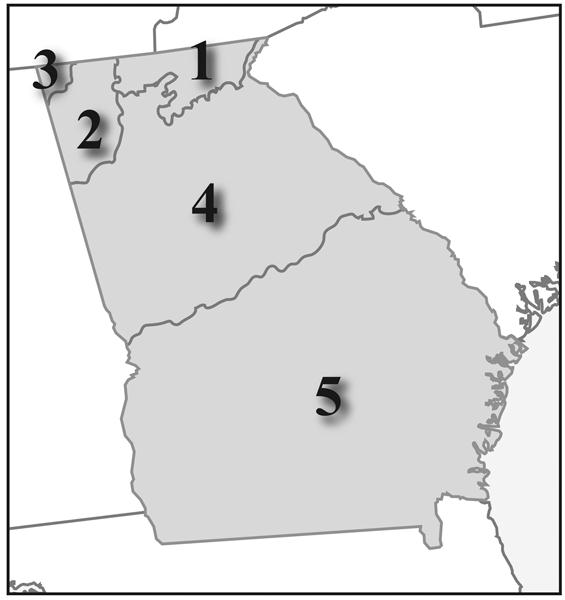
(SS8G1d) Because of its warm weather and sunny beaches, beach-goers would most likely be attracted to which geographic region?
(SS8G1) ~ Most populated, Industrial Heart (cars and planes built here),2nd largest geographic region
Coastal Plain
Blue Ridge
Ridge and Valley
Piedmont

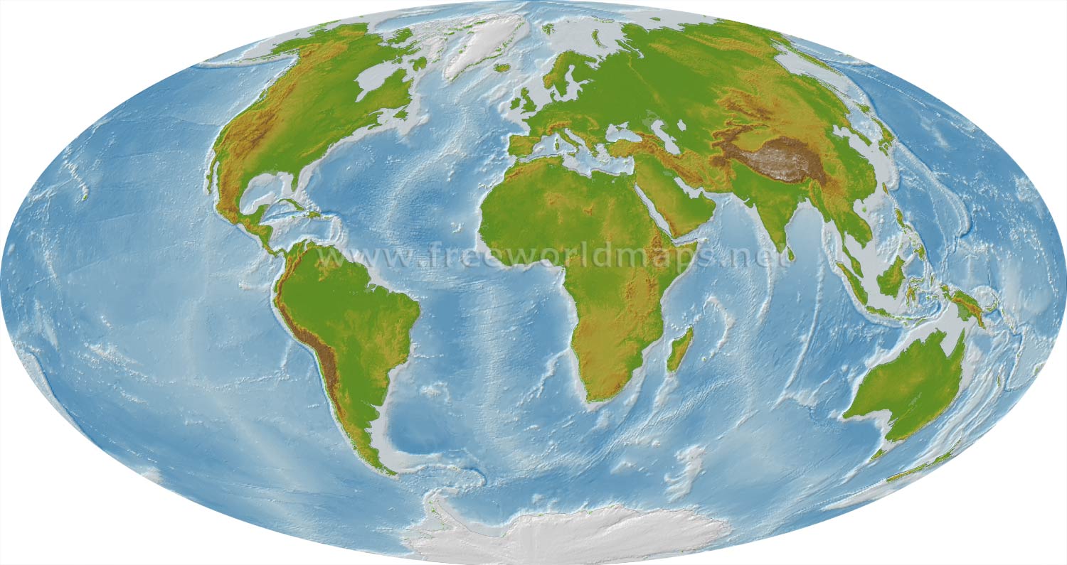
On which hemisphere will you find Georgia?
Southern
Eastern
Northern
This separates the Piedmont from the Coastal Plains. It drops in elevation creating waterfalls
Barrier Islands
Region
Fall Line
Longitude
(SS8G1b) Which region is Georgia's only source of coal?
On which hemisphere will you find Georgia?
Southern
Eastern
Western
Northeastern

What is shown as the yellow area on this map?
Northern Hemisphere
Western Hemisphere
North America
United States of America

Which number is the Atlantic Ocean?
1
2
3
4
Which is the largest region in Georgia?
Blue Ridge
Piedmont
Coastal Plains
Valley and Ridge

In which region is Atlanta located?
1
2
3
4
Which is the smallest region in Georgia?
Blue Ridge
Appalachian Plateau
Coastal Plains
Valley and Ridge
Which region in Georgia has the most farmland?
Blue Ridge
Appalachian Plateau
Coastal Plains
Piedmont
Which region in Georgia has the most rainfall?
Blue Ridge
Appalachian Plateau
Coastal Plains
Piedmont
Which region in Georgia is known as the "Carpet Capital of the World?"?
Blue Ridge
Appalachian Plateau
Ridge and Valley
Piedmont
In which region is Savannah located?
2
3
4
5
Which region is the Coastal Plains?
2
3
4
5
Which region is the Ridge and Valley?
2
3
4
5
Which region is the Piedmont?
2
3
4
5
In which region is Appalachian Plateau?
1
2
3
4
In which region is the Blue Ridge?
1
2
3
4

Where is the Okefenokee Swamp located?
6
11
12
14
Where are the Blue Ridge Mountains/Appalachian Mountains located?
6
11
12
14
What is indicated by the yellow circles on this map?
Savannah River
Okefenokee Swamp
Atlantic Ocean
Atlanta
Where is the Chattahoochee River located?
6
12
13
14
Where is the Savannah River located?
6
12
13
14
Where is Atlanta located?
7
8
8
10
What is directly to the LEFT of the yellow circles on the map?
Savannah River
Okefenokee Swamp
Barriers Islands
Atlanta
What form of transportation would be used to bring a large shipment of foreign oil to its first point for unloading in Georgia?

Which transportation system has the biggest impact on making GA a center of international business?
The Port at Brunswick
The Marta rail system
The Interstate system
Hartsfield-Jackson Airport

Which of GA's transportation systems allows GA business people to travel to international cities?
MARTA
AMTRAK (National Railroad Passenger Corporation)
Hartsfield-Jackson International Airport
Interstate Highway System

Which transportation system has the biggest impact on providing Georgians with consumer goods?
Interstates 75, 85, and 20
the port of Brunswick
the MARTA rail system
Hartsfield-Jackson Airport


How does GA’s railroads benefit the state’s economy?
Railroads benefit the state's economy because they can move a large amount of goods throughout our state and the nation.
The railroads benefit the state's economy by linking the interstate highway, deepwater ports, and airport together to move goods and people on both a national and international market.
By utilizing an intermodal system to move goods and people to destinations throughout our state and the rest of the country.
All of these
The Interstate system has helped Georgia companies to...
supply their products to many more areas
increase the speed of traffic in Atlanta
reduce the number of accidents involving trucks
create many congested traffic areas in Atlanta
Rolling hills are to the Piedmont region as Georgia’s highest mountains are to the _____ region.
Ridge and Valley
Blue Ridge
Appalachian Plateau
Piedmont
The high peaks in this region provide precipitation for the rest of the state as well as the creation of many river systems in Georgia.
Coastal Plain
Appalachian Plateau
Blue Ridge
Piedmont
Which region is known for red clay soil, a large population, and its location near the Fall Line?
Ridge and Valley
Coastal Plain
Blue Ridge
Piedmont
Suzy wants to put new carpet in her house. In which region will the new carpet most likely be manufactured?
Ridge and Valley
Blue Ridge
Coastal Plain
Piedmont
Which region has the following features?
· Okefenokee Swamp
· Barrier Islands
· Fall Line
Coastal Plain
Blue Ridge
Ridge and Valley
Piedmont
What do the cities of Columbus, Macon, and Augusta have in common?
They were all once a capital of Georgia
They were all established along the Fall Line
They were all located on the Chattahoochee River
They are all located in the highest elevations of Georgia
What would happen during Georgia’s hurricane season if the barrier islands did not exist? Choose more than one answer...
The hurricane intensity would be more damaging to Savannah.
The mainland of Georgia would be at risk of greater erosion and loss of land.
Ships would not be able to enter Georgia’s ports.
Georgia’s annual precipitation would decrease.
1.) Pretend it is 1820 and electricity does not yet exist. You need to build a small factory that will use water to generate hydropower. At which physical feature are you most likely to construct your factory?
Okefenokee Swamp
Warm Springs
Coastal Plain
Fall Line
Why is the Okefenokee Swamp unique?
It is the only swamp in North America.
It is the largest area of land in the world NOT inhabited by humans.
It is the only wetland home to alligators in the southeast United States.
It is the largest freshwater swamp in North America.
Which of the following best describes the economic importance of the Savannah River?
Native Americans and de Soto both used the river for transportation and exploration.
Forms the border between Georgia and South Carolina.
Provides drinking water for Atlanta.
International companies use the deepwater port at Savannah to transport goods overseas.

Which hemispheres is the state of Georgia located? (Select TWO)
Northern Hemisphere
Southern Hemisphere
Eastern Hemisphere
Western Hemisphere
In what region is granite mined, cars & planes manufactured, and poultry raised?
Ridge and Valley
Blue Ridge
Piedmont
Appalachian Plateau
Georgia relies on transportation for the distribution of goods and services domestically and internationally.
Which of the following types of transportation does Georgia use? (Select all that apply)
Rail (Trains)
Water (Ships)
Air (Planes)
Roads (Trucks)
On a map or globe, Georgia is located in the northern and western ones of these.
Latitudes
Longitudes
Continents
Hemispheres
This northwestern most region of Georgia is known for its coal deposits.
Appalachian Plateau
Blue Ridge
Coastal Plain
Piedmont
Ridge and Valley
This is the northeastern most region of Georgia and location of the highest point in the state.
Appalachian Plateau
Blue Ridge
Coastal Plain
Piedmont
Ridge and Valley
This is the most populated region.
Appalachian Plateau
Blue Ridge
Coastal Plain
Piedmont
Ridge and Valley
This region in central Georgia contains over half of the state’s population.
Appalachian Plateau
Blue Ridge
Coastal Plain
Piedmont
Ridge and Valley
This region contains the capital city of GA.
Appalachian Plateau
Blue Ridge
Coastal Plain
Piedmont
Ridge and Valley
This river in western Georgia forms half of the state’s border with Alabama and provides drinking water for 70% of the people in Atlanta.
Okefenokee
Chattahoochee
Savannah
Barrier
This river forms Georgia’s border with South Carolina & served as a source of travel for early settlers.
Okefenokee
Chattahoochee
Savannah
Barrier
This is the location where the Piedmont and Coastal Plain regions meet.
Okefenokee Swamp
Fall Line
Barrier Islands
Appalachian Mountains
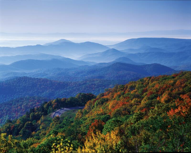
This mountain range extends into North Georgia.
Okefenokee Swamp
Fall Line
Barrier Islands
Appalachian Mountains

