
NEW
Font size
 Worksheets
Map Projection
Total questions: 44
Worksheet time: 23mins
True or false: Globes provide a three-dimensional view of the Earth. They provide the most accurate view of the world, but have limitations in their use.
True
False
True or false: All world map projections create distorted images of the Earth to some degree. These distortions relate to size, shape, direction, and distance.
True
False
True or false: The cartographer’s purpose and the projection used to create a map influence what information is accurate and what is distorted.
True
False
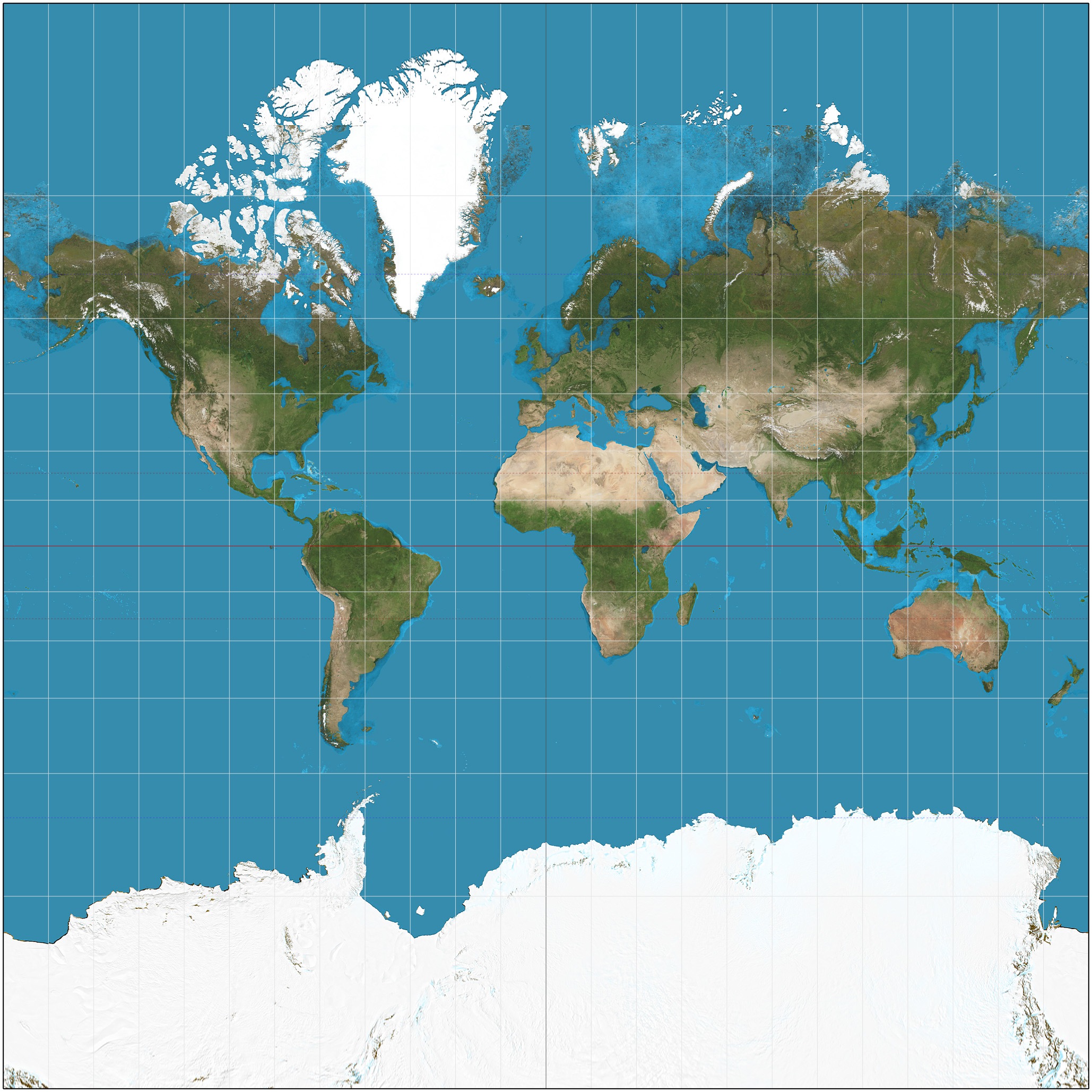
Which projection is this?
Gall Peter's
Robinson
Mercator
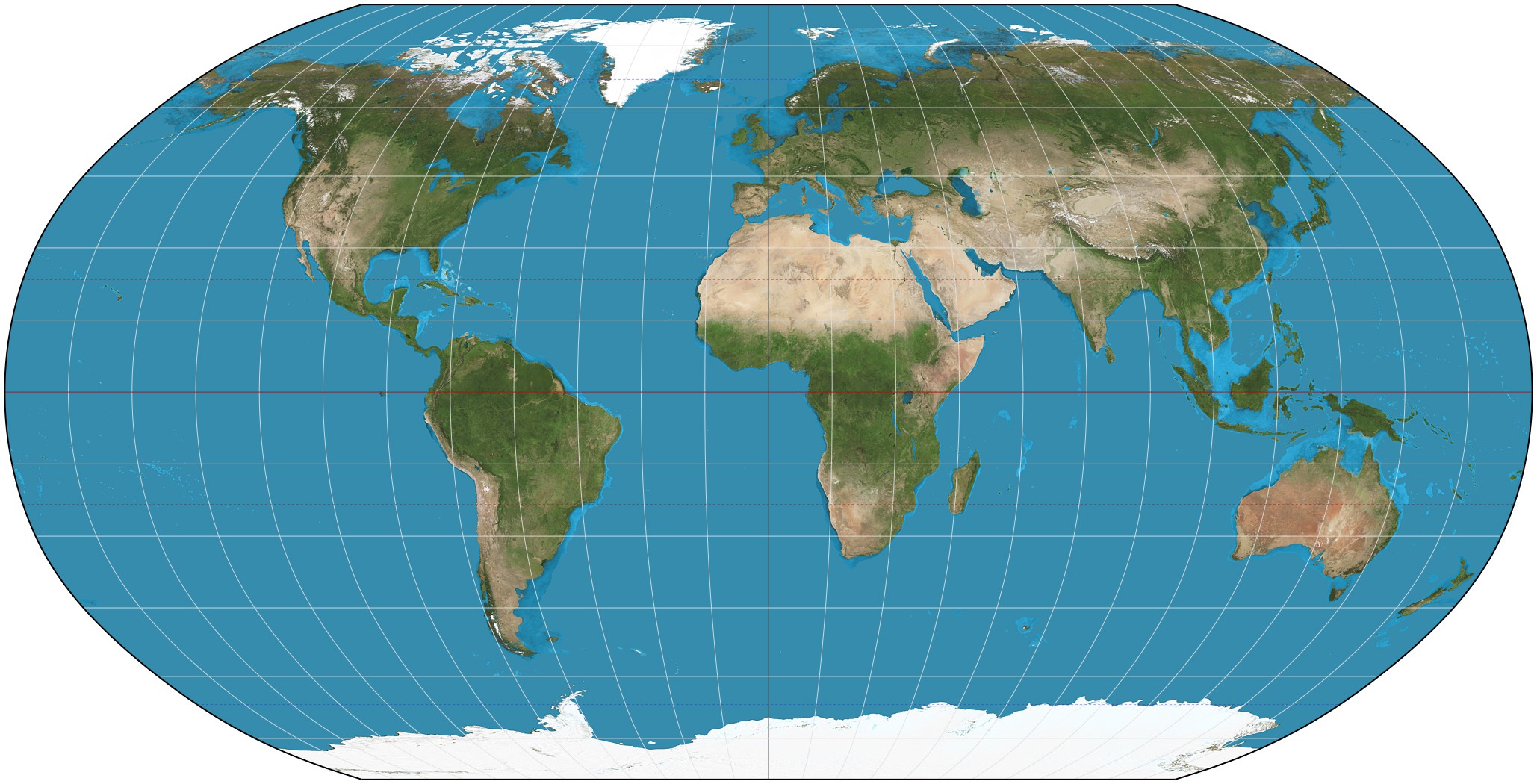
Which projection is this?
Gall Peter's
Robinson
Mercator
Which map projection's shape and direction are accurate but size is very distorted?
Robinson
Gall Peter's
Mercator
Which map projection's size and shape are both fairly accurate even though they are slightly distorted near the poles?
Robinson
Gall Peter's
Mercator
Which map projection was created in the 1500’s in order to help ships navigate the oceans?
Mercator
Gall Peter's
Robinson

This is a Mercator projection map. Why is this map projection not be the greatest to use when determining land size?
Places at the poles, like Greenland and Antarctica, are extremely distorted in their size, appearing larger than they really are.
Africa appears too large on this map.
All the continents are smaller than they actually are.
Places by the equator are highly distorted and appear much larger than they really are.


This is a...
political map
physical map
elevation map
thematic map

Type of projection?
Conical
Azimuthal
Cylindrical
Topographic

What type of projection?
Azimuthal
Conical
Cylindrical
Topographic

What is the disadvantage of a map compared to a globe?
a map distorts properties like distance, area, direction, shape
a map shows little detail
a map indicates actual distances
a map is very large

What type of projection?
Azimuthal
Conical
Cylindrical
Topographic

What type of map?
Azimuthal
Conical
Cylindrical
Topographic

The terrestrial icosahedron that we made is not only an assembly exercise, it corresponds to a real type of map projection. It is called the ______ map projection.
Miller
Albers
Van Der Grinten
Fuller
Map makers use different types of ______________ to show flat images of Earth's rounded surface.
projections
locator map
political map
relative location
Which is better to find your way around a city?
globe
map
aerial photo
relative location
To find out how may US states border Mexico, you would look at a _____________.
political map
physical map
globe
key
The four (4) features on a map
Title, Compass, US Map, and Caribbean Map
Title, Key, scale, and Compass
Key, scale, title, flags
Stars, key, Compass, title
Used to measure distance on a map


What does the title show on a map?
shows the person who made the map
attracts the reader's attention
shows the purpose of the map
shows important information about the size
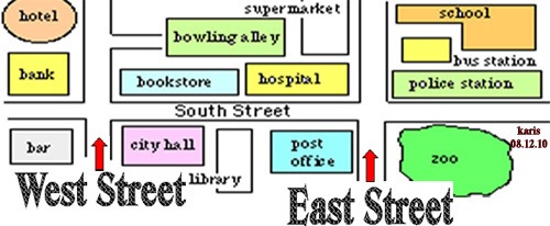

0 degrees latitude is known as which geographic feature on a map?
Parallel
Prime Meridian
Hemisphere
Equator
the number of people or things in a given area or space
density
degree
distort
navigate
projection
a unit of measurement used to measure where a location is on earth
accuracy
degree
distort
navigate
projection
giving a false impression of features on a flat map when trying to project a globe upon it
accuracy
degree
distort
navigate
projection
a method for representing part of the surface of the earth or a celestial sphere on a plane surface
accuracy
degree
distort
navigate
projection
an angle which ranges from 0° at the Equator to 90° (North or South) at the poles also known as parallels; run east–west as circles parallel to the equator
latitude
longitude
minutes
seconds
degree
a measurement ranging from 0° at the Prime Meridian to +180° eastward and −180° westward. It is used to denote the location of a place on Earth east or west of the Prime Meridian.
latitude
longitude
minutes
seconds
degree
A map projection in which the surface features of a globe are centered horizontally and the distortion of shape and scale is minimal in equatorial regions and maximal at the poles.
cylinder
globe
spheroid
South Pole
North Pole
an imaginary line drawn around the earth equally distant from both poles, dividing the earth into northern and southern hemispheres and constituting the parallel of latitude 0°
Equator
Prime Meridian
Longitude
South Pole
North Pole
The imaginary 0° longitude that divides Earth into the Eastern Hemisphere and the Western Hemisphere. It runs through Greenwich, England.
Equator
Prime Meridian
180° Parallel
180° Meridian
North Pole
a person who draws or produces maps
cartographer
geographer
stenographer
photographer
Which is NOT a distortion property map projection?
azimuthal
conformal
equidistant
equal-area
imaginary lines on Earth that run parallel to the equator
lines of latitude
location
lines of longitude
equator
imaginary lines on Earth that run between the North and South Poles
lines of latitude
equator
lines of longitude
grid

What letter is found at (60S, 120W)?
I
F
B
C

What letter is found at (15N, 45W)?
A
H
J
D

