NEW
Font size
 Worksheets
2023 W/E/D/Exam
Total questions: 49
Worksheet time: 4hrs 5mins

The diagram below represents a portion of the water cycle. Letters A, B, C, and D represent processes or features related to the water cycle; Arrows represent movement of water. Which table correctly matches these letters with the processes or features related to the water cycle?


The diagram below represents four different land surfaces of equal area. Which area would most likely have the greatest permeability as each area receives the same amount of rainfall?
sand
forest with clay soil
pebbles
grassy field with silt soil
A mudslide is most likely to occur on a hillslope having soil that is
saturated with water and without vegetation
unsaturated and covered by vegetation
unsaturated and without vegetation
saturated with water and covered by vegetation
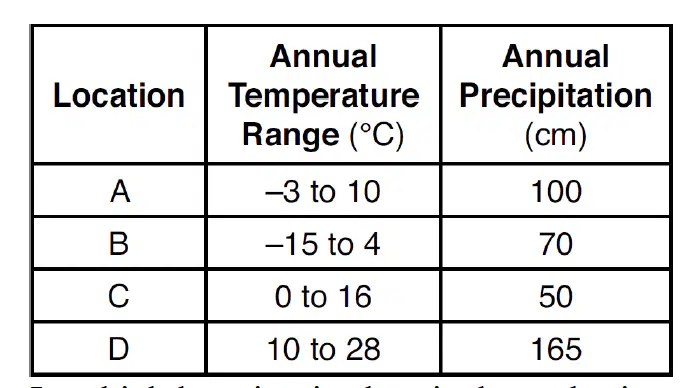
The table below shows general climate conditions of four different locations, A, B, C, and D. In which location is chemical weathering probably greatest, based on these climate conditions?
A
B
C
D
The sediment deposited by a landslide is usually
sorted and layered
unsorted and non-layered
unsorted and layered
sorted and non-layered
Which particles most likely will be deposited first as the velocity of a stream carrying a mixture of particles decreases?
small, flat, low-density particles
large, flat, high-density particles
arge, round, high-density particles
small, round, low-density particles
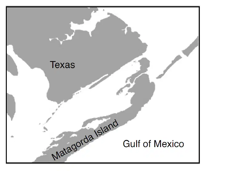
The map below shows a portion of Matagorda Island. This barrier island is located along the coast of Texas in the Gulf of Mexico. Which agent of erosion is primarily responsible for
the formation of Matagorda Island?
streams
wind
wave action
moving ice
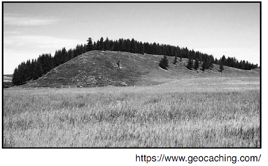
The photograph below shows an elongated hill that
was originally deposited by a glacier. This landscape feature is identified as a
drumlin
dune
outwash plain
terminal moraine
Compared to a well-sorted sample of larger-sized
particles, a well-sorted sample of smaller-sized
particles has greater
transpiration
porosity
permeability
capillarity
Which changes in surface water movement are likely
to occur when vegetation is removed from the side
of a hill?
infiltration decreases and runoff decreases
infiltration increases and runoff increases
infiltration increases and runoff decreases
infiltration decreases and runoff increases

What is the approximate minimum stream velocity
required to transport the smallest particles of sand?
0.3 cm/s
1.0 cm/s
0.1 cm/s
0.7 cm/s
What is the minimum stream velocity necessary to
transport a quartz particle that is 0.1 centimeter in
diameter in a stream?
0.5 cm/s
5.0 cm/s
0.05 cm/s
50.0 cm/s
Which agent of erosion is primarily responsible for
the formation of the barrier islands along the south
shoreline of Long Island, New York?
wave action
mass movement
glacial ice
wind
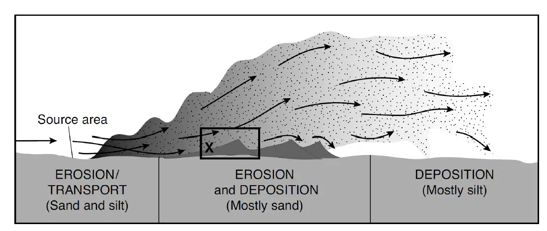
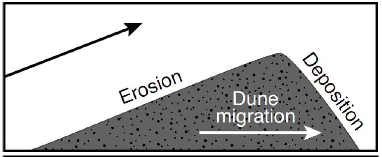
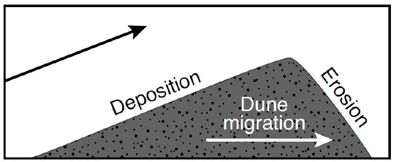
The diagram represents an erosional-depositional system in an arid environment, and indicates the processes occurring at various locations within the atmosphere and on the land surface. The box labeled X identifies one sand dune. Arrows represent the movement of particles. The total range of particle sizes indicated in this system is..
0.0004 to 0.006 cm, only
less than 0.0004 cm
.006 to 0.2 cm, only
0.0004 to 0.2 cm
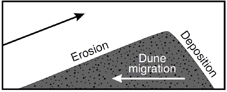
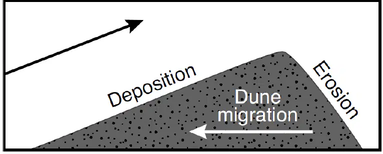
The diagram represents an erosional-depositional system in an arid environment, and indicates the processes occurring at various locations within the atmosphere and on the land surface. The box labeled X identifies one sand dune. Arrows represent the movement of particles. Which diagram indicates both the direction of dune migration (movement) and the dominant process
occurring on each slope of the dune in box X?
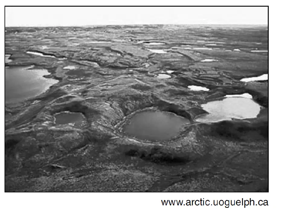
The aerial photograph below shows small, circular bodies of water surrounded by sediment in an area that was once covered by glaciers. These bodies of water are known as
finger lakes
watersheds
tributaries
kettle lakes

The cross section represents processes in the water cycle. Arrows represent the movement of water. Letters A, B, C, and D represent locations on Earth's surface. The greatest amount of transpiration and evaporation will occur most likely when the air temperature is
low and the humidity is low
high and the humidity is high
high and the humidity is low
low and the humidity is high
The cross section represents processes in the water cycle. Arrows represent the movement of water. Letters A, B, C, and D represent locations on Earth's surface. The downward movement of water from location A will usually be greatest when the soil is
nonporous and the particles are uniformly small in size
nonporous and the particles are uniformly large in size
porous and the particles are uniformly small in size
porous and the particles are uniformly large in size

The diagram represents three tubes, A, B, and C, each containing an equal volume of uniform-sized spherical beads. The bottom of each tube is covered with a wire screen. XY is a reference line. These tubes are placed in water up to the level of line XY to demonstrate capillarity. After one hour,
the height of the water above line XY will be
highest in tube A
the same height in all three tubes
highest in tube C
highest in tube B
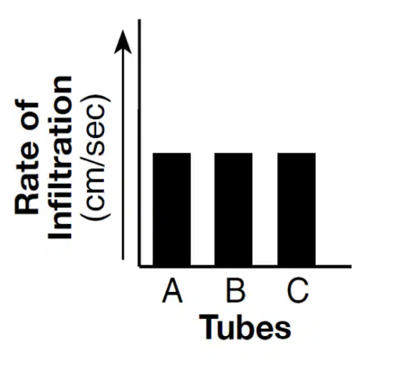
The diagram represents three tubes, A, B, and C, each containing an equal volume of uniform-sized spherical beads. The bottom of each tube is covered with a wire screen. XY is a reference line.
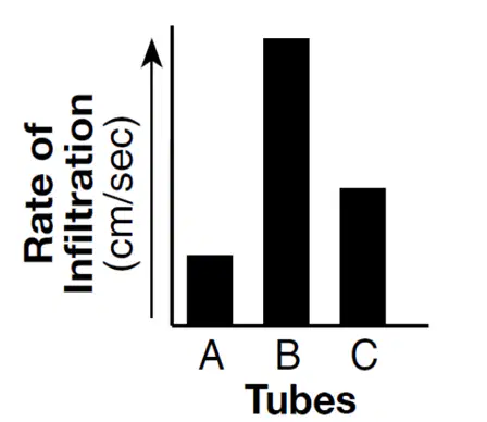
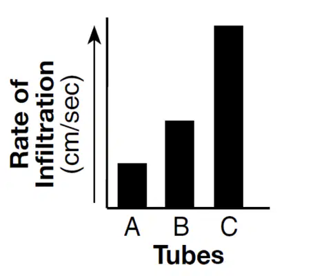
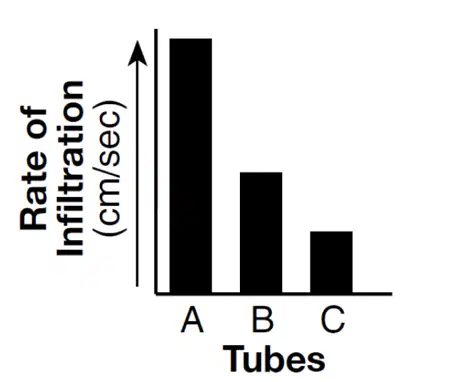
Which bar graph would best represent the rate of water infiltration through tubes A, B, and C?
Which type of sediment sample normally has the
greatest permeability rate?
unsorted pebbles
unsorted sand
sorted pebbles
sorted sand
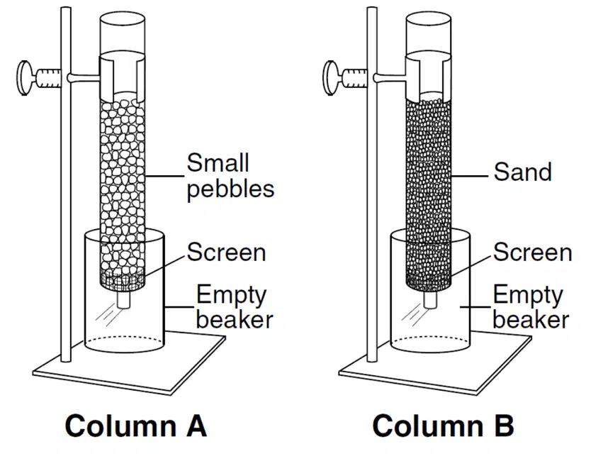
The diagram below represents two columns, A and B, that were used to determine the infiltration rate and water retention of two different particle sizes by pouring equal amounts of water through each column. Compared to column A, column B had a..
lower rate of infiltration and retained less water
lower rate of infiltration and retained more
water
higher rate of infiltration and retained less water
higher rate of infiltration and retained more
water
Which two factors will increase the rate of a stream's flow?
decreased precipitation and decreased slope
decreased precipitation and increased slope
increased precipitation and decreased slope
increased precipitation and increased slope
Which condition normally lowers the water table?
irrigation of fields for several weeks, using
well water
several days of heavy snowfall, followed by
rain
streambanks overflowing during spring runoff
several days of moderate rainfall
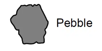
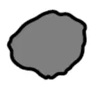
The diagram below represents the size and shape of a pebble. This pebble and 20 other pebbles having a similar size and shape were placed in a rock tumbler with water and allowed to abrade for five days. Which diagram best represents the size and shape of this pebble after the five-day period?

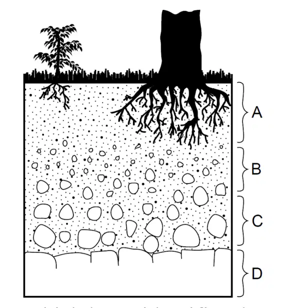
The cross section below represents zones of soil
labeled A, B, and C. Letter D represents underlying
bedrock. Which letter identifies the zone having the most organic and weathered material?
A
B
C
D
The rate of soil development in tropical areas is
usually greater than the rate of soil development in
arctic areas because tropical areas have
less chemical weathering and a scarcity of
living organisms
less chemical weathering and an abundance of
living organisms
more chemical weathering and a scarcity of
living organisms
more chemical weathering and an
abundance of living organisms
What are two major factors that control the
development of soil in a given location?
vegetative cover and slope
tectonic activity and elevation
erosion and transpiration
bedrock composition and climate
As a quartz pebble is transported by a stream, the
pebble will become more rounded as a result of
dissolving as water is running over the rock
abrasion by colliding with other rocks
deposition in well-sorted layers
resistance to weathering and erosion
What is the name of the largest sediment that can be transported by a stream moving at a velocity of 100 centimeters per second (cm/s)?
silt
sand
pebbles
cobbles
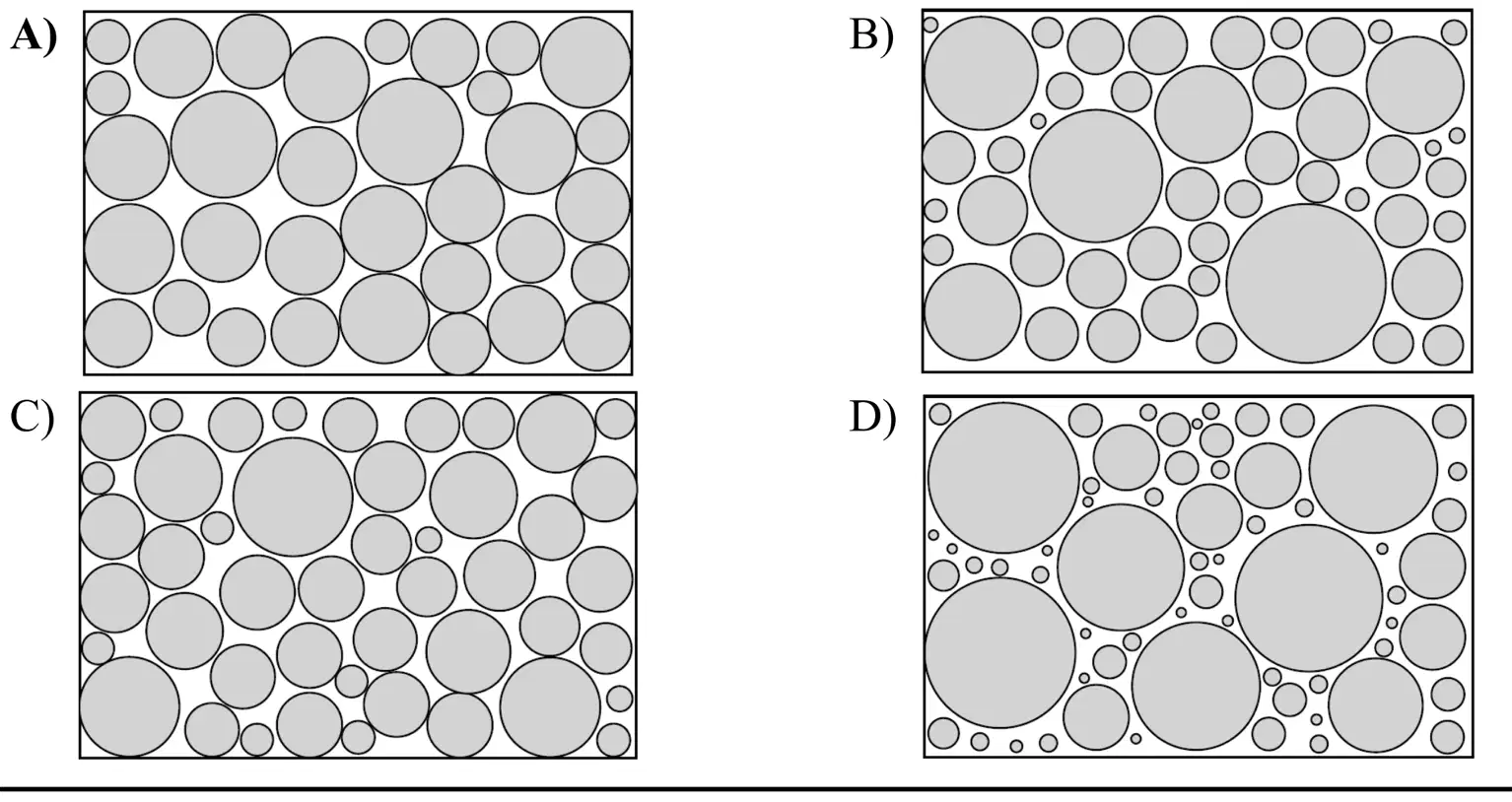
Which diagram best represents sediments with the greatest degree of sorting by size?
A
B
C
D
What is the largest particle size that a stream can
transport at a velocity of 5 centimeters per second?
silt
sand
pebbles
cobble
The minimum stream velocity necessary to transport a sediment particle that is 0.1 centimeter in diameter is closest to
0.1 cm/s
5.5 cm/s
0.002 cm/s
10.0 cm/s
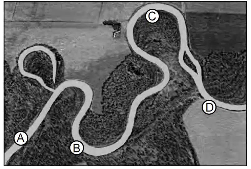
The photograph below shows a portion of the
Genesee River in western New York. Letters A, B,
C, and D are locations in the river. At which location would deposition of sediments most likely be greater than erosion?
A
B
C
D
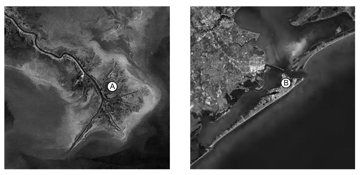
The photographs below shows two depositional features labeled A and B. Which terms correctly identify depositional features A and B?
A-delta;
B-barrier island
A-sand bar;
B-island arc
A-barrier island;
B-delta
A-island arc;
B-sand bar

The photograph below shows a depositional feature located near the shore of Texas. Letter X represents a location on this feature. On which depositional feature is location X found?
an island arc
a barrier island
a drumlin
a floodplain

The photograph shows a meandering stream in a wooded area. Points A and B represent locations on the streambanks. Letter X represents a flat area near the stream. Most of the particles deposited where the stream velocity decreases from 50 centimeters per second
to 5 centimeters per second are
[Use ESRT p 6]
small cobbles and large pebbles
small pebbles and large sand
small sand and large silt
small silt and large clay
The photograph shows a meandering stream in a wooded area. Points A and B represent locations on the streambanks. Letter X represents a flat area near the stream. The streambank at location B is steeper than the streambank at location A because the water near
location B is moving
slower than the water near location A, causing more erosion
slower than the water near location A , causing more deposition
faster than the water near location A, causing more erosion
faster than the water near location A, causing more deposition
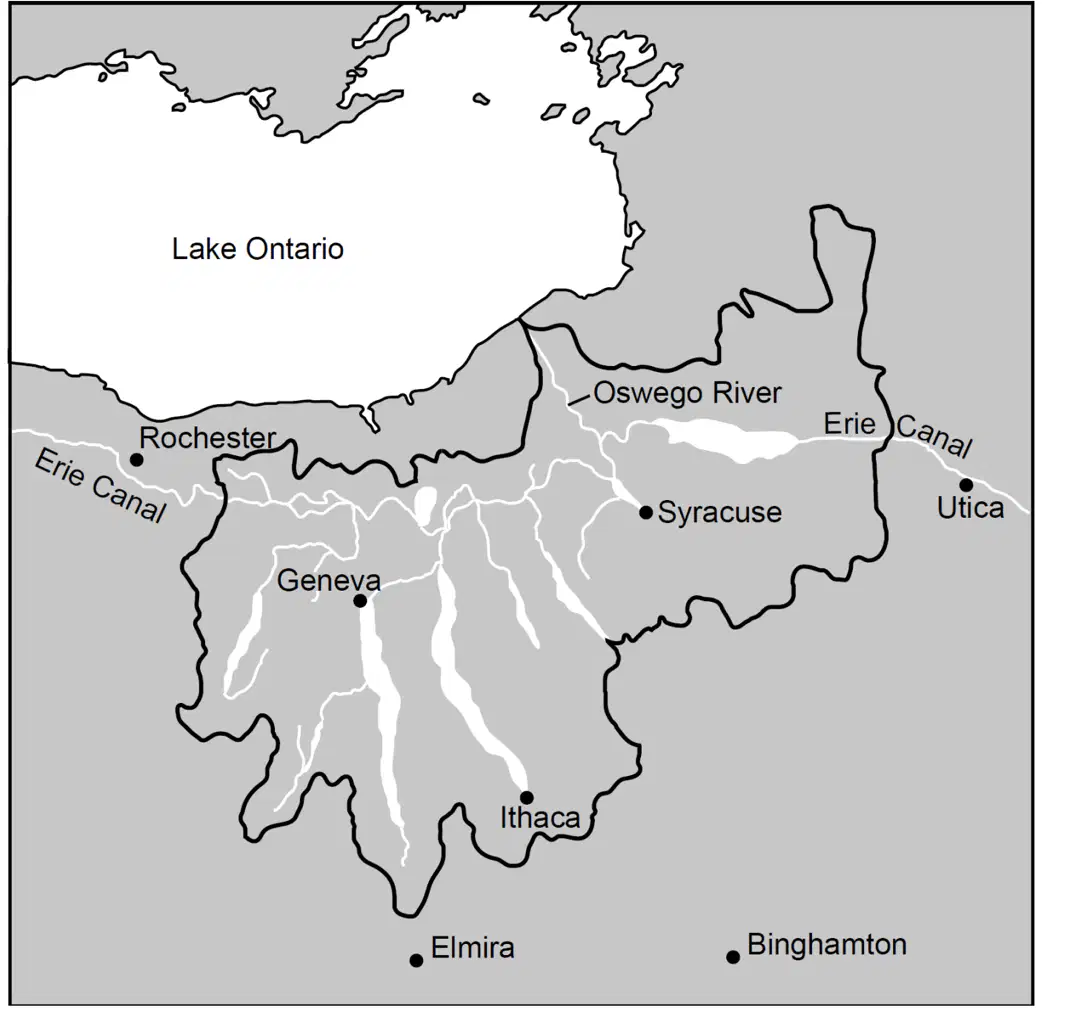
The map below shows the land area in New York State drained by the Oswego River and its tributaries. The land area drained by the Oswego River and its tributaries is called a
delta
floodplain
water table
watershed
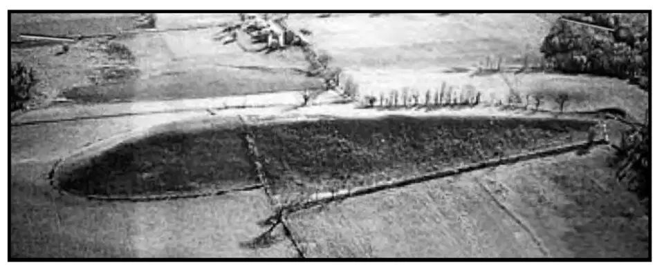
The aerial photograph below shows an elongated hill near the Finger Lakes formed by glacial deposition in New York State. This elongated hill is best identified as a
kettle
drumlin
sand dune
moraine
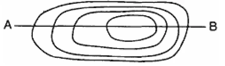
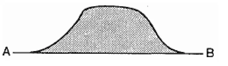
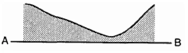
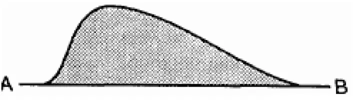
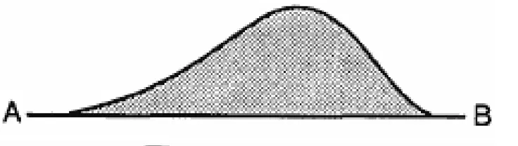
The diagram below represents contour lines on a
topographic map with cross-section line AB. Which diagram best represents the topographic profile along line AB?
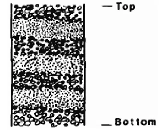
The diagram below represents a cross section of
sedimentary deposits. Where would this type of
deposition most likely occur?
at the base of a shifting sand dune
in a lake fed by a stream
beneath a large glacier
at the rapids in a stream
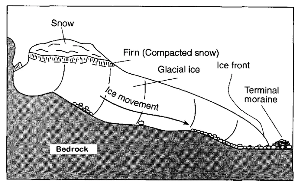
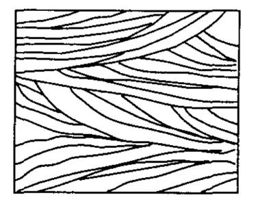
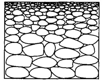
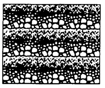
Base your answer to the following question on the
diagram which represents a profile of a mountain
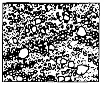
glacier in the northern United States. Which cross section best represents the sediment that was transported and deposited by this glacier?
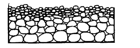
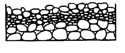
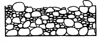
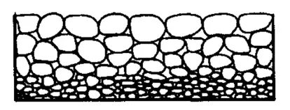
Quartz particles of varying sizes are dropped at the
same time into deep, calm water. Which cross
section best represents the settling pattern of these
particles?
A
B
C
D
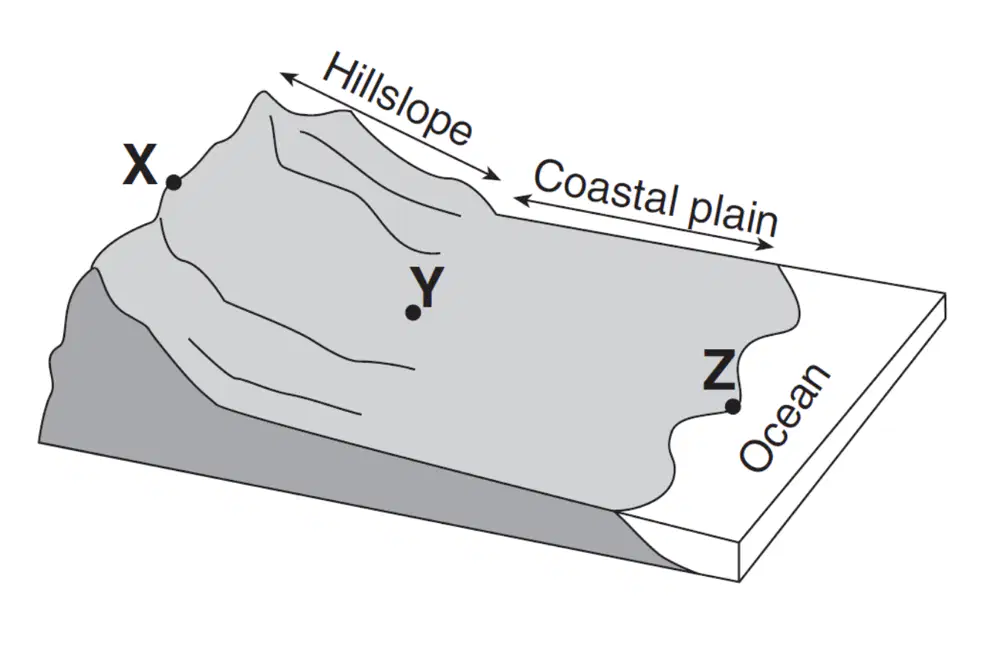
The diagram below which shows a coastal region in
which the land slopes toward the ocean. Point X is near the top of the hill, point Y is at the base of the hill, and point Z is a location at sea level. The same type of surface bedrock underlies this entire region. A stream flows from point X through point Y to point Z. This stream is not shown in the diagram.
Which cross section best shows the pattern of sediments deposited by the stream as it enters the ocean near point Z?
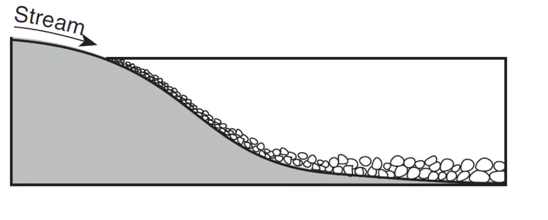
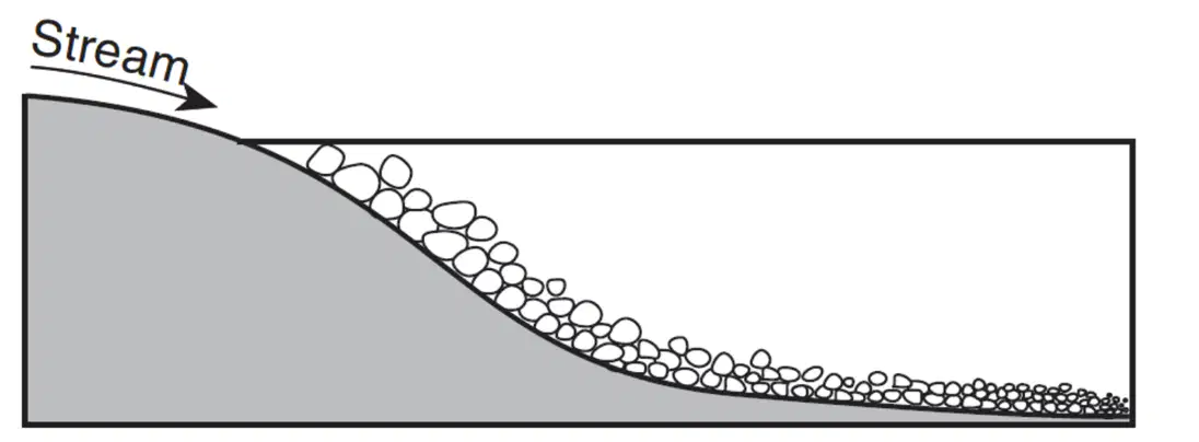
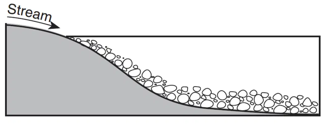
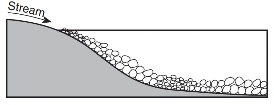
The diagram below which shows a coastal region in
which the land slopes toward the ocean. Point X is near the top of the hill, point Y is at the base of the hill, and point Z is a location at sea level. The same type of surface bedrock underlies this entire region. A stream flows from point X through point Y to point Z. This stream is not shown in the diagram.
Which diagram best shows the most probable path of the stream flowing from point X to point Z?
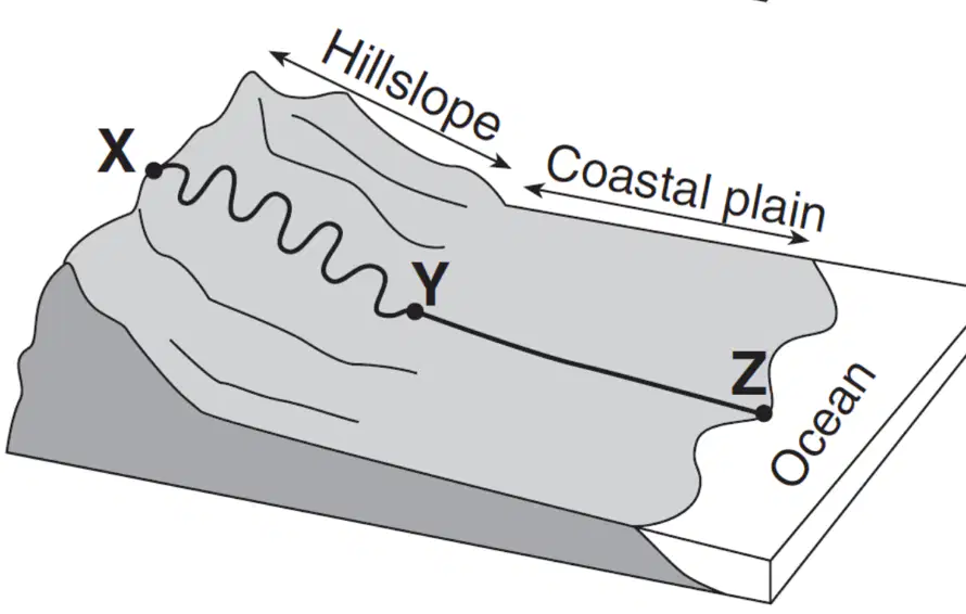
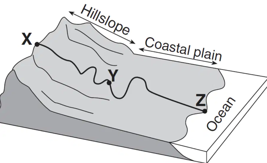
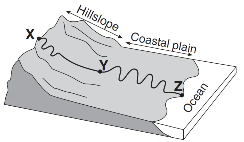
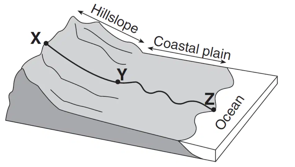
At a particular location within a stream, the erosional
rate and the depositional rate have the same value.
What condition exists at this location?
Uplifting forces are now dominant over
leveling forces.
All of the stream's kinetic energy has been
changed to potential energy.
The stream's velocity will no longer change.
A state of dynamic equilibrium has been
reached.
A pebble is being transported in a stream by rolling.
How does the velocity of the pebble compare to the
velocity of the stream?
The pebble is moving slower than the
stream.
The pebble is moving at the same velocity as
the stream.
The pebble is moving faster than the stream.
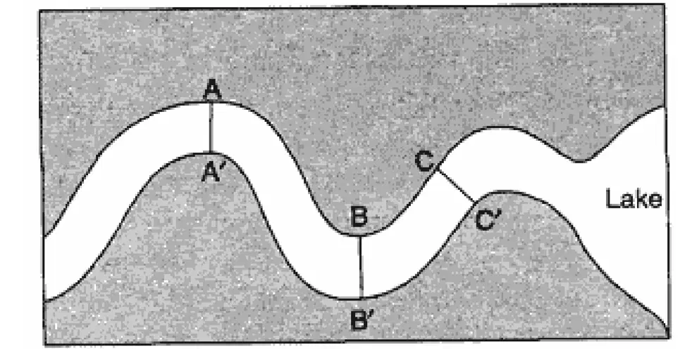
The map below represents a meandering stream
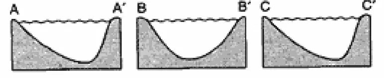
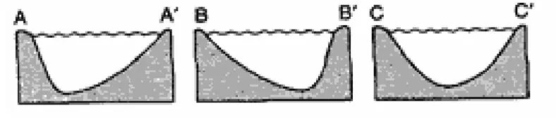
flowing into a lake. A student measured water depths in the stream at three locations: A–A', B–B', and
C–C'. Which set of cross sections best represents the
stream bed at the three locations?