
 Worksheets
Test Review
Total questions: 77
Worksheet time: 28mins

What is a glacier?
A glacier is any piece of ice that moves.
A glacier is a mass of ice that thaws and re-freezes repeatedly.
A mass of ice must be at least 1 mile thick
Masses of ice made made up of snow that has accumulated and compacted over time .

Why do glaciers move?
due to their immense weight
gravity
meltwater at the bottom of the glacier
All of the answers

Which statement about glaciers is NOT true?
Glaciers move so slowly that their movement cannot be noticed by humans.
Glaciers change the surface of the land
Glaciers transport sediment.
Glaciers are found on every continent.

Large rocks or boulders that are transported by glaciers are called...
striations
erratics
till
abrasions

Unsorted sediment or pebbles, sand, clay, etc. that is transported and deposited by glaciers is called:
striations
erratics
till
abrasions

This glacial landform was created by the weathering of sediment, eroded through glacial water than ran through a tunnel in the glacier. The sediment deposited, compacted into rock, and left the following mark on the landscape:
esker
till
ice
moraine
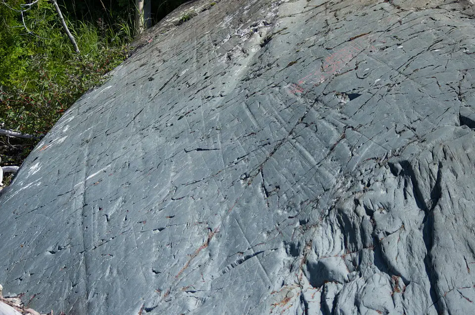
Erosion caused by rocks and boulders in the bass of the glacier acting like a giant file scratching and scraping the rocks below.
Hanging Valley
Outwash
Plucking
Striation
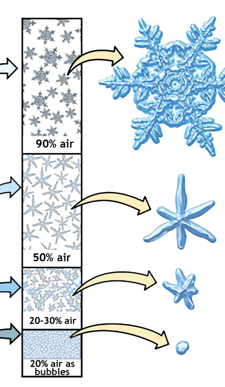
Névé is snow that has become granular(hard) but has not yet compressed into ice? Which layer of a glacier is it in?
Top
Bottom
Middle
Nowhere
What term is given to the breakdown of rocks in situ by the action of water, extremes of temperature and biological activity?
Erosion
Disintegration
Abrasion
Weathering
Pick the correct order
Transportation, weathering, deposition, erosion
weathering, erosion, transportation, deposition
Erosion, transportaion, depositon, weathering
stream "walls" by louis tomlinson
How do river bends develop?
Rivers bends develop because of the water's eroding powers.
Rivers bends develop because we interfer with them.
Rivers bends develop because of erosion
Rivers bends develop because of weathering
Current is fastest
Outside bend
Inside bend
Why is there material beside a stack?
It's material that has been deposited
Build up of materials from cracks
Material from another collapsed stack
It's material from a collapsed arch
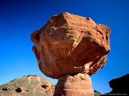
The process that breaks down rocks and other materials on Earth's surface is called
Weathering
Erosion
Deposition
Decomposition

Over long periods of time, deposition may change the Earth’s surface by _____.
forming new land features.
breaking down large rocks into smaller ones.
washing away beaches.
moving topsoil.
Some agents of weathering are water, wind, ice, temperature and plant roots.
true
false

_____ is the process by which soil and sediment (weathered rock) are transported (moved) from one place to another by water, wind, glaciers, and gravity
Erosion
Deposition
Weathering
Running Water

A farmer's topsoil is blown away during a hurricane is an example of ___________.
weathering
erosion
deposition
______________________ occurs when eroded materials stop moving and begin to build up.
Weathering
Erosion
Deposition
Flood water pounding against a canyon wall and wearing it down
weathering
erosion
deposition
Waves dropping sand on the beach
weathering
erosion
deposition
Deltas forming at the mouths of rivers
weathering
erosion
deposition
A mudslide flowing down a steep hill
weathering
erosion
deposition
Glaciers scraping rocks across the Earth's surface
weathering
erosion
deposition
Ponds filling up with sediment and becoming marshes
weathering
erosion
deposition
Layers of sediment forming at the bottom of the ocean
weathering
erosion
deposition
Flood waters moving soil from one location to another
weathering
erosion
deposition
Wind blasting sand at rock and carving out arches
weathering
erosion
deposition
Rocks being made smooth by tumbling across a streambed
weathering
erosion
deposition

The cracked, discolored and weakened rocks in this building are the result of ___________________.
Erosion
Weathering
Both
Neither
Sediment is produced as a result of weathering. The sediment is moved by wind, water or gravity during erosion. Which of these refers to sediment that has stopped moving after erosion?
Dissolution
Declaration
Deposition
Disposition

Assume that the diagram below shows a cross section of part of the lithosphere.
Which diagram correctly shows what will happen to the lithosphere when pushed by tectonic forces?


In 1912, Alfred Wegener proposed the theory of continental drift, stating that all the continents were once joined together and slowly moved apart. However, his theory was not widely accepted in his time. In 1962, the discovery of sea floor spreading (sea floor being forced apart by the formation of new crust) eventually led to a more modern and widely accepted theory of plate tectonics.
Why did the theory of plate tectonics improve upon Wegener’s theory of continental drift?
The theory of plate tectonics was a less complete theory because it provided a reason and mechanism for why the plates and continents moved.
The theory of plate tectonics was a more complete theory because it failed to provide reasons and mechanisms for why the plates and continents moved.
The theory of plate tectonics was a less complete theory because it failed to provide complete reasons and mechanisms for why the plates and continents moved.
The theory of plate tectonics was a more complete theory because it provided a reason and mechanism for why the plates and continents moved.

Ancient fossils have been placed on the map indicating where they were found.
The strongest evidence exists for which two continents to have been connected when Pangaea was present?
South America and Africa
North America and Africa
Africa and Australia
South America and Australia

The map below shows the present day locations of South America and Africa. Remains of Mesosaurus, an extinct fresh water reptile have been found in similarly aged rock layers formed from lake sediments.
Which statement represents the most logical conclusion from this evidence?
Mesosaurus migrated across frozen oceans from Africa to South America during an ice age.
The continents of South America and Africa were once joined when the Mesosaurus lived.
The continents of South America and Africa once had underground waterways where the Mesosaurus travelled from continent to continent.
The continents of South America and Africa had very different climates from each other which caused the Mesosaurus to migrate from season to season.

The diagram below shows the continents present day continents once joined together as one super continent.
What is the name of this one large landmass?
Eurasia
Gondwanaland
Laurasia
Pangaea

The Mesosaurus was a fresh water reptile that existed on Earth about 250 million years ago. Fossils of the reptile can be found today in some rock layers in both Africa and South America as shown on the map below in locations X and Y.
Which reason bestexplains why fossils of this animal are found on both continents today?
The ocean between the two continents was once frozen, and the Mesosaurus traveled across the ice.
The continents were once joined together as a single land mass.
The Mesosaurus swam across the ocean due to its migration.
During a sea level rise and floods fossil remains of the Mesosaurus were carried across the oceans between the two continents.

Which color would be the mantel?
Outside on the earth
red
orange
yellow

What color would be the earth's crust?
Outside on the earth.
red
orange
yellow
Which is the outermost, rigid layer of the earth, made of the crust and the rigid upper part of the mantle.
Lithosphere
Asthenosphere
Mesosphere
Outer core
Inner core
Convergent boundary
Where two tectonic plates collide
Where two tectonic plates separate
Where two tectonic plates slide past each other
Divergent boundary
Where two tectonic plates collide
Where two tectonic plates separate
Where two tectonic plates slide past each other
Transform Boundary
Where two tectonic plates collide
Where two tectonic plates separate
Where two tectonic plates slide past each other
Subduction is when
a yellow submarine
old ocean crust gets pushed up by continental crust
old ocean crust gets pushed down by continental crust.
a yellow submarine

What type of boundary?
convergent
divergent
transform

What type of boundary is this?
convergent
divergent
transform

What type of boundary is this?
convergent
divergent
transform
Where do volcanoes typically form?
At plate boundaries.
In the middle of tectonic plates.
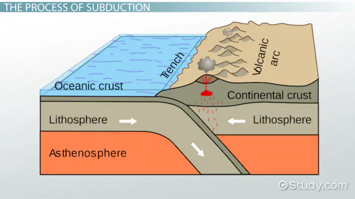
Volcanic eruptions can lead to the formation of new land masses when two plates converge - and one plate subducts beneath the other.
True
False
Volcanoes are usually found
in the middle of the ocean
along plate boundaries
at the edge of continents
in the southern hemisphere
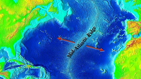
A huge undersea earthquake off the Alaskan coastline could produce a
tsunami
cyclone
hurricane
thunderstorm

What is the largest span of geological time?
Era
Period
Epoch
Eon
What era are we currently living in?
Paleozoic Era
Mesozoic Era
Cenozoic Eon
Cenozoic Era
This chronological time chart is broken into different time chunks, the largest being the Eon, then Era, Period, and Epoch.
Timeline
Calendar
Geological time scale
Time chart
What is the Anthropocene?
A new type of rock layer found on Earth
A period when humans became the dominant driver of Earth's environment
A new species discovered in the 21st century
A type of climate change phenomenon
What is an epoch in the context of geologic time?
A type of fossil
A time period with significant changes in Earth's rock layers
A large volcanic eruption
A specific type of mineral
What is the main reason for proposing the Anthropocene as a new epoch?
To recognize the impact of natural disasters on Earth
To note how human activities are reshaping the planet on a global scale
To classify new types of minerals
To study the effects of solar radiation on Earth
What is the current status of the Anthropocene in the official geologic time scale?
It is officially recognized as an epoch
It is still under debate and not yet official
It has been rejected as a concept
It is recognized as a new era
What is the primary force that drives the movement of tectonic plates?
Magnetic fields
Solar radiation
Convection currents in the mantle
Wind patterns
Which process is responsible for the formation of sand dunes?
Weathering
Erosion
Deposition
Compaction
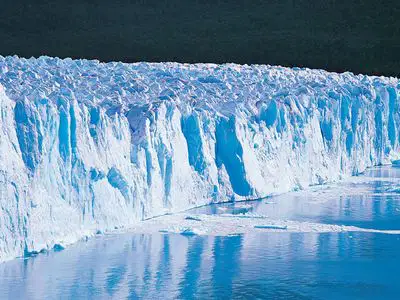
There are two kinds of glaciers:
Alpine and Ice sheet
Northern and southern
Erratic and Moraine
Bulldozers and Lake diggers
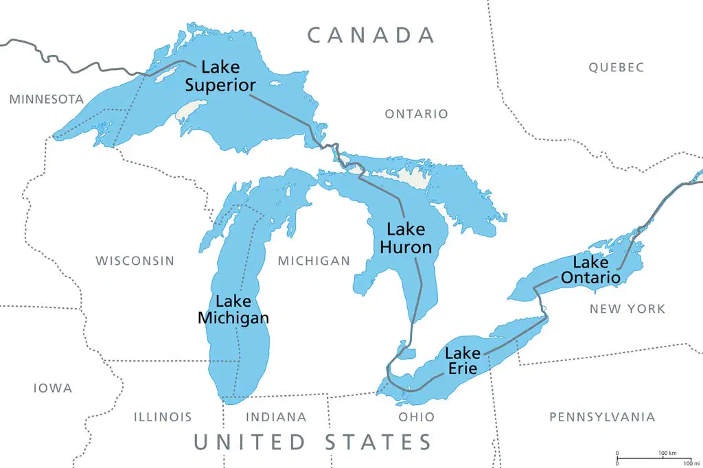
The great lakes were created by:
Weathering of river beds that expanded the rivers so much, they enlarged to lakes.
Diverging plates that allowed ground water to seep into the cracks left behind.
Giants throwing temper tantrums on the land - stomping holes and filling them with their tears.
Glaciers that carved deep holes in the landscape and left ice within to melt after they retreated.
The Canadian Shield was influenced by glaciation - over 11,000 years ago. Which picture best reflects it?
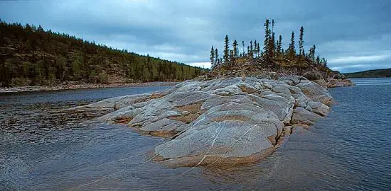

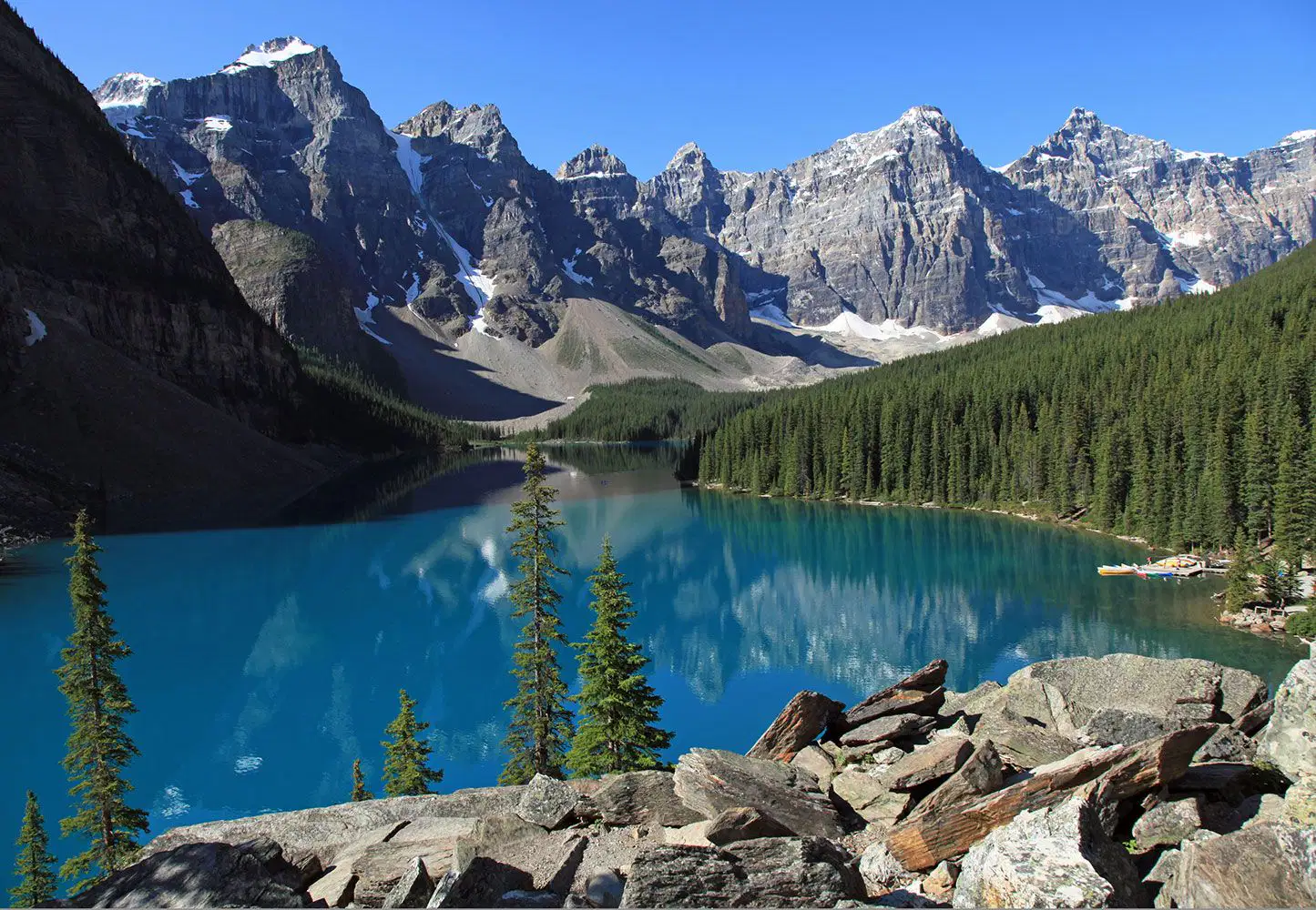


What landform do you see in the photo?
Mountains
Volcano
Plateau
Delta

