
 Worksheets
EDW: 8th Grade: World Geo: EV: Q1 :Test 1 Intro to Geo and Maps
Total questions: 86
Worksheet time: 1hrs 11mins
is an important theme of geography because all places on earth can be located in either absolute or relative terms.
can be determined by the lines of latitude and longitude. As lines of latitude and longitude cross one another, they form a grid pattern. The grid pattern is used to find this.
Relative location
Absolute location
is determined by a place's relation to other places.
What imaginary lines used in finding absolute location.
Starting from the Prime Meridian (0 degrees), lines of longitude measure distance ____ to ____?
east to west
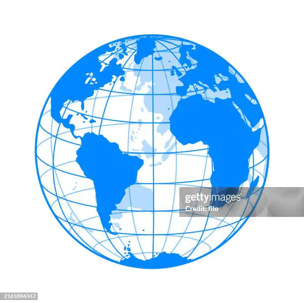
Lines of longitude measure distances east to west and run from _____ to _____?
Are imaginary lines that circle the Earth parallel to the Equator?
Measures distance north and south of the Equator?
Lines of latitude are also called ________?
Click on the dot that identifies:
0°, 0°
Click on the dot that identifies:
30°N, 120°W
Click on the dot that identifies:
45°N, 75°E
(a) are lines of latitude where (b) are lines of longitude.
0o Longitude represents?
0o latitude represents?
______ are valuable tools that geographers use to show the location of various places.
Maps compare places and relate people's activities to the locations where they live.
People who create maps are called ________?
Cartographers use ________ that show features on maps.
examples, cities, roads, railroads, parks, airports, and other points of interest
Two specific tools used by cartographers are ________ and ________?
compass rand scale
______ is used to measure distance on maps?
Scale
Compass Rose
Equation
Meridian
A ______ is used to show the cardinal directions of North, South, East, and West on a map?
A compose rose may also show the intermediate directions of NE, NW, SE, SW?
label the compass rose with both cardinal and intermediate directions
List the three Main types of Maps we learned in World Geography class?
Physical Maps
Political Maps
Thematic Maps
This map shows the location and the topography or shape of the Earth's physical features.
Physical map
Another name for a Physical map is _______?
This map show the boundaries and locations of political units such as countries, states, counties, cities and town. Many of these features on this map are Human-made.
Physical Maps
Political Maps
Thematic Maps
Many features shown on this map are human made, or determined by humans rather than nature?
Physical Maps
Political Maps
Thematic Maps
This type of map emphasizes a single idea or a particular kind of information about an area?
Thematic Maps typically show us what?
(select all answers that are correct)
climate
natural vegtation
population density
economic activities
Thematic maps emphasize on a single idea or a particular kind of information about an area. List the four types of thematic maps we learned in class?
Flow-line maps
Qualitative maps
Cartograms
Movement maps
This type of Thematic map illustrates the movement of people, animals, goods, and ideas, as well as physicals processes like hurricanes and glaciers. Arrows are usually used to represent the flow and direction of movement.
Movement map
Qualitative map
Cartograms
This is a type of Thematic map that uses colors, symbols, dots, or lines to help you see patterns related to a specific idea or area.
Qualitative maps
Flow line maps
Movement maps
Cartograms
This is a type of Thermotic Map that present information about a country based on a set of data other than land area; drawn in proportion of that data not actual land size
flow line maps
movement maps
qualitative maps
cartograms
This is a type of Thematic map that is a diagram showing the relation between two or more varibables; geograhpers use graphs to compare information from specific areas.
ex: bars, lines, and pie graphs
flow
movement maps
qualitative maps
S

Name the type of map.
Physical
Political
Thematic

What type of map is this?
physical map
political map
thematic map
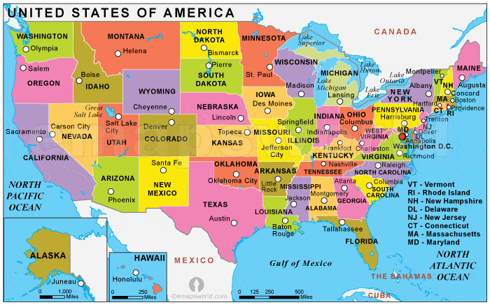
______ is a way of drawing the Earth's surface that reduces the distortion cause by presenting a round Earth on flat paper.
List the three types of map projections discussed in class?
Cylindrical
Conic
Azimuthal
This map projection is most accurate near the equator, shapes and distances distorted near the poles?
Planar Projections
Conic Projections
Cylindrical Projections
This map projection is best for showing limited east-west areas not too far from the Equator, distance and direction fairly accurate
Planar Projections
Cylindrical Projections
Conic Projections
This map projection is most accurate at its center, most often used for maps of the poles.
planar projection
conic projection
cylindrical projection
This is a specific cylindrical map projection that has minor distortions, the poles are flattened and is most commonly use by students, teachers and textbooks?
This is a specific cylindrical map projection that accurately shows directions and shapes of land masses; most commonly use for ships.
The most common type of planar map projection. It is most accurate at its center and most commonly used for airplane navigation.
Azimuthal Projection

Label ocean #1
Arctic
Southern
Indian
Pacific

Select the name of ocean #2
Indian
Southern
Pacific
Arctic

Select the name of ocean #3
Indian
Pacific
Atlantic
Arctic

Select the name of ocean #4
Southern
Pacific
Arctic
Indian

Select the name of ocean #5
Pacific
Atlantic
Arctic
Indian

Select the name of continent #6
North America
Antarctica
Europe
Africa

Select the name of continent #7
Antarctica
Europe
Asia
North America

Select the name of continent number 8
Asia
Antarctica
Africa
Europe

Select the name of continent #9
Africa
Australia
Asia
Antarctica

Select the name of continent #10
South America
Asia
Australia
Africa

Select the name of continent #11
Africa
Antarctica
Asia
North America

Select the name of continent #12
Australia
Antarctica
North America
Europe

What is the most popular religion in Lebanon?
Buddhism
Islam
Christianity
Druze

Based this line graph, what type of media will be the MOST used in the future?
Internet
Radio
Magazines
Television

Based on the bar graph, which of the following will be likely use LESS of in the future?
Smartphone Browser/Apps
Time Shifted TV
Internet via PC
Live TV

Which type of person spends the most time on working and work related stuff?
Bachelor's Degree
Less than HS
HS Grad
Some College, Associate's Degree
A three-dimensional, or spherical representation of Earth is called a ________________. Useful when you need to see Earth as a whole, but it is not helpful if you need to see a small section of Earth.
globe
map
legend
scale
A two-dimensional, or flat, representation of Earth is called a ______________.
scale
map
globe
A __________________ tells the subject of the map or globe
title
scale
symbol
legend
Which element of a map explains what the symbols and colors on the map or globe represent?
legend
scale
title
Which element of a map shows how much distance on Earth is represented by distance on the map or globe?
legend
title
scale
Which element of a map shows the cardinal directions north (N), south (s), east (E), and west (W)?
title
legend
scale
compass rose
Which type of lines are imaginary lines that run east to west, parallel to the equator?
lines of latitude
lines of longitude
meridians
Which lines are imaginary lines that run north to south from the North Pole to the South Pole?
longitude
latitude
Which line divides the Earth into the Northern Hemisphere & Southern Hemisphere?
Tropic of Capricorn
Prime Meridian
Equator
The map element show latitude and longitude marks?
title
legend
grid
directions
scale
A _______ is an imaginary line that follows the curve of the Earth and represent the shortest distance between two points on the the surface of a sphere?
A Map Key is...
Shows the cardinal directions on a map.
Uses symbols, colors, and images to represent important places or landmarks on a map
Something you use to unlock the door
the precise position where one line of latitude crosses one line of logitude
relative location
absolute location
the location of a place in relation to other places
relative location
absolute location
A type of distance of how far across the earth a person, idea or product travels
Linear distance
Time distance
the amount of time it takes for a person, idea, or product to travel
ex: time zones
linear distance
time distance
Name the three type of regions discussed in class?
Formal (uniform) Regions
Functional (nodal) Regions
Perceptual (vernacular) Regions
Positional (lost) Regions
Regions designated by official boundaries such as cities, states, counties, and countries; for the most part, they are clearly indicated and publicly known.
ex: city of Thibodaux, the state of Louisiana, the United State of America
Formal (uniform) Regions
Functional (nodal) Regions
Perceptual (vernacular regions)
regions that are defined by their connections; an area with a certain set of activities or interactions that happen within it organized around a node, focal point, central hub, people may use the functionality of the city but have to drive there to do so
Ex: New Orleans metro area (Kenner, Metairie)
Formal (uniform) Regions
Functional (nodal) Regions
Perceptual (vernacular) Regions
Regions of the world that have no formal boundaries but are understood in mental maps of the world; common assumptions are made about the place or people; this type of region does not exist in a literal sence
Ex: The Midwest, The Middle East
Formal (uniform) Regions
Functional (nodal) Regions
Perceptual (vernacular) Regions
What is the purpose of Geography?
To study the interaction of physical and human features on the Earth.
What is human Geography?
Human geography studies how people live, work and interact in different places on Earth.
What this the definition of physical geography?

