
Font size
 Worksheets
Meteorology & Density Unit Test Practice
Total questions: 179
Worksheet time: 8hrs 40mins
On a weather map, which statement best describes a cold front’s typical effects?
Heavy precipitation then falling temperatures
Steady drizzle with gradual warming
No air mass movement and stable skies
Complex mixed weather with unclear trends

Which description matches a warm front as it appears and behaves on weather maps?
Warmer air advances with light rain
Two fronts combine causing mixed weather
Cooler air arrives with thunderstorms
Air masses stop moving and remain fixed
Stationary fronts are best characterized by which condition?
Intensifying winds due to close isobars
Rapid temperature drops behind front
Little or no movement of air masses
Steady warming with gentle drizzle
What kind of weather is most often associated with an occluded front?
Complex, mixed precipitation and clouds
Fair, sunny skies with calm winds
Thunderstorms followed by cooling
Steady drizzle with warming air
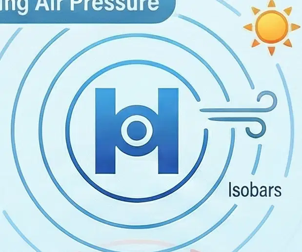
High-pressure systems generally bring what conditions?
Cloudy, rainy weather with frequent storms
Fair, sunny weather with calmer skies
Complex mixed weather near merging fronts
Thunderstorms followed by temperature drops
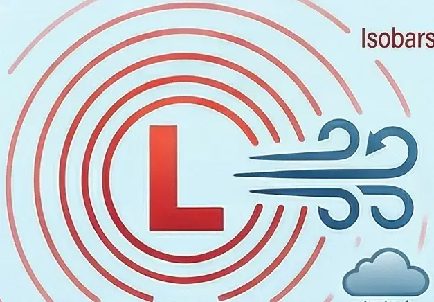
What weather is commonly linked to low-pressure systems on a map?
Clouds and precipitation with unsettled skies
Clear, sunny conditions with light winds
No movement of air masses and stable temperatures
Gentle drizzle with gradual warming

How do isobars help you estimate wind speed on a weather map?
Closer lines indicate stronger winds
Farther lines indicate stronger winds
Line color shows stronger winds
Line shape determines stronger winds
A map shows tightly packed isobars around a low-pressure center. What wind conditions are likely?
No winds due to air mass stalling
Weak winds with gentle breezes
Strong winds with turbulent flow
Calm winds and sunny skies
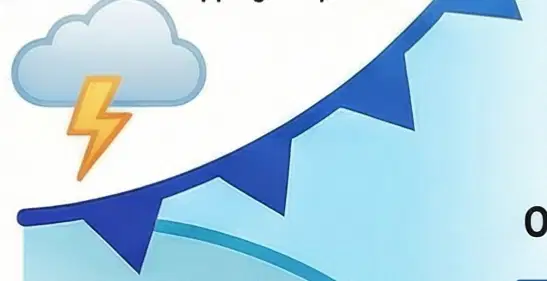
Which sequence best represents typical weather changes as a cold front passes a region?
Thunderstorms then cooler, drier air
Sunny conditions then clouds and rain
Steady drizzle then gradual warming
Calm skies then complex mixed rain
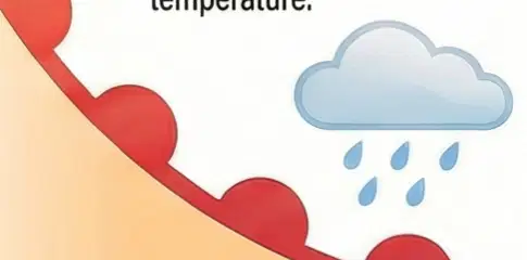
You see a warm front approaching and pressure rising. Which short-term forecast is most reasonable?
Heavy storms followed by sharp cooling
Light rain or drizzle with temperatures increasing
Strong winds caused by widely spaced isobars
Cloudy periods with no air mass movement




What type of front is over Texas?
warm front
cold front
stationary front
occluded front
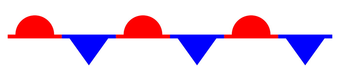
What is the name this front?
warm front
cold front
stationary front
occluded front
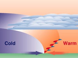

Which front is in this picture?
Warm front
Cold front
stationary front
occluded front


Which weather front bring stratus clouds and drizzle before bringing sunny, clear skies?
Cold front
Warm front
High pressure
Low pressure

Which weather front causes cumulonimbus clouds to form resulting in strong storms?
Cold Front
Warm Front
High Pressure
Low Pressure
A low reading on a barometer means which type of weather?
blue skies
stormy weather
cold days
hot temperatures
In which part of the water cycle are clouds formed?
Evaporation
Condensation
Precipictation
Run Off
What is the energy source for the water cycle?
sun
wind
rain
oceans
What is not a stage in the water cycle?
Evaporation
Precipitation
Drizzle
Runoff
When the Northern Hemisphere is tilted toward the ______, it receives a lot of energy from it.
sun
moon
The half of the Earth south of the equator is called the __________ __________.
Northern Hemisphere
Southern Hemisphere
When the Northern Hemisphere is tilted toward the sun, the Southern Hemisphere is tilted _______ from it.
away
near
What season has the longest nights?
spring
summer
autumn
winter
Which season has the longest days?
spring
summer
autumn
winter
More direct sunlight means it feels
hotter
colder
heavier
darker
True or false: We would still have seasons if the Earth's axis was straight
True
False
1. Some mountains located near the Earth's Equator have snow-covered peaks.
2. Icecaps exist at the Earth's poles.
What is the condition of the atmosphere at a certain time and place?
climate
weather
Describe the climate for the tropical zone.
Very cold
Very hot
Different seasons (hot, cold, warm, cool)
Near what latitude(s) is angle of sunlight highest?
Equator
The Poles
The seasons are caused by___________?
The direction the Earth's axis is tilted toward the sun
Tropical Storms
Changes in the moon
The Earth's revolution on its axis around the Sun
decreases, decreases
increases, increases
increases, decreases
increases, stays the same

What season would it be in the Northern hemisphere?
Summer
Fall
Winter
Spring
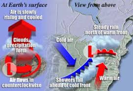
What type of front can cause multiple days of rain in an area?
Warm
Cold
Stationary
Occluded
What type of front can cause severe weather like thunderstorms, hail, and tornadoes?
Warm
Cold
Stationary
Occluded

What type of front does this symbol indicate?
Warm Front
Cold Front
Stationary Front
Occluded Front

What type of front does this symbol indicate?
Warm Front
Cold Front
Stationary Front
Occluded Front
The lines on a weather map that connect areas of equal air pressure
contour lines
isotherms
isobars
latitude

Wind moves from an area of _______ pressure to an area of _______ pressure.
high; low
low; high
hot; cold
cold; hot

What is the main factor that determines the global wind patterns?
the direction of ocean currents
Earth's revolution around the sun
Earth's rotation about its axis
uneven heating of Earth's surface by the sun

What causes the Earth's winds to rotate?
global warming
ocean currents
the Coriolis effect
the Earth's tilted axis
What is the difference between weather and climate?
time of year
amount of time we consider
amount of sunlight reaching Earth
they're the same
Which of the following questions is about weather?
What are the winters like here?
Do you think it'll snow tomorrow?
Does it snow much throughout the year?
When do most storms occur during the year?
Land near the ocean experiences weather that is more moderate than the inland climate. So, along the coast, you can predict that compared to inland weather, it should be _________ during the summer, and _________ during the winter.
cooler; warmer
warmer; cooler
cooler; cooler
warmer; warmer

Weather patterns are mainly caused by the:
rotation of the Earth
uneven heating of the Earth
gravitational pull of the Moon
distance of the Earth from the Sun

_______________ are ribbons of fast moving air that pilots take advantage of to gain speed.
trade winds
polar easterlies
jet streams
westerlies
_________ is the name of the average weather in an area over a long period of time.
global warming
weather
storms
climate
The sun's unequal heating of the ocean causes:
cyclones
tides
wind
currents

You wake up one morning and the sky is filled with stratus clouds like the ones pictured. What can you predict the weather will be like based on these clouds?
Light rain all day
Low chance of rain
Heavy rain and hail
Strong thunderstorms
A city has a temperature of 750F, with partly cloudy skies. Weather forecasters are predicting that the temperature and air pressure will drop during the day. Which type of weather is most likely for this area in the afternoon?
Rainy
Sunny
Snow
Hail

Your teacher takes you outside to look at the clouds in the sky. Today, you drew the following cloud. What type of weather do you expect to have today?
Gentle winds
Low humidity
Rainstorms
Fog
When Lora left home for school today, the thermometer outside her house read 220C. After school, she felt much hotter, but the temperature on the thermometer still read 220C. What best explains why Lora felt that the afternoon was hotter than the morning?
The humidity was higher in the morning.
There was a breeze in the morning.
The temperature was higher in the afternoon.
The humidity was higher in the afternoon.
In Scott’s city, the weather report states that an air mass formed over a tropical ocean is moving into the area. What type of weather will Scott experience in his city?
Cold and dry
Warm and wet
Warm and dry
Cold and wet
Joe and Scott live in different cities. In Joe’s city, the weather reporter announces that a high-pressure system is over the area. What should Joe take with him to the park?
Sun hat
Umbrella
Snow boots
Raincoat

Climate is affected by latitude. Based on the map, which places are more likely to experience four seasons?
Points A and B
Points B and D
Points C and E
Points D and E

Which places on the map have a tropical climate?
Points A and B
Points B and D
Points C and E
Points D and E

Which place would you most likely find freezing temperatures and very little precipitation?
Point A
Point B
Point C
Point D
As you climb a mountain, the climate changes. Why is the climate at the top of the mountain different than the climate at the bottom?
The top of the mountain is warmer.
The bottom of the mountain has more sunny days.
The top of the mountain has a lower air pressure.
The bottom of the mountain receives more hours of sunlight each day.

What process is shown in Part A when water moves from the ocean to the atmosphere?
Condensation
Precipitation
Runoff
Evaporation

What is the ocean’s main role in the Water Cycle?
The ocean has a key role because it is a source of water and a storage unit for water.
Not very important, as glaciers and ice sheets provide most of the water needed for the water cycle.
Not very important, because the ocean is made out of salt water.
Lakes and rivers have a more important role than the ocean, because they are made of fresh water.

What process is shown at Point B when clouds are beginning to form?
Condensation
Precipitation
Runoff
Evaporation
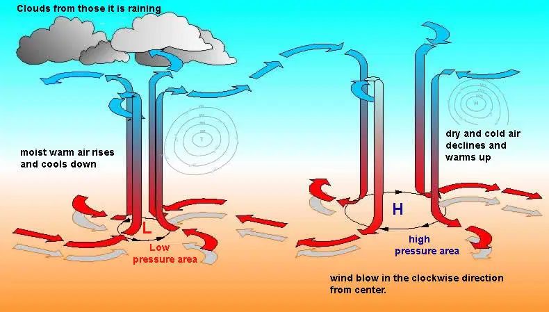
On a weather map, what combination of weather and wind direction is characteristic of a high-pressure system?
Stormy conditions and clockwise winds
Fair weather with few clouds and clockwise winds
Fair weather with few clouds and counterclockwise winds
Stormy conditions and counterclockwise winds

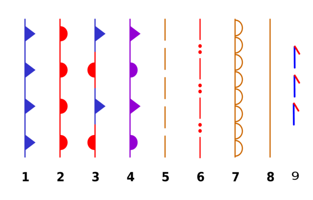
How is a warm front symbolized on a standard, color weather map?
A blue line with jagged triangles
An alternating red and blue line
A red line with half circles
A purple line with alternating triangles and half-circles

What do tightly packed isobars on a weather map signify?
An area of calm weather
Windy conditions
A stationary front
A significant temperature change
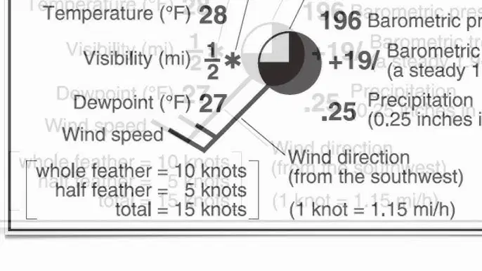
What is the primary function of a station model on a weather map?
To summarize multiple weather conditions observed at a specific location.
To show the general temperature range over a large region using colors.
To indicate the boundary between two different air masses.
To mark the center of a high or low-pressure system.
What is the primary function of a station model on a weather map?
To summarize multiple weather conditions observed at a specific location.
To show the general temperature range over a large region using colors.
To indicate the boundary between two different air masses.
To mark the center of a high or low-pressure system.

In North America, what is the typical (usual) direction of movement for a cold front?
From the south toward the north
From the east toward the west
It does not move, remaining stationary
From the northwest toward the southeast
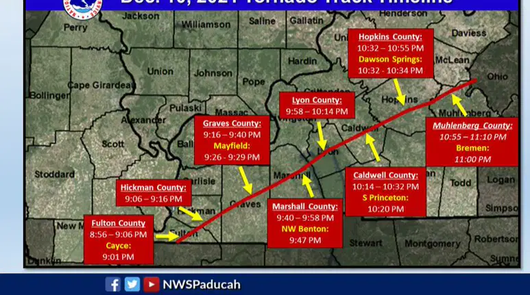
If a meteorologist places a red box on a weather map, what does this indicate?
An area where severe thunderstorms are likely to form.
The location of an active hurricane.
An area where conditions are favorable for tornadoes to form.
A region that is currently experiencing hail.
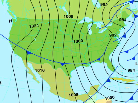
When marking a high-pressure system, what is the key criterion for placing the 'H' on the map?
Place it on any pressure reading greater than 1015.
Place it on the outermost concentric circle of the system.
Place it on the highest four-digit number that is in the centermost concentric circle.
Place it where the isobars are most tightly packed.
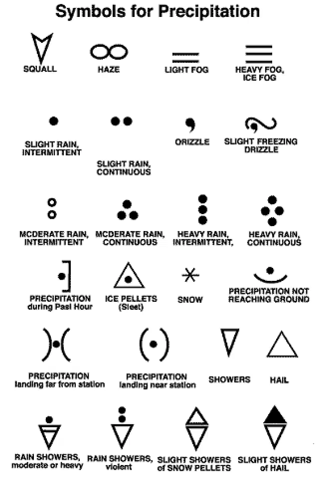
According to the 'Cloud Types and Precipitation' image, which symbol is used to represent snow?
An asterisk or star shape
D.
A triangle
Two horizontal lines
D.
A solid dot

What kind of weather generally follows the passage of a cold front?
Warm and humid conditions
Dry conditions
Heavy prolonged rain
Foggy and overcast skies
C.
Which of the following statements correctly compares warm fronts and cold fronts?
In North America, temperatures are cooler south of a warm front.
C.
Warm fronts are typically associated with more severe storms than cold fronts.
Warm fronts are indicated by purple lines on a weather map.
Warm fronts move more slowly than cold fronts.

In a convection current warm air _____.

In a convection current cold air _____.
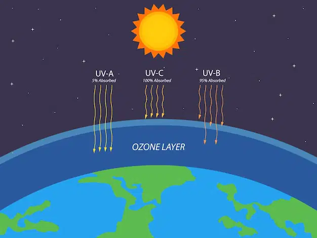
The ozone layer is important because it protects us from _____.
harmful ultraviolet (UV) radiation
beneficial (helpful) visible light

What can increase global warming?
planting trees
burning fossil fuels
riding bicycles as transportation
using solar panels

When warm air and cold air meet, what happens to the warm air?
goes into the ground
sinks
rises
stays in one place
When warm air and cold air meet, what happens to the cold air?
goes into the ground
sinks
rises
stays in one place
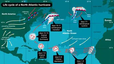
Which of the following does not help hurricanes form?
land
warm temperature
water
wind
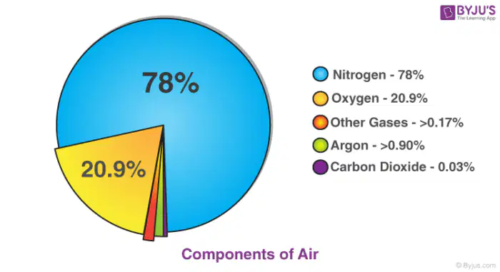
A mixture of gaseous elements and compounds is called _____.
air
dirt
sunlight
wind
Which is the most common gas in our atmosphere?
argon
carbon dioxide
nitrogen
oxygen
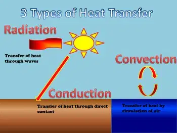
What form of energy transfer gives us energy from the sun?
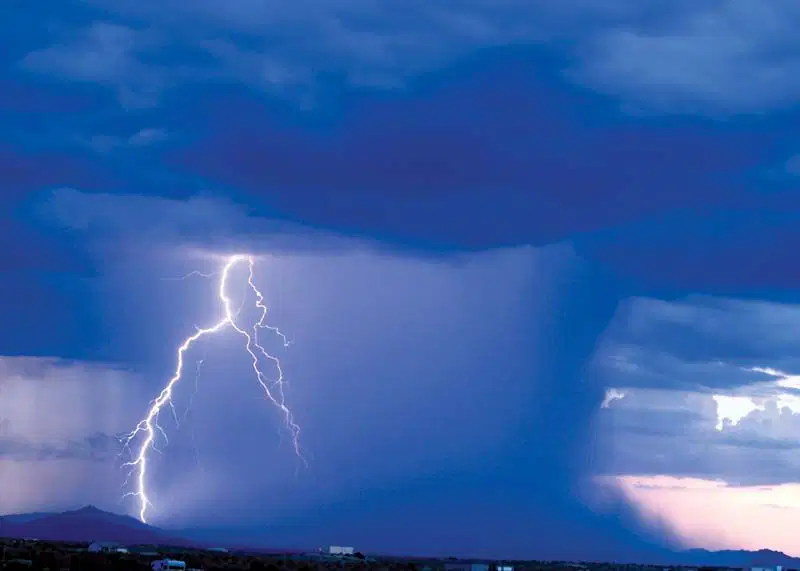
Thunderstorms can turn into _____.
blizzards
heat waves
tornadoes
hurricanes

The condition of the atmosphere at a specific time and place is called _____.
The long-term condition of the atmosphere at a specific time and place is called _____.

Most of the energy from the Sun is absorbed by _____.
Some of the energy from the Sun is _____.
reflected back into space
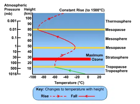
According to the diagram, what happens to temperature as you travel higher in the troposphere?

Which layer of the atmosphere protects us from meteors?
Which layer of the atmosphere protects us from UV rays?
Which layer of the atmosphere contains most of our weather?

Which layer of the atmosphere has the highest temperatures?
mesosphere
stratosphere
thermosphere
exosphere
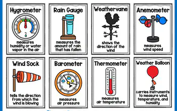
Which tool measures air pressure?
Which tool measures windspeed?
Which tool measures temperature of the air?

Identify the Cu cloud.
Identify the St cloud.
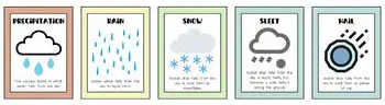
Which type of precipitation is made of balls of ice?
Which type of precipitation is made of a mixture of ice and water?
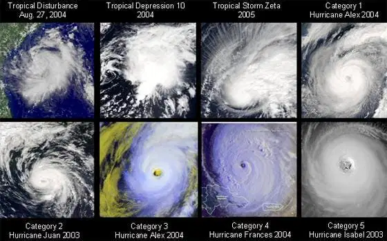
Which spinning funnel storm forms over warm ocean water?
hurricane
snow
tornado
water spout
How many stages move toward a hurricane forming?
one
two
three
eight
How many categories of hurricanes are there?
two
three
four
five
Which is the weakest level of a hurricane?
one
two
four
five
Which is the strongest level of a hurricane?
one
two
four
five
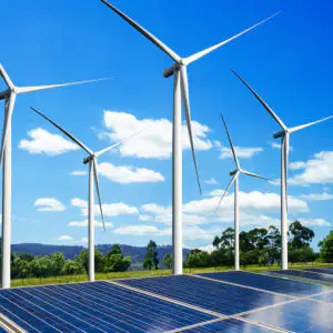
What is the main cause of wind on Earth?
Cloud formation
Earth's rotation
Ocean currents
Differences in air pressure
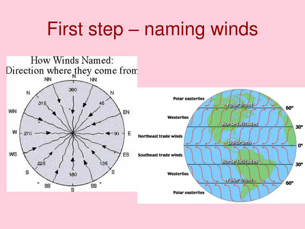
How are winds named?
Winds are named by where they start blowing.
Which latitudes are the locations for the westerlies?
equator
0o - 30o
30o - 60o
60o - 90

What is the Coriolis Effect?
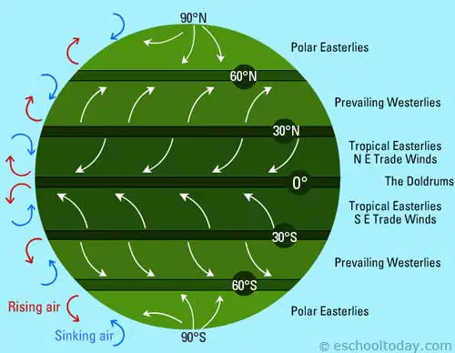
What are global winds?
winds that blow all over the Earth
seasonal weather patterns that change with the time of year, affecting climate zones.
caused by humidity
local winds
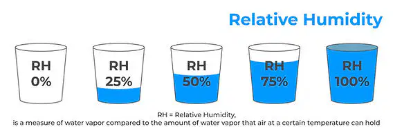
What is relative humidity?
Relative humidity is the total amount of water vapor in the air.
Relative humidity is the percentage of water vapor in the air compared to the maximum amount of the air can hold at that temperature.
How are weather and climate similar?
Both weather and climate involve factors such as temperature and precipitation.
How are weather and climate different?
There are 2 answers! You must choose TWO answers to earn points.
Weather is short-term and describes the atmosphere today, tomorrow, etc.
Climate is short-term and describes the atmosphere today, tomorrow, etc.
Climate is a long-term average of patterns in specific areas and looks for trends over time.

What are some human causes of climate change?
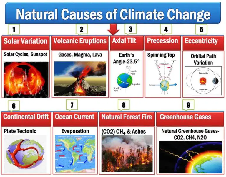
What are some natural causes of climate change?
Natural disasters, forest fires, ocean currents, volcanic eruptions, and solar activity.
An air mass is a portion of the atmosphere that has similar...
Water and temperature
Air pressure and wind speed
Humidity and temperature
Humidity and air pressure

Which air mass would be classified as Maritime Polar (mP)?
purple
green
blue
yellow
red

Which air mass is represented by letter A?
continental polar (cP)
maritime polar (mP)
continental tropical (cT)
maritime tropical (mT)
Which air mass is represented by letter G?
continental polar (cP)
maritime polar (mP)
continental tropical (cT)
maritime tropical (mT)
Which air mass is represented by letter B?
continental polar (cP)
maritime polar (mP)
continental tropical (cT)
maritime tropical (mT)
Which air mass is represented by letter E?
continental polar (cP)
maritime polar (mP)
continental tropical (cT)
maritime tropical (mT)

Dee measured the the temperature and humidity every afternoon for four days. She recorded the results in the table below.
Which day could Dee conclude was the most hot and humid?
Monday
Wednesday
Tuesday
Thursday

The following map shows the weather conditions in a coastal area during a hot summer week. At which point is relative humidity the highest?
A. Point 1
B. Point 2
C. Point 3
D. Point 4
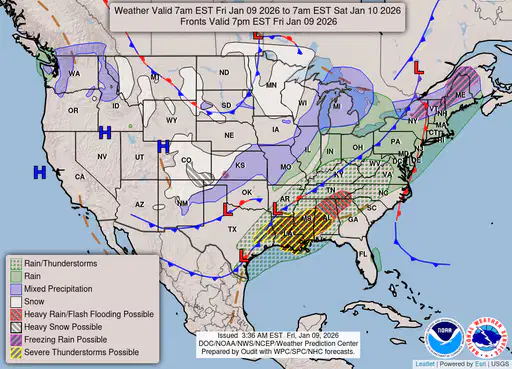
(a) (b)
(c) (d) (e)
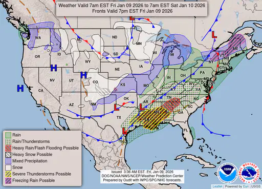
(a) (b)
(c) (d) (e)

What are the lines drawn over ALL of this weather map?
cold fronts
isobars
places with the same temperature
warm fronts
What colors are the high and low temperatures written in on this weather map?
Choose the answer that list the high temperatures color first!
yellow & orange
green and red
brown and blue
red and green
What information is connected by brown lines on this weather map?
winter high temperatures
points of the same air pressure readings
climate change data
occluded fronts
What is the lowest air pressure reading on the map?
997 mb
1013 mb
1020 mb
1032 mb
What is the highest air pressure reading on the map?
997 mb
1013 mb
1020 mb
1032 mb
This weather map shows all of North America: Canada, the United States, and Mexico.
Use drag and drop to mark the place with the highest wind speeds.
(There is only ONE correct answer.)
(a)
As temperature decreases, more water can be held in the air.
True
False

When the temperature decreases, the relative humidity:
increases.
decreases.
stays the same.

When ______ is low, the air is very dry.
Which type of front is most likely to bring steady rain over several hours?
Occluded Front
Warm Front
Cold Front
Stationary Front
Which of the following best describes the effect of high humidity on how hot the air feels?
It makes the air feel cooler than the actual temperature.
It only affects nighttime temperatures.
It makes the air feel warmer than the actual temperature.
It has no effect on how hot the air feels.
As altitude increases (higher up in the atmosphere), the air pressure ____.
decreases
does not change
stays the same
increases
A sudden drop in air pressure accompanied by lower temperatures usually means that a ___.
cold front has passed
high pressure system is overhead
stationary front is overhead
warm front has passed

Which statement summarizes the weather conditions in Virginia as shown on the map?
A warm front followed by snow is passing through
A cold front followed by snow is passing through
A stationary front followed by rain is passing through
A stationary front followed by snow is passing through
What is the most likely forecast of any area experiencing high barometric pressure?
Sunny
Stormy
Rainy
Windy
Differences in air pressure have what effect on air?
Air pressure differences cause the movement of air
Air pressure differences cause the air to remain still
Air pressure differences heat up the air
Air pressure differences create humidity
Which types of air masses have higher air pressure?
cold front
hot front
low pressure
tropical
Why should you care about the weather?
For full credit on the unit test at the end of the semester, you must share three reasons in enough detail that I can understand why you think understanding weather is important.
DO NOT USE THE INTERNET OR ARTIFICIAL INTELLIGENCE! This should be a personal answer. If I hear or see the same answers from people, in the same words, those students will lose the 12 points and I will call your parents. Speak clearly and use English.

