
16 Q
5th - 8th
10 Q
5th

10 Q
5th

24 Q
5th
12 Q
4th - 6th
12 Q
4th - 6th
10 Q
5th
12 Q
4th - 6th
15 Q
5th - Uni
12 Q
5th
15 Q
5th - Uni
15 Q
5th - Uni
15 Q
5th - Uni
15 Q
5th - Uni
25 Q
5th - Uni
12 Q
5th
16 Q
5th
10 Q
5th
25 Q
5th - Uni
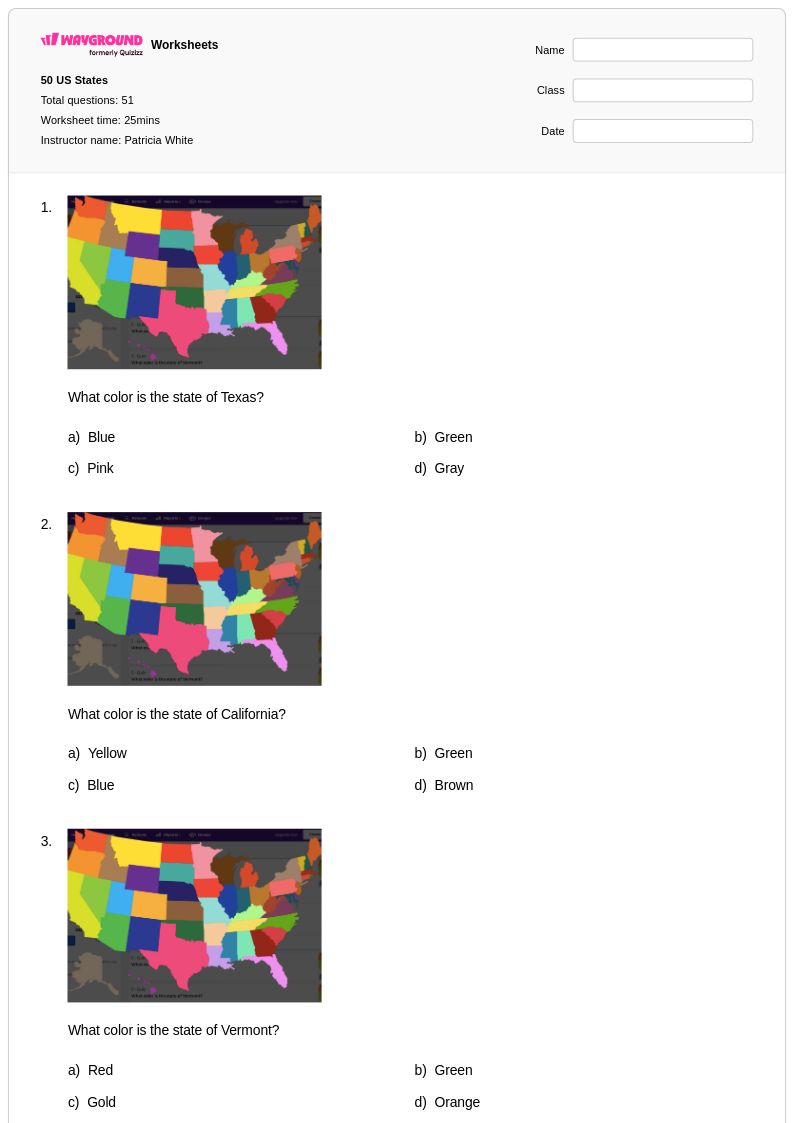
51 Q
5th
16 Q
5th
15 Q
5th - Uni
15 Q
5th - Uni
13 Q
5th
Explore Other Subject Worksheets for class 5
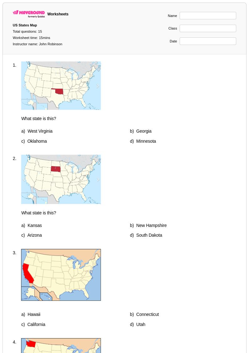
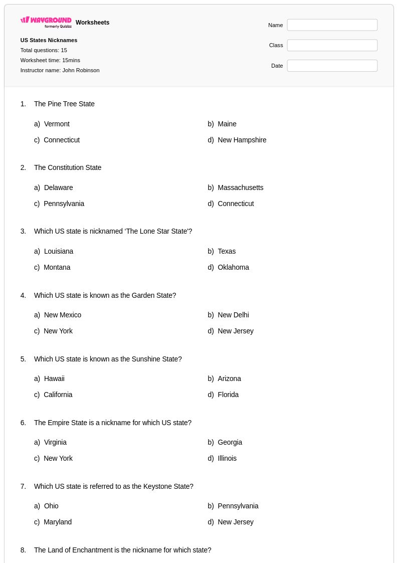
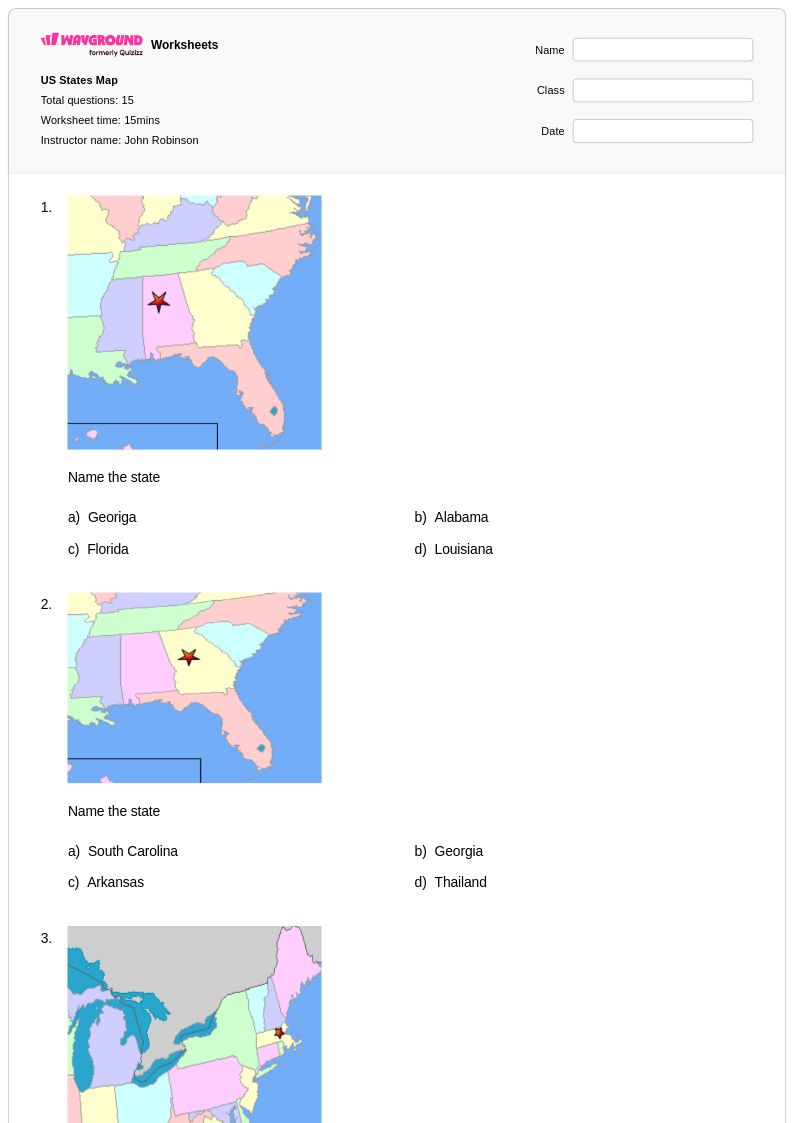
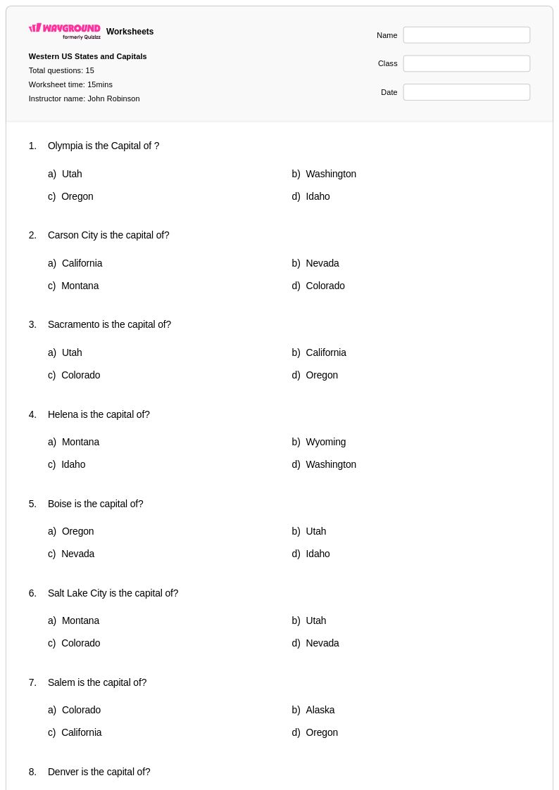
Explore printable US States worksheets for Class 5
US States worksheets for Class 5 students available through Wayground (formerly Quizizz) provide comprehensive practice for mastering the geographical knowledge essential to elementary social studies curricula. These educational resources strengthen students' ability to identify state locations, capitals, major physical features, and regional characteristics across the United States. The worksheet collection includes diverse practice problems that challenge fifth graders to apply their understanding of state boundaries, geographic relationships, and spatial reasoning skills. Each printable resource comes with a complete answer key, enabling teachers to efficiently assess student progress while students can engage in self-directed learning. These free materials support both classroom instruction and independent study, offering pdf formats that ensure consistent formatting and easy distribution for homework assignments or assessment preparation.
Wayground's extensive library supports educators with millions of teacher-created US States resources specifically designed for Class 5 learners, featuring robust search and filtering capabilities that allow instructors to locate materials aligned with specific learning objectives and state standards. The platform's differentiation tools enable teachers to customize worksheets based on individual student needs, whether for remediation of fundamental geographic concepts or enrichment activities for advanced learners. Resources are available in both printable and digital formats, including downloadable pdf versions that facilitate seamless integration into existing lesson plans. This comprehensive collection streamlines instructional planning by providing ready-to-use materials for skill practice, formative assessment, and targeted intervention, empowering teachers to address diverse learning styles and academic levels within their Class 5 geography instruction focused on United States geographical literacy.
FAQs
How do I teach US states and capitals effectively?
What activities help students practice identifying US states on a map?
What are common mistakes students make when learning US states and capitals?
How can I differentiate US states worksheets for students at different skill levels?
How do I use Wayground's US States worksheets in my classroom?
How do I assess whether students have mastered US states geography?