Free Printable Countries in South America worksheets
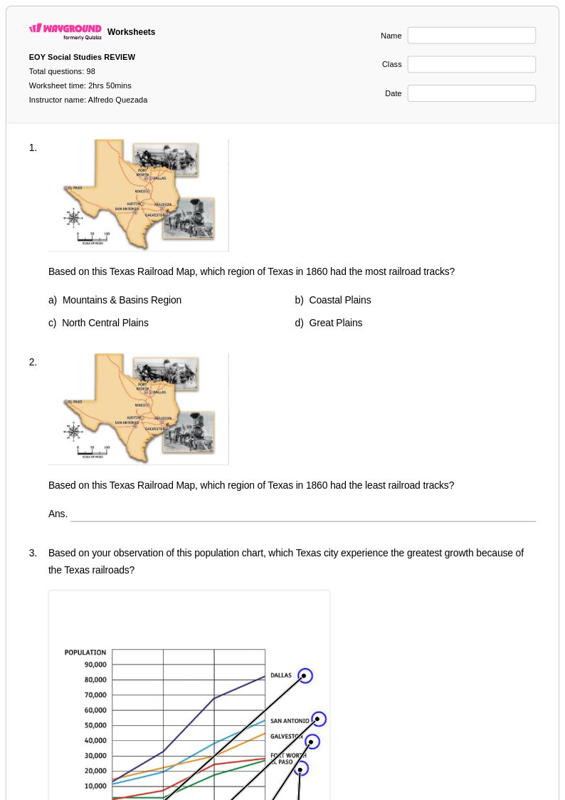
Explore Wayground's free printable worksheets and PDF resources covering countries in South America, featuring engaging practice problems and comprehensive answer keys to help students master South American geography through interactive learning activities.
Explore printable Countries in South America worksheets
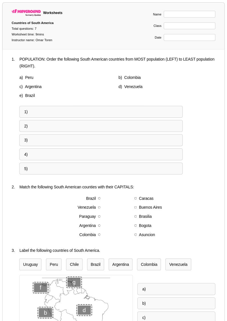
Countries in South America worksheets available through Wayground (formerly Quizizz) provide comprehensive educational resources designed to strengthen students' geographical knowledge and cultural awareness of the South American continent. These expertly crafted materials guide learners through the identification, location, and characteristics of all thirteen sovereign nations, from Argentina's vast pampas to Venezuela's Angel Falls, while developing essential map reading and spatial reasoning skills. The collection includes diverse practice problems that challenge students to memorize capital cities, analyze population distributions, and explore economic and political systems across the region. Teachers can access complete answer keys for efficient grading and assessment, while the free printable pdf format ensures convenient classroom distribution and homework assignments that reinforce critical thinking about regional geography and international connections.
Wayground (formerly Quizizz) empowers educators with millions of teacher-created resources specifically focused on South American geography, featuring robust search and filtering capabilities that streamline lesson planning and curriculum alignment. The platform's comprehensive worksheet collection supports differentiated instruction through customizable difficulty levels and varied question formats, enabling teachers to address diverse learning needs while maintaining rigorous academic standards. These flexible materials are available in both printable and digital formats, including downloadable pdfs that facilitate seamless integration into existing geography curricula and remote learning environments. The extensive resource library proves invaluable for targeted remediation of geographical misconceptions, enrichment activities for advanced learners, and systematic skill practice that builds students' confidence in identifying and analyzing the complex political and physical geography of South America.
FAQs
How do I teach students to identify the countries of South America?
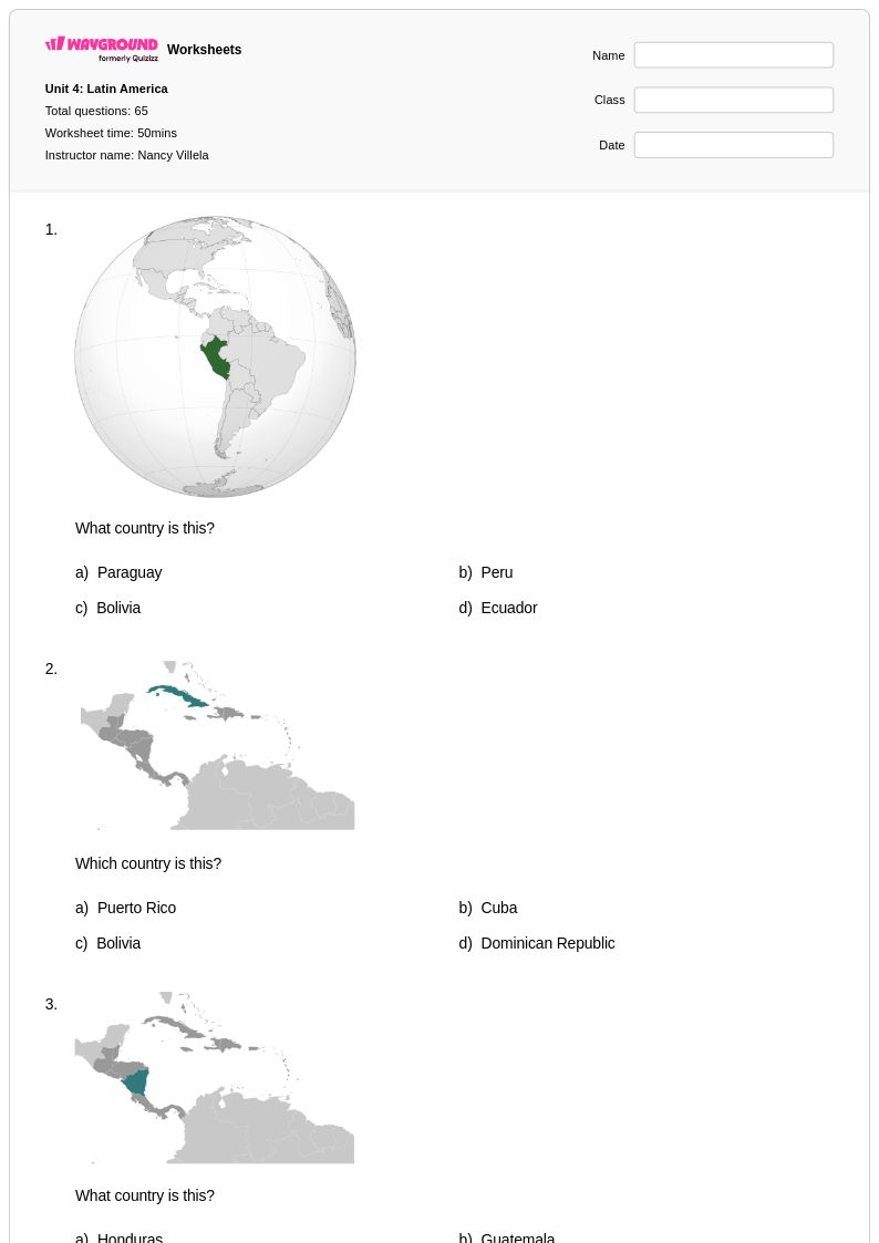
Start by having students work with blank outline maps, labeling countries by region before tackling the full continent. Grouping countries geographically, such as Andean nations, Southern Cone, and coastal countries, gives students a mental framework that makes memorization more manageable. Repeated low-stakes retrieval practice, like map quizzes and fill-in activities, builds retention over time.
What are good exercises for practicing South American country identification?
Effective practice exercises include labeling blank political maps, matching countries to their capital cities, and completing country-characteristic charts that connect nations to physical features or economic traits. Varied question formats, such as multiple choice, short answer, and map-based tasks, ensure students engage with the material in different ways. Repeated practice across these formats reinforces both recognition and recall of all thirteen sovereign nations.
What mistakes do students commonly make when learning South American geography?
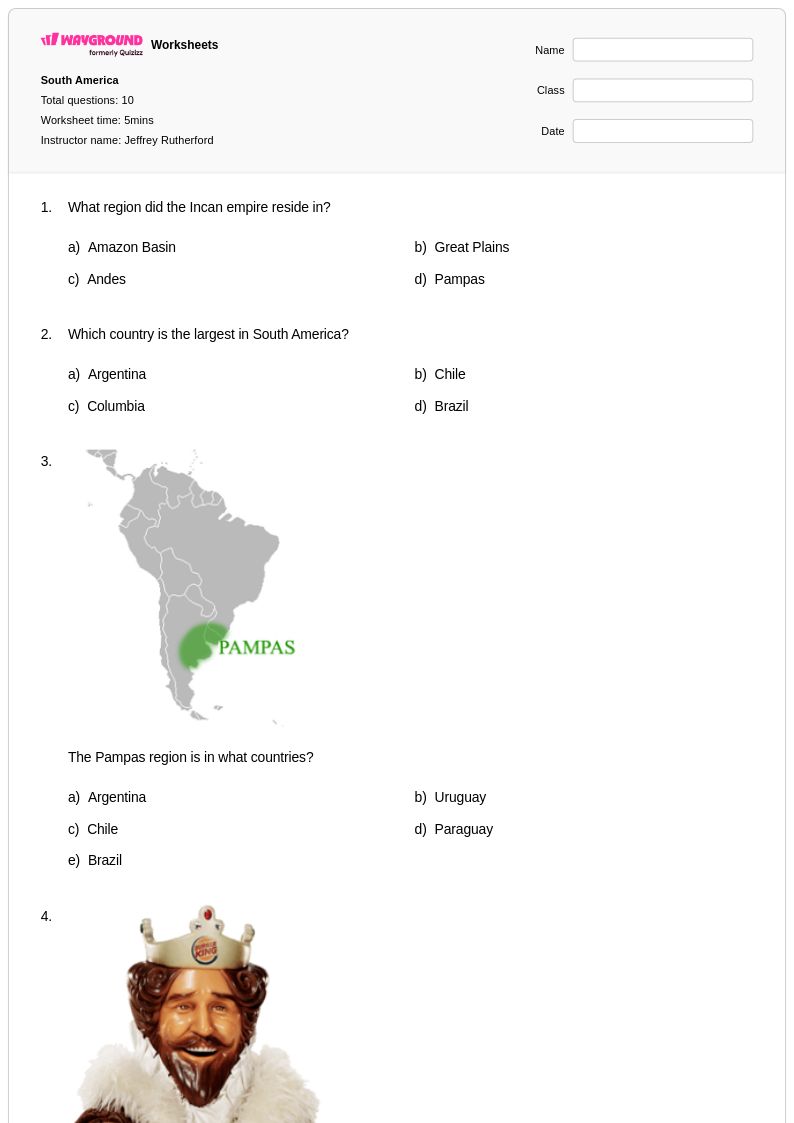
Students frequently confuse neighboring countries with similar shapes, particularly in the central and northern regions, such as Paraguay and Bolivia or Colombia and Venezuela. Misplacing capital cities is another common error, especially for landlocked nations like Paraguay and Bolivia, which have less geographic visibility. Students also tend to conflate physical features with the wrong country, so explicitly pairing landmarks like Angel Falls with Venezuela or the Pampas with Argentina helps correct these misconceptions.
How can I use South America geography worksheets to support different skill levels in my class?
For foundational learners, start with country identification and capital city matching before introducing more analytical tasks. Advanced students can be challenged with questions about population distribution, economic systems, or political geography comparisons across the region. On Wayground, teachers can apply accommodations such as reduced answer choices or read-aloud support to individual students, allowing the same worksheet to serve the full range of learners without singling anyone out.
How do I use Wayground's Countries in South America worksheets in my classroom?
Wayground's Countries in South America worksheets are available as printable PDFs for traditional classroom use and in digital formats for technology-integrated or remote learning environments. Teachers can also host the worksheet as a quiz directly on Wayground, enabling real-time student responses and automatic grading. Complete answer keys are included, making these resources practical for both in-class practice and homework assignments.
How many countries are in South America, and how do I help students remember them all?
South America has thirteen sovereign nations, ranging from the geographically large Brazil and Argentina to smaller countries like Uruguay and Suriname. Helping students remember all thirteen is most effective through chunking by subregion, paired with visual map anchoring so each country has a shape and location students recognize on sight. Regular retrieval practice, such as timed blank-map exercises, accelerates long-term retention significantly.