Explore Wayground's comprehensive collection of free 50 States worksheets and printables with answer keys, helping students master state capitals, geography, and locations through engaging practice problems and educational activities.
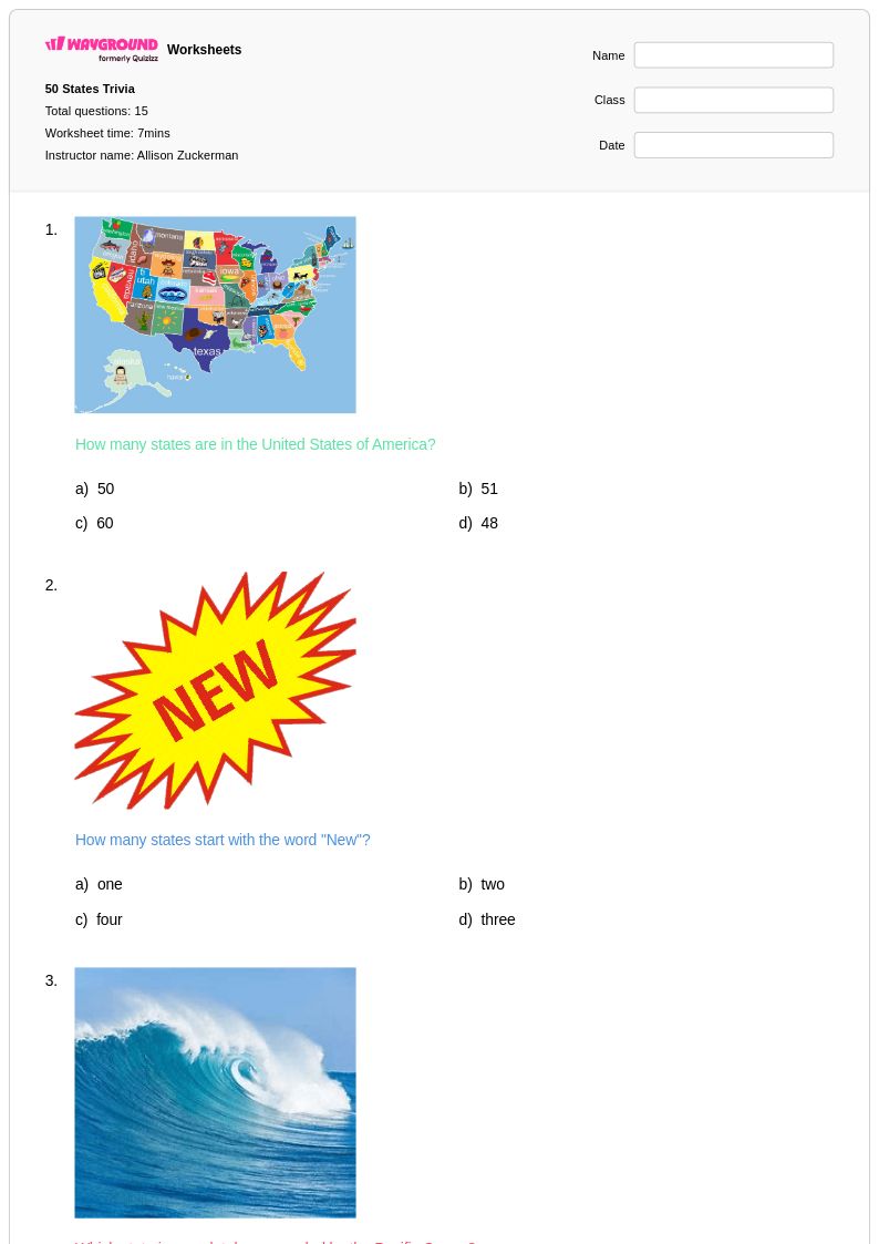
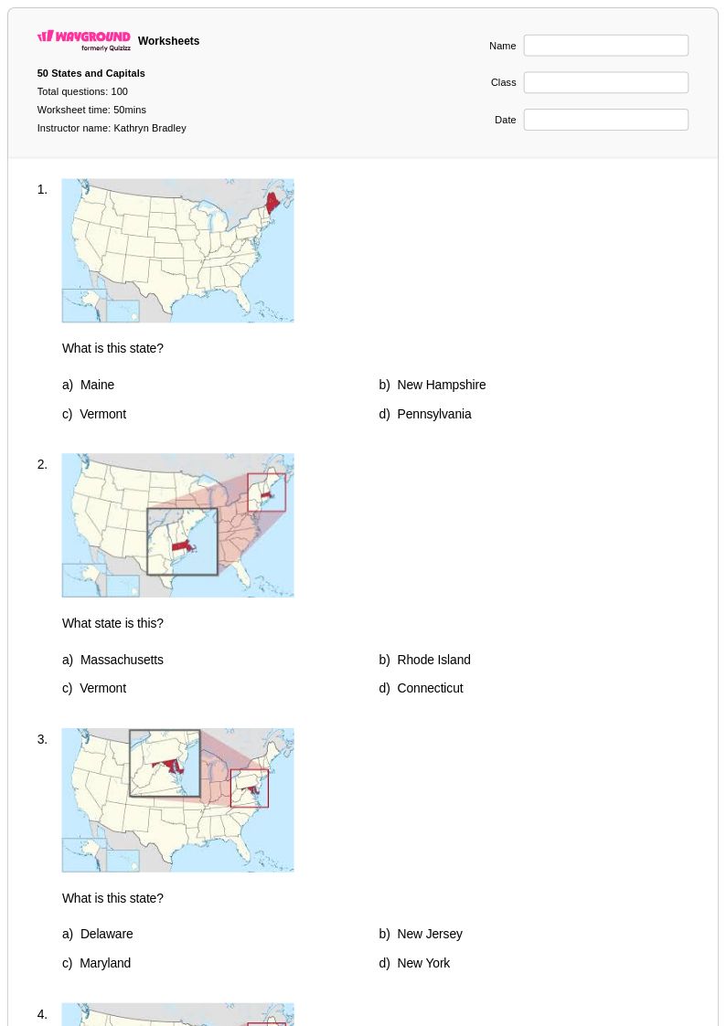
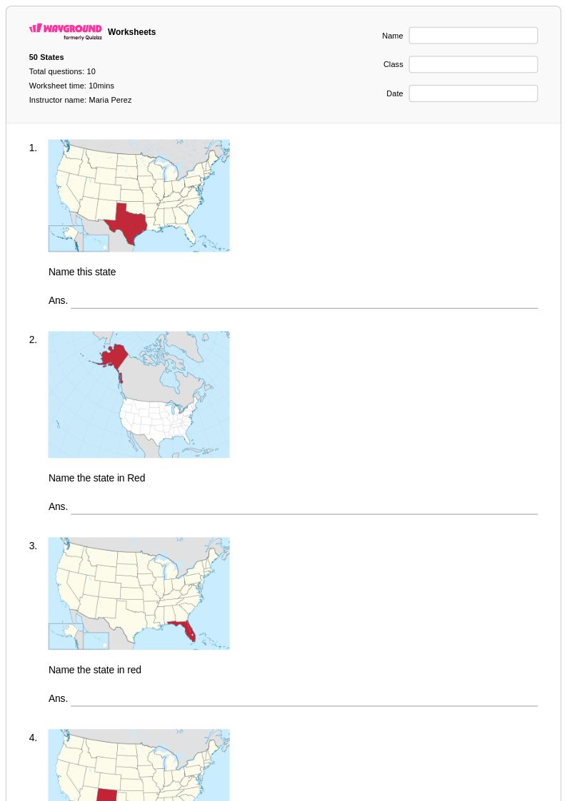
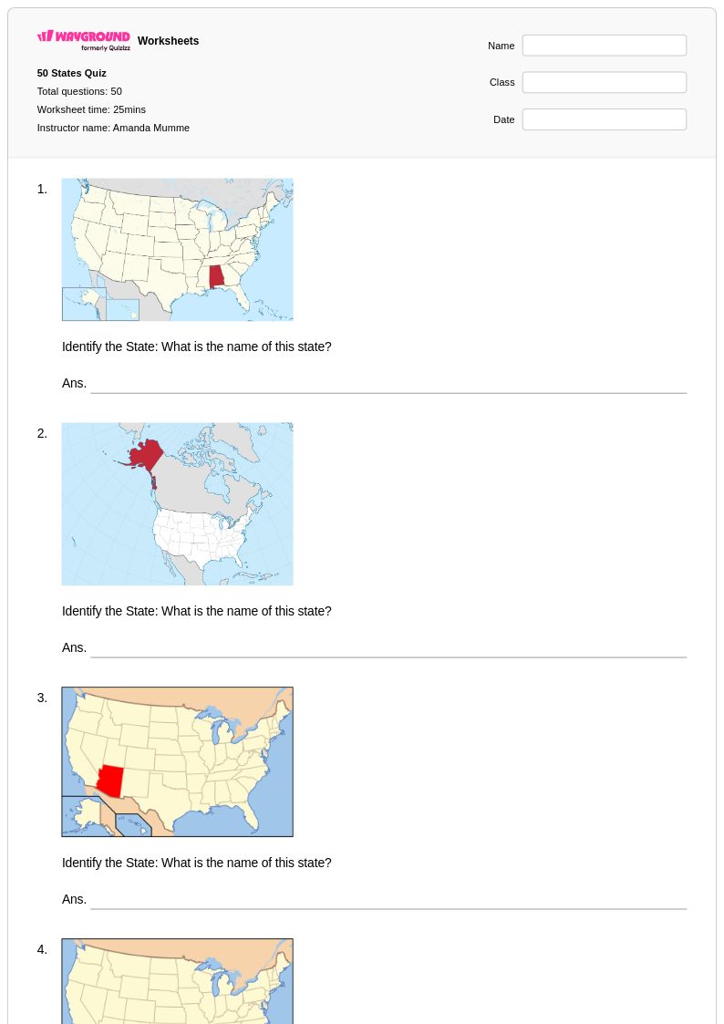
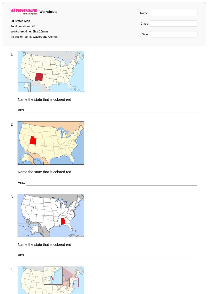
50 States worksheets available through Wayground (formerly Quizizz) provide comprehensive resources for students to master essential knowledge about American geography and civics. These expertly designed materials strengthen critical skills including state identification, capital cities recognition, geographic location awareness, and understanding of regional characteristics across the United States. Students engage with practice problems that reinforce memorization of all fifty states and their capitals while developing spatial reasoning abilities through map-based activities. The collection includes free printables with detailed answer keys, making it easy for educators to assess student progress and provide immediate feedback. These pdf resources support both independent study and classroom instruction, helping students build the foundational geographic literacy essential for informed citizenship.
Wayground (formerly Quizizz) empowers teachers with millions of educator-created resources specifically focused on 50 States content, featuring robust search and filtering capabilities that allow quick access to materials aligned with state social studies standards. The platform's differentiation tools enable teachers to customize worksheets based on individual student needs, whether for remediation of basic state identification skills or enrichment activities exploring regional economies and cultural characteristics. Teachers can seamlessly transition between printable pdf formats for traditional classroom use and digital formats for technology-integrated learning environments. These flexible resources streamline lesson planning while providing targeted skill practice opportunities that help students master the geographic knowledge necessary for success in advanced social studies coursework and standardized assessments.
FAQs
How do I teach students all 50 states and capitals?
Teaching the 50 states and capitals is most effective when broken into regional chunks rather than attempting all 50 at once. Start with a region students are familiar with, then layer in map-based activities that connect state location to capital name. Repetition through varied formats, such as fill-in-the-blank, matching, and blank map labeling, builds retention more reliably than rote memorization alone.
What worksheets help students practice identifying states on a map?
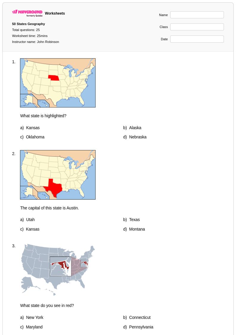
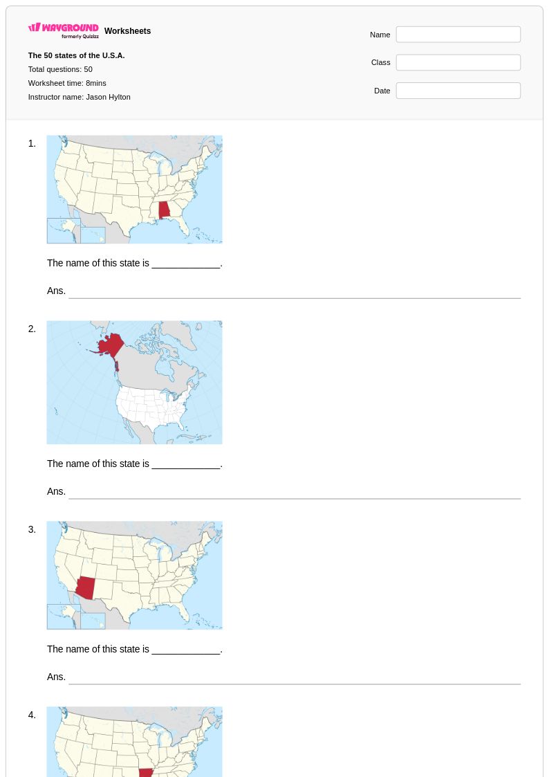
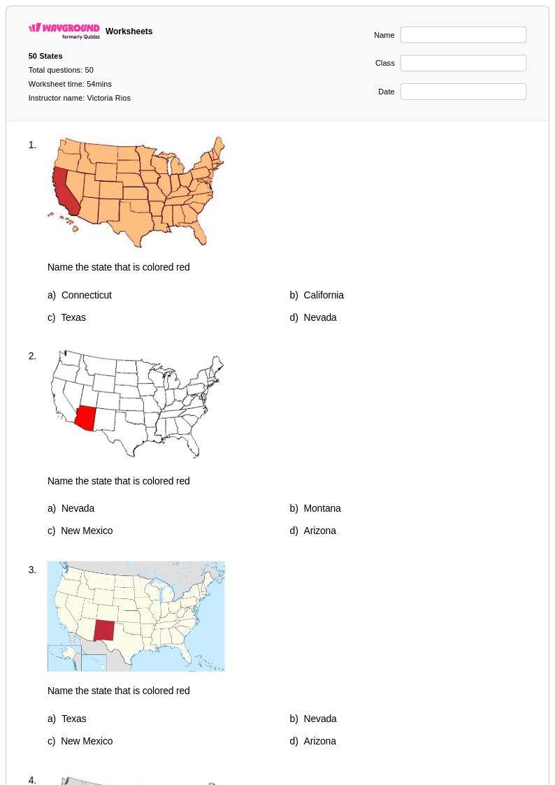
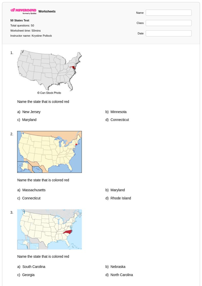
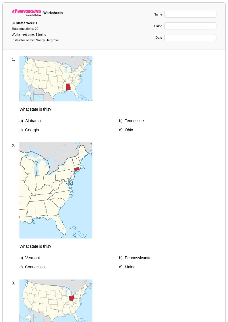
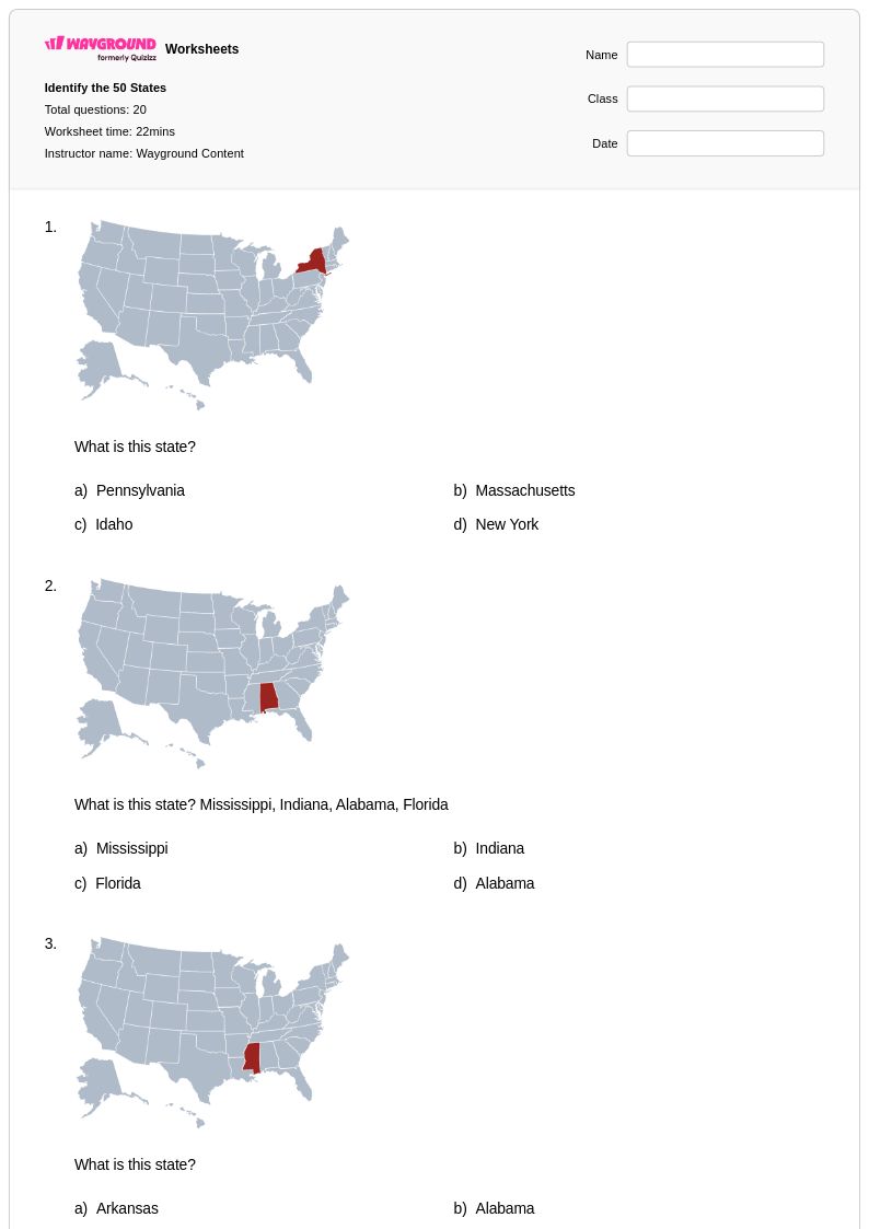
Blank U.S. map worksheets are the most direct tool for practicing state identification, requiring students to label states by location rather than simply recognizing a name. Pairing these with region-specific activities helps students build spatial reasoning incrementally. Repeated low-stakes practice using printable map worksheets is especially effective before formal assessments.
What are common mistakes students make when learning the 50 states?
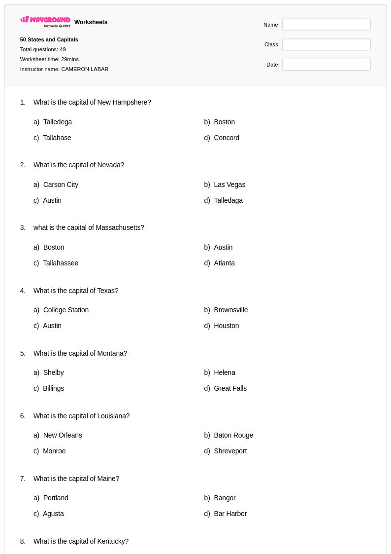
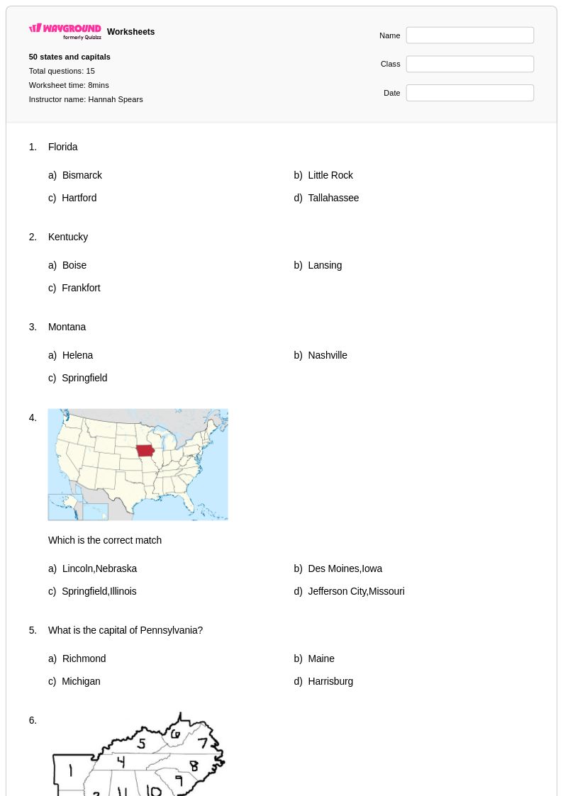
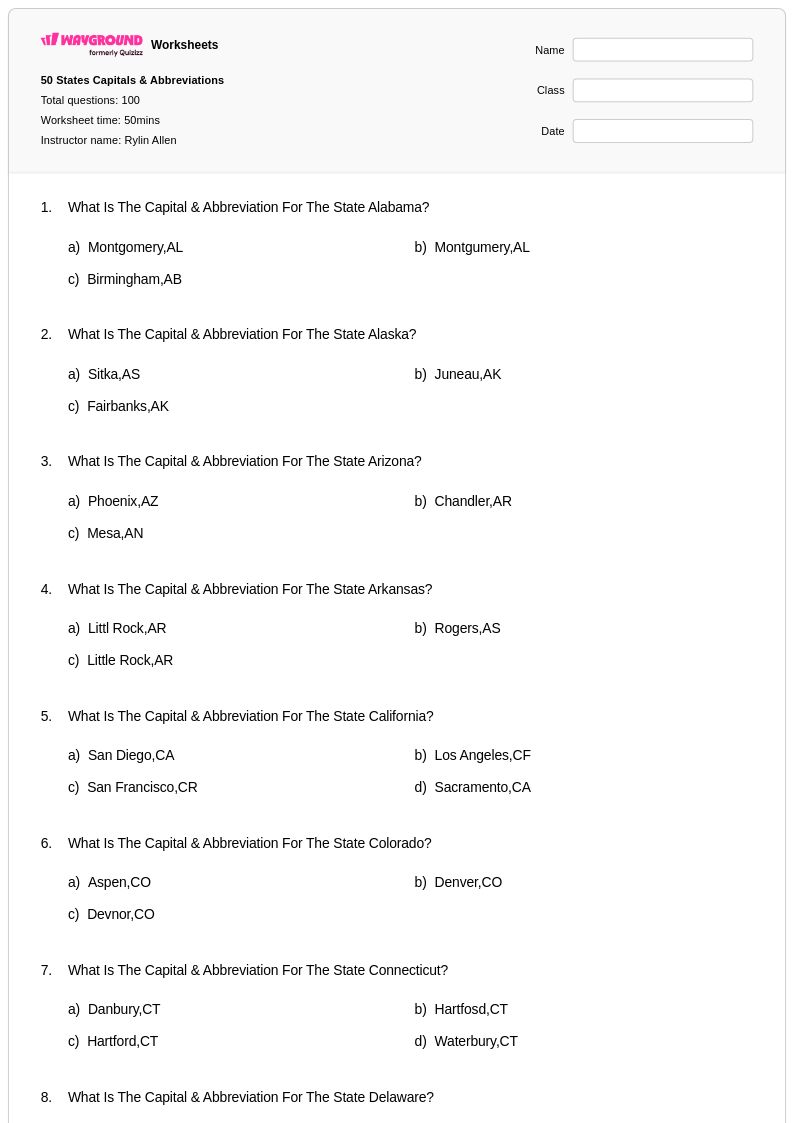
Students most commonly confuse states that share borders or have similar shapes, particularly in the Midwest and mid-Atlantic regions, such as mixing up Indiana and Illinois or Maryland and Delaware. Another frequent error is mismatching state capitals, especially for states where the capital is not the largest or most recognizable city, like Sacramento for California or Juneau for Alaska. Targeted practice on these high-confusion pairs helps correct these patterns before they become ingrained.
How can I differentiate 50 states instruction for students at different levels?
For students still mastering basic identification, focus on high-frequency states and the most commonly tested capitals before expanding to all 50. For students ready for enrichment, extend learning to regional geography, state nicknames, or economic characteristics. On Wayground, teachers can apply accommodations such as reduced answer choices for students who need additional support, and these settings are saved and reusable across future sessions without disrupting the experience for other students.
How do I use 50 States worksheets from Wayground in my classroom?
Wayground's 50 States worksheets are available as printable PDFs for traditional classroom use and in digital formats for technology-integrated environments, and teachers can also host them as a quiz directly on Wayground. All worksheets include answer keys, making it straightforward to provide immediate feedback or use them for self-paced review. The flexibility between print and digital makes these resources practical for homework, centers, or whole-class instruction.
How do I help students who keep mixing up state capitals?
Capital city confusion is usually tied to the assumption that the largest city is always the capital, which is often incorrect. Direct instruction should explicitly address high-profile mismatches, such as New York City versus Albany or Chicago versus Springfield. Focused matching and short-answer practice that isolates state-capital pairs, rather than full 50-state assessments, helps students correct specific gaps more efficiently.