
 Worksheets
Review for Midterm
Total questions: 117
Worksheet time: 6hrs 51mins
Which theory helped scientists understand how and where volcanoes erupt?
Theory of Plate Tectonics
Theory or Relativity
Theory of the Rock Cycle
Big Bang Theory
Which type of volcano is built by alternating layers of lava flows and ash flows? It can
be very explosive.
Cinder Cone
Composite
Lava Dome
Shield
Which type of volcano has steep angled sides, throws blobs of lava in the air that fall as cinders, and is built over a short period of time?
Cinder Cone
Composite
Lava Dome
Shield
Which type of volcano if found in the Hawaiian Islands with thick flowing, slow moving lava? This is the most common type of volcano on earth.
Cinder Cone
Composite
Lava Dome
Shield
The weak point in the Earth’s crust where hot magma rises and reaches the earth’s
surface is call the __________.
Crater
Magma Chamber
Main Vent
Secondary Cone
An active volcanic area on earth is found at_______.
Diverging Boundaries
Converging Boundaries
Hot Spots
All of the above
What is the active volcano area around the Pacific Rim called?
Hot Spots
Pacific Ocean
Ring of Fire
Hawaii
Large projectiles thrown through the air during an eruption are called
Volcanic bombs
Hot Spot
Lava
Magma chamber
Magma is found above the earth surface?
True
False


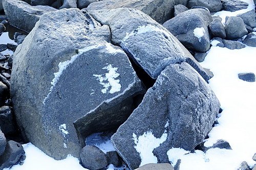
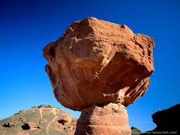


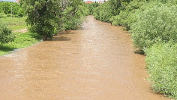

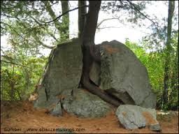
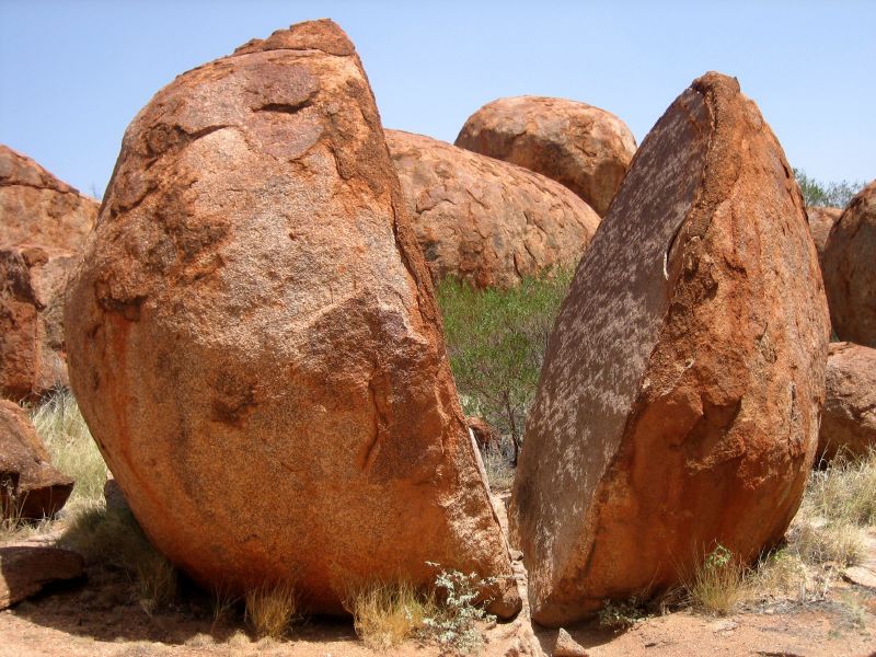


Which location would allow the least amount of water to be absorbed into the ground?
a grassy terrain
a sandy beach
a forest
a mountain

The land around these rivers is known as the _____________.
tributary
divide
water system
watershed
What is the power behind the water cycle?
gravity
the Sun
evaporation
condensation
The carrying capacity of a stream is its ___________.
ability to transport sediment
rate of runoff entering the channel
volume of flow
stream bank height

Water that stands or flows across the Earth’s surface.
Groundwater
Surface water
Runoff
Divide
What is all of the land area whose water drains into a stream system?
Runoff
Watershed
Divide
Suspension
water cycle
the continuous movement of water between the atmosphere, the land, the oceans, and living things
the change of state from a liquid to a gas that usually occurs at the surface of a liquid over a wide range of temperatures
the process by which plants release water vapor into the air through stomata; also the release of water vapor into the air by other organisms
the change of state from a solid directly to a gas
evaporation
the process by which plants release water vapor into the air through stomata; also the release of water vapor into the air by other organisms
the change of state from a gas to a liquid
at constant pressure and water vapor content, the temperature at which the rate of condensation equals the rate of evaporation
the change of state from a liquid to a gas that usually occurs at the surface of a liquid over a wide range of temperatures
transpiration
a cloud that forms near the ground and results in a reduction in visibility
a collection of small water droplets or ice crystals suspended in the air, which forms when the air is cooled and condensation occurs
the process by which plants release water vapor into the air through stomata; also the release of water vapor into the air by other organisms
any form of water that falls to Earth's surface from the clouds
condensation
the change of state from a gas to a liquid
any form of water that falls to Earth's surface from the clouds
at constant pressure and water vapor content, the temperature at which the rate of condensation equals the rate of evaporation
the change of state from a liquid to a gas that usually occurs at the surface of a liquid over a wide range of temperatures
precipitation
any form of water that falls to Earth's surface from the clouds
the change of state from a gas to a liquid
the process by which plants release water vapor into the air through stomata; also the release of water vapor into the air by other organisms
the change of state from a liquid to a gas that usually occurs at the surface of a liquid over a wide range of temperatures
cloud
the change of state from a gas to a liquid
a collection of small water droplets or ice crystals suspended in the air, which forms when the air is cooled and condensation occurs
at constant pressure and water vapor content, the temperature at which the rate of condensation equals the rate of evaporation
any form of water that falls to Earth's surface from the clouds
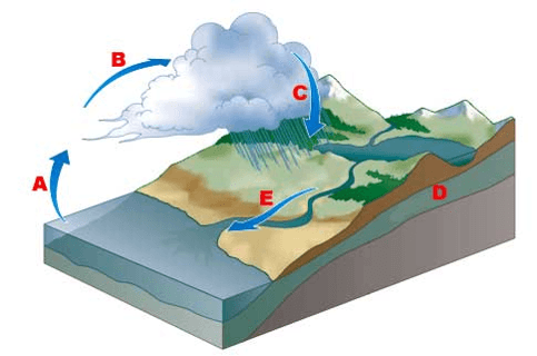
What percentage of the world's water is found in the Oceans?
25%
50%
75%
97%
99%
Movement of water through the soils of Earth is what?
Diffusion
Infiltration
Exfoliation
Precipitation

curve or loop in a river
Delta
Beach
Meander
Canyon
land that gets covered by water from a stream or river during a flood
Mountain
Valley
Meander
Floodplain
a fan shaped deposit at the mouth of a river
Plain
Delta
Dune
Canyon


The photograph shows both erosional and depositional features formed by an agent of erosion. Which agent of erosion produced the features shown in the photograph?
running water
glacial ice
ocean waves
prevailing wind

The photograph shows a valley. Which agent of erosion most likely produced this valley's shape?
blowing wind
ocean waves
moving ice
running water

The cross sections show a three-stage sequence in the development of a glacial feature. Which glacial feature has formed by the end of stage 3?
kettle lake
finger lake
drumlin
parallel scratches

Base your answer to the following question on the map. Arrows on the map show the location and orientation of glacial striations on the surface bedrock. Dark shading shows the location of large moraines (glacial deposits). How were the striations made?
Frost action cracked the bedrock during the ice age.
Rocks at the bottom of the glaciers were dragged over the bedrock.
Particles carried by winds scratched the bedrock during the ice age.
Particles carried by glacial meltwater eroded the bedrock.
Which landscape feature was most likely formed by glacial activity?
an eroded plateau
a flat floodplain
a U-shaped valley
a V-shaped valley
The bedrock at a certain location is deeply scratched, and in some places is covered by a layer of unsorted sediment. Which erosional agent was probably responsible for these features?
ocean waves
wind
running water
glaciers

Base your answer to the following question on the diagram which represents a profile of a mountain glacier in the northern United States. Over a period of years, this glacier gains more snow mass than it loses. What will be the most likely result of this gain?
The glacier will decrease in size, and the ice front will retreat.
The glacier will decrease in size, and the ice front will advance.
The glacier will increase in size, and the ice front will retreat.
The glacier will increase in size, and the ice front will advance.

The diagram represents a stream valley. Which diagram below best shows how this valley might be modified after a glacier has moved through it?


The diagram shows the edge of a continental glacier that is receding. R indicates elongated hills. The ridge of sediments from X to Y represents a landscape feature. The elongated hills labeled R are most useful in determining the
age of the glacier
direction the glacier has moved
thickness of the glacier
rate at which the glacier is melting

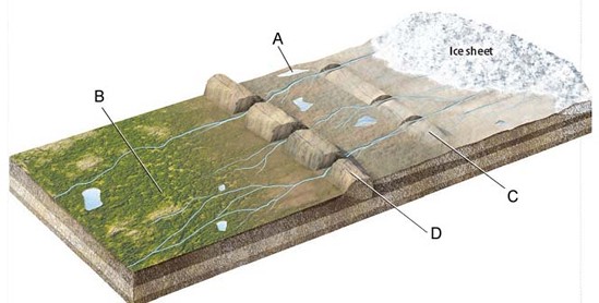

Poorly graded (unsorted) rock material deposited directly by a glacier.
glacial drift
stratified drift
till
glacier
Poorly graded (unsorted) rock material deposited directly by a glacier.
glacial drift
stratified drift
till
glacier
A _____ is a mass of snow and ice that moves slowly over the land.
moraine
glacier
till
u-shaped valley
_____ is the removal of large chunks of rock picked up by the glacier
Plucking
Abrasion
Weathering
Erosion

_____ is the material that is deposited by the melting glacier.
kettles
cirque
horn
till
_____ are piles of till deposited at the bottom of glaciers.
cirque
end moraine
lateral moraine
erratics

_____ are depressions that were formed when pieces of glacier ice melted.
Erratic
Kettles
Cirque
Aretes

What is the arrow pointing to in the image?
Cirque
Erratic
Esker
Kettle

What landform is shown in the image?
Horn
Cirque
Erratic
Kettle
A valley glacier generally forms in mountainous areas
True
False

What glacial feature is shown in the image?
Horn
Continental glacier
V-shaped river valley
Hanging Valley

Ms. D is standing on top of a _________
Cirque
Arete
Lateral Moraine
Kettle Lake

Ms. D is staring up at a
Continental Glacier
Valley Glacier
V-shaped River Valley
None of the above

Why is the glacier so dirty?
The glacier picks up rocks and transports it to the top of the glacier.
Rocky debris fall off the steep sides of the mountains and accumulate on the top of the glaciers.
The glacier carries debris as it moves and small sediment like sand is blown via wind to the top of the glacier.
All of the above

______ is a smooth hill composed of till.
Drumlin
Cirque
Esker
Erratic

The image shows a...
continental glacier
valley glacier

A _____ glacier carves a U-shaped valley into a V-shaped valley.
Continental
Valley
River
Plain

A period of time when much of Earth's land is covered in glaciers.
glacier
ice age
snowline
ice sheet

A thick ice mass that moves slowly over the land surface.
glacial trough
ice sheet
ice age
glacier

The lowest elevation in a particular area that remains covered in snow all year
snowline
ice sheet
glacial trough
valley glacier

Sediment laid down by glacial meltwater.
till
stratified drift
alluvial fan
moraines

A cone of debris left when a desert stream flows out of a canyon, loses speed, or quickly dumps its sediment.
moraine
stratified drift
alluvial fan
playa lake

After a heavy rain/snowmelt in the mountains, streams may flow across alluvial fans to the center of the basin. They only last a few days or a few weeks.
stratified drift
till
moraines
playa lake

When wind deposits sand in mounds or ridges.
desert pavement
dunes
deflation
loess
Massive sheets of ice that may cover millions of square kilometers?
alpine glaciers
continental glaciers
Sand dunes are are a result of a powerful force of erosion. What is this force?
Sun
Wind
Rain
When it does rain in the desert, _______ streams fill with water and often _____.
intermittent ; carry large boulders
very narrow ; move with high velocity
ephemeral ; flood
At the start of an Ice Age, ice sheets increase in size, sea level falls, and the shoreline moves _____.
inland
seaward
In areas of much ice accumulation, ___ of the land may result.
subsidence
rebound
__________ leave behind U-shaped valleys.
Alpine Glaciers
Continental Glaciers
Sand Dunes
Loess
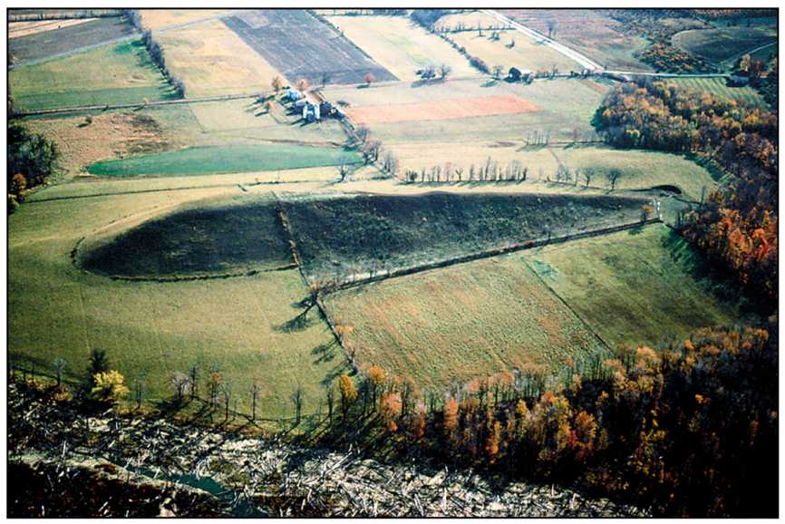
The ability of the wind to move materials
exceeds that of other transporting agents, such as water and ice.
is small compared to other transporting agents, such as water and ice.
is greater than that of water because of the higher density of air compared to water.
is equal to other transporting agents, such as water and ice.

