
 Worksheets
Geo Final Exam
Total questions: 116
Worksheet time: 2hrs 52mins

Identify this country.

Identify this country.

Identify this country.

Identify this country.

Identify this country.

Identify this country.

Identify this country.

Identify this country.
Colombia

What is the name of the ocean highlighted blue?
Southern Ocean
Atlantic Ocean
Pacific Ocean
Arctic Ocean

What is the name of this physical feature?
Patagonia Highlands
Andes Mountains
Rocky Mountains
Brazilian Highlands

What geographic feature stretches nearly the entire width of South America?
Amazon Basin
Andes Mountains
Angel Falls
Guiana Highlands

What continent is this?
Eurasia
North America
South America
Australia

What continent is this?
Eurasia
North America
South America
Australia
Why is the Roman Catholic religion the dominant religion in South America?
African slaves brought new religious traditions to Latin America
Spanish colonization of Latin America spread new religious traditions
Incan leaders encouraged people in South America to convert to new religions
Colonial immigrants adopted the beliefs of indigenous people living in Latin America

What does the red line represent?
meridian line
date line
Prime Meridian
Equator
What are the 3 largest countries of North America?
Greenland, Canada, Mexico
United States, Canada, Mexico
Mexico, Belize, Costa Rica
United States, Cuba, Mexico

What country is this
Canada
Cuba
Mexico
The US

What country is this
Canada
Cuba
Mexico
The US

What country is this
Canada
Cuba
Mexico
The US
What was a major motivation for many early groups emigrating to the United States?
Religious freedom
Travel
Educational opportunities
Reuniting with family

Identify the physical geographic feature shown in red above.
Colorado River
Ohio River
Gulf of Mexico
Mississippi River

Identify the mountain range shown by the red line on the map
The Rocky Mountains
Appalachian Mountains
Sierra Madre Range
Alaska Range

Which mountain range is pictured here?
Rocky Mtns.
Andes Mtns.
Appalachian Mtns.
Canadian Mtns.


What country is highlighted here?
Madagascar
South Africa
Chad
Libya

What country is highlighted here?
Sudan
Ethiopia
South Africa
Congo

What country is highlighted here?
South Africa
Kenya
Madagascar
Sri Lanka

What country is highlighted here?
Mali
Chad
Kenya
Botswana

What country is highlighted here?
Zambia
Tanzania
Democratic Republic of the Congo
Burkina Faso

What country is highlighted here?
Niger
Nigeria
Ghana
Liberia

What is the name of the highlighted country?
Nigeria
Botswana
Democratic Republic of Congo
Egypt

The Suez Canal connects the Red Sea with the:
Atlantic Ocean
Mediterranean Sea
Gulf of Suez
Indian Ocean

The largest "hot desert" in the world.
The Sahara Desert
The Kalahari Desert
The Antarctic Desert
The Arctic Desert

What continent is this?
Africa
South America
Australia
Eurasia

What continent is this?
Eurasia
North America
South America
Australia

What is this line called?
longitude
prime meridian
latitude
equator

This Ocean is the 3rd largest Ocean in the world. It is also the WARMEST Ocean.
Atlantic Ocean
Pacific Ocean
Indian Ocean
Arctic Ocean
The South African government’s policy of racial separation between 1948 and 1994 was called
Pan-Africanism
Segregation
Apartheid
Suffrage

Which country is highlighted in green?
China
Japan
Vietname
North Korea

Which country is highlighted in green?
Japan
China
Vietnam
South Korea

Indonesia
Malaysia
Laos
Cambodia

Vietnam
China
Burma
North Korea

North Korea
South Korea
Vietnam
China

South Korea
North Korea
Japan
Taiwan

India
Nepal
Pakistan
Myanmar

Pacific Ocean
Arctic Ocean
Indian Ocean
Russian Communist Ocean

Which country is this?
India
United States
Russia
China

What country is this?
Japan
Afghanistan
Saudi Arabia
Iraq
What is the largest country in Europe, by size?
Russia
France
Italy
Germany

Which country is highlighted in red on the map?
Ireland
Poland
Greece
France

Which country is highlighted in red on the map?
Italy
Germany
Spain
Switzerland
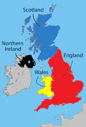
Scotland, Northern Ireland, Wales, and England make up what country in Europe
Ukraine
United Kingdom
Sweden
France

Which body of water is circled?
North Sea
Black Sea
Mediterranean Sea
Atlantic Ocean


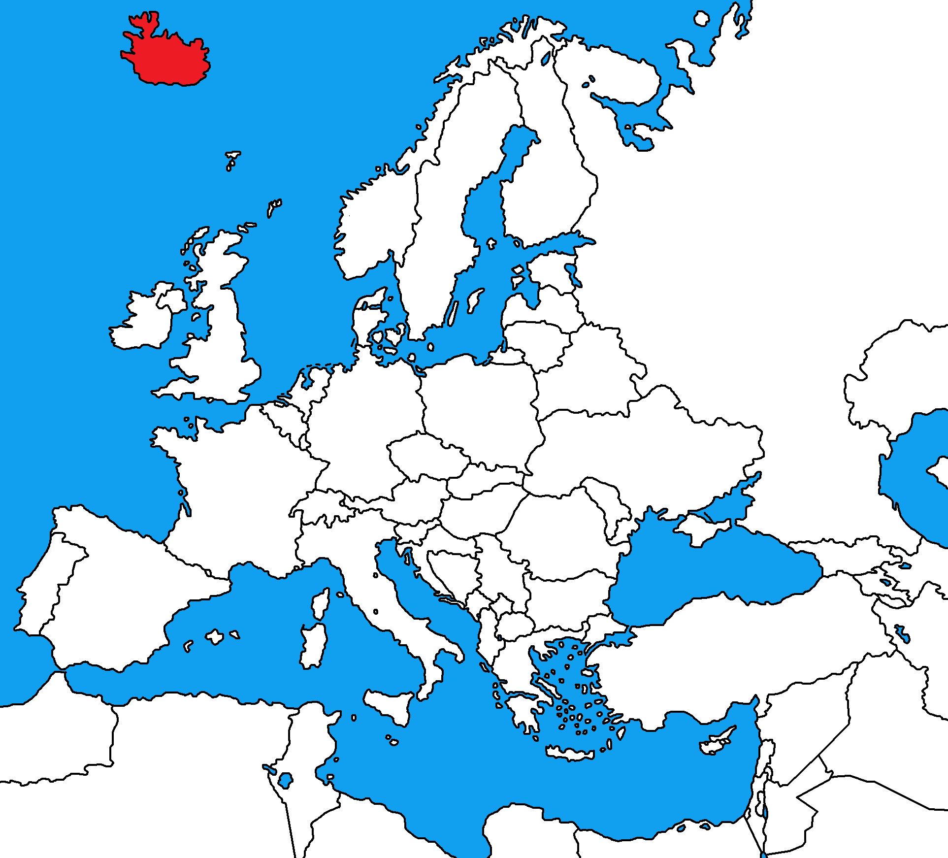
What country is this?
Finland
Iceland
Ireland
United Kingdom
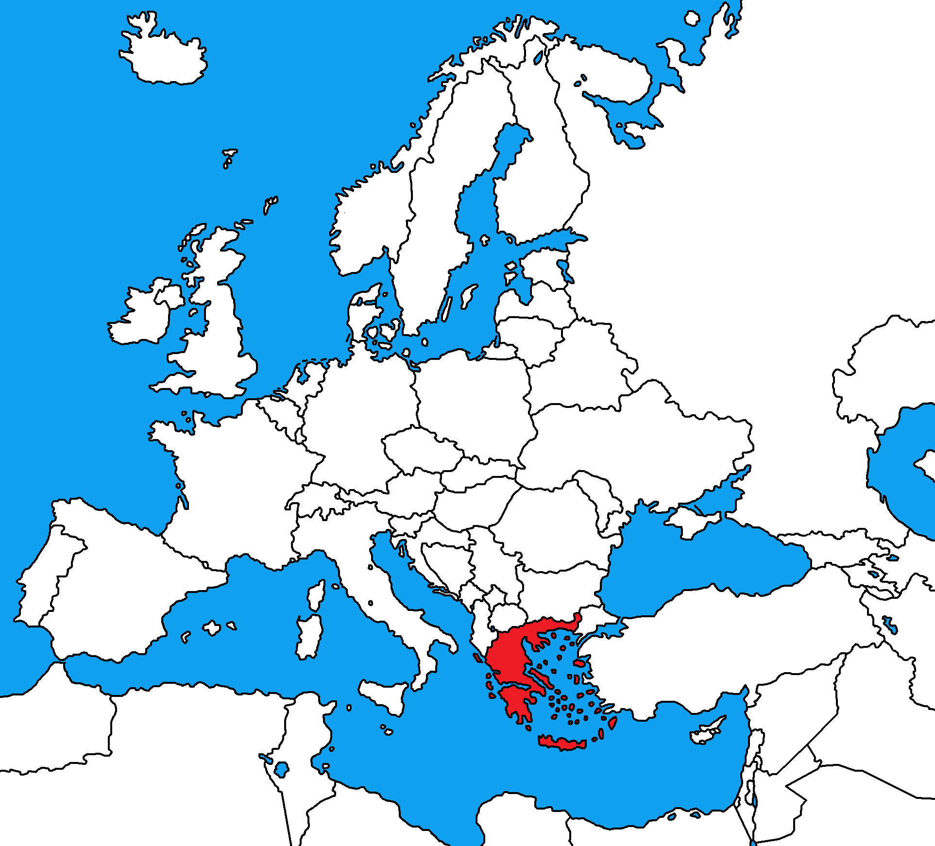
What country is this?
Bulgaria
Greece
Serbia
Turkey
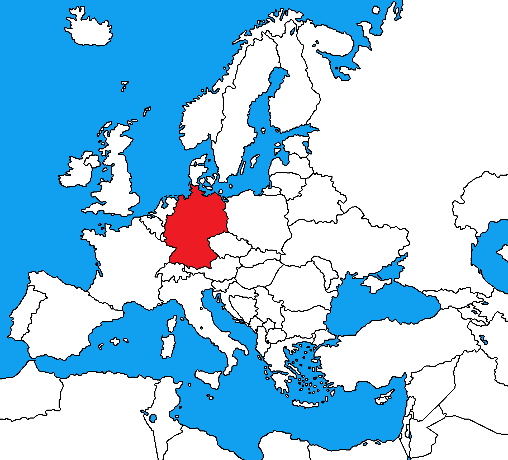
What country is this?
France
Germany
Poland
Sweden


What is this map tool called?
scale
map
compass rose
map title

A piece of land that extends into a body of water and is surrounded on three sides, but connected to a larger body of land
Peninsula
Archipelago
Plateau
Isthmus

A group or chain of islands
Peninsula
Archipelago
Plateau
Isthmus

A narrow strip of land that connects two larger pieces of land
Isthmus
Cape
Atoll
Strait

A low area between hills or mountains often with a river running through it.
valley
atoll
mesa
plateau

Which city on the map is most likely to experience a major earthquake?
Paris
New York
Juneau
Rio de Janeiro
chaparral
Boreal Forest
Tundra
Deciduous Forest
Grassland
This biome has trees that lose their leafs in the winter, experiences four seasons, and gets enough rain to support the growth of trees.
Rain forest
Taiga
Grassland
Deciduous forest

The Andes are located along the western side of South America


The Himalayas are located in Asia & separate India from China. Mt Everest is located here.


The Rockies are located in the western US & Canda


The Ural Mountains are located in Russia & allegedly separate Europe and Asia.


Atlantic Ocean
Pacific Ocean
Indian Ocean
Southern Ocean
Arctic Ocean

Atlantic Ocean
Pacific Ocean
Indian Ocean
Southern Ocean
Arctic Ocean

Atlantic Ocean
Pacific Ocean
Indian Ocean
Southern Ocean
Arctic Ocean

Atlantic Ocean
Pacific Ocean
Indian Ocean
Southern Ocean
Arctic Ocean

Mississippi River
Colorado River
Nile River
Amazon River
Yellow River

Mississippi River
Colorado River
Nile River
Amazon River
Yellow River

Mississippi River
Colorado River
Nile River
Amazon River
Yellow River

Mediterranean Sea
Gulf of Mexico
Bering Sea
Caribbean Sea

This picture shows which of the following geographic features?
The Great Dividing Range
The Great Barrier Reef
Lake Eyre
Uluru
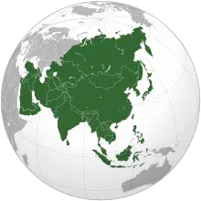
What continent is this, shaded green?
Asia
Africa
Australia
Europe
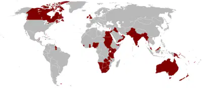
What European country colonized all of this land?
England
France
Spain
Portugual
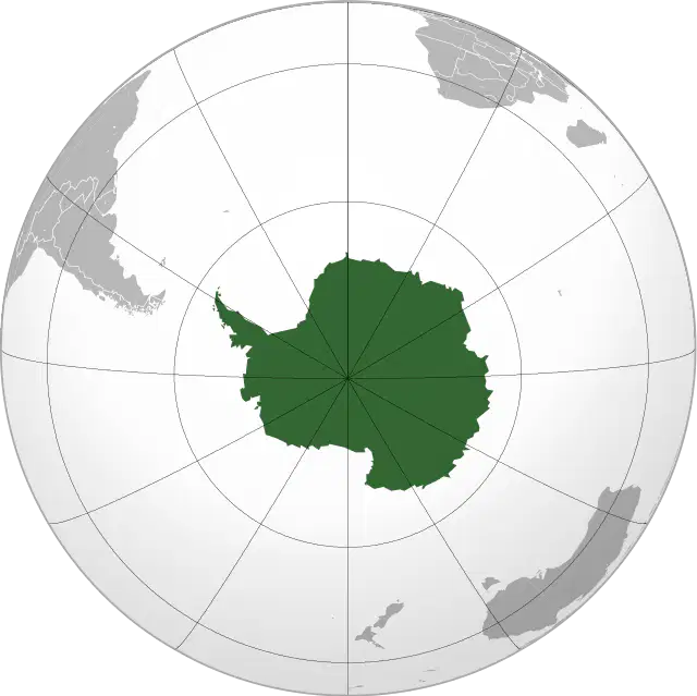
What continent is this?
South America
Africa
Australia
Antarctica
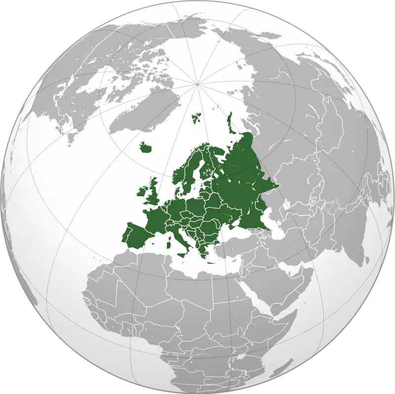
What continent is this?
Africa
Europe
Asia
North America
What continent do you live on?
North America
South America
Africa
Europe
What country do you live in?
Canada
LaSalle
the United States of America
America
What state do you live in?
Indiana
Illinois
Wisconsin
Iowa
What county do you live in? (Actually, what county does the school live in?)
Kendall
DeKalb
Putnam
LaSalle
What is the zip code for Leland, Illinois?
60531
60552
60545
60548
Match the following
Location
the position on the Earth's surface
Place
human characteristics/ phy. features
Region
an area with unifying characteristics
Movement
how thing travel and wear down
Human Environment Interaction
how people adapt due to nature
What are the 2 official languages in Canada?
English and French
English and Spanish
French and Spanish
English and Portuguese
What is the largest mountain range in South America?
the Rockys
the Andes
the Alps
the Himalayas
What people ruled over modern day Mexico until the 1520s ? (a)
What people ruled the Andes Mountains until conquered by the Spanish? (b)
What people saw the U.S. go to war during the 1960s and 1970s?
(c)
What people are home to the Taj Mahal? (d)
What people are home to the largest wall on earth? (e)
What country has the largest Muslim population in the world?
Iran
Iraq
Indonesia
India
What country build the Great Man Made River? (a)
What is the largest island that is a part of Africa? (b)
What is the highest point in Africa? (c)
What is the feature that runs from the Red Sea to Mozambique? (d)
What desert is located in Southern Africa? (e)
What 2 mountain ranges separate Europe and Asia?
the Urals and the Caucasus Mountains
the Urals and Himalayan Mountains
the Caucasus and the Alps
the Andes and the Rockys
This is the holy city of Christians, Muslims, and Jews.
(a)
Oceania is home to 36 species of this animal.
Spiders
Snakes
Birds
Scorpions
What makes the Great Barrier Reef significant as a natural feature?
It is a man-made structure built for marine research.
It is located in the Indian Ocean off the coast of Australia.
It is composed entirely of volcanic rock formations.
It is the largest coral reef system in the world, visible from space.
Which area of Europe is traditionally considered part of Scandinavia?
Northern
Southern
Western
Eastern

