
 Worksheets
Test- Regions (Extra Points)
Total questions: 35
Worksheet time: 18mins
Name
Class
Date
1.
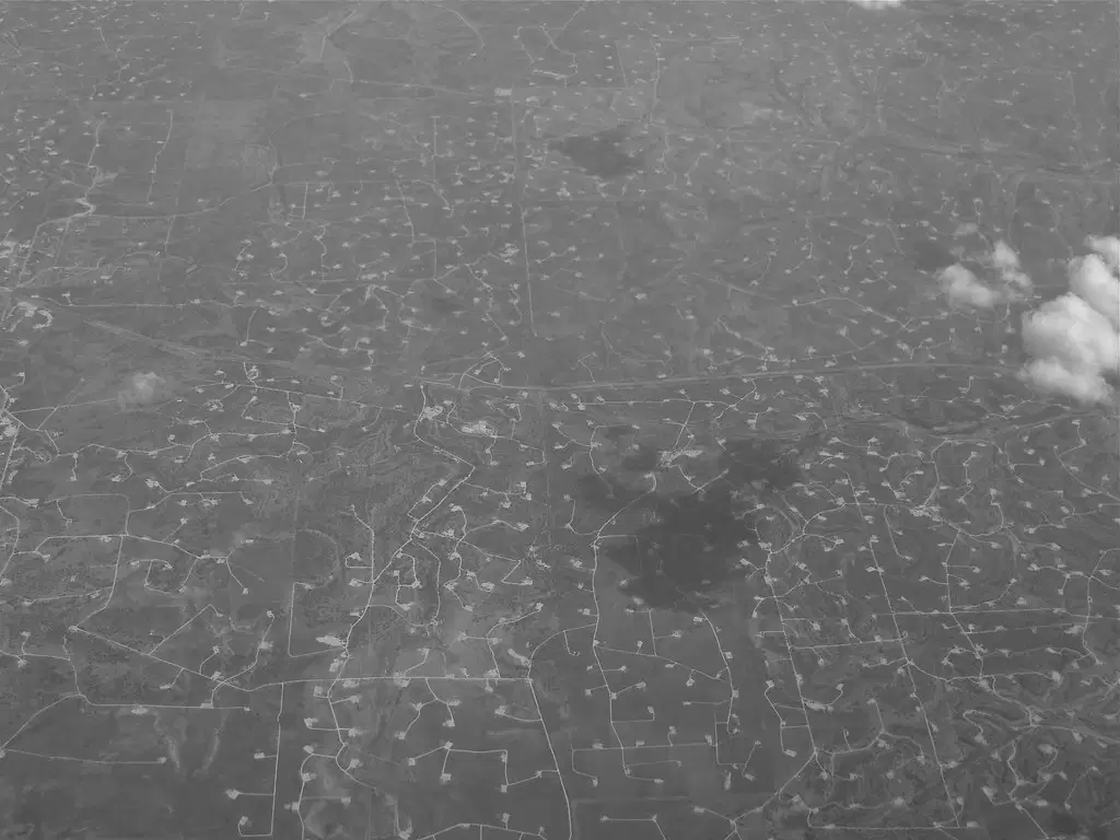
This region contains the area known as the Permian Basin-
a)
Coastal Regions
b)
North Central Plains
c)
Great Plains Region
d)
Mountains and Basins
2.

This region is known for tornadoes, and includes the Metroplex are with the cities of Forth Worth and Dallas-
a)
Coastal Regions
b)
North Central Plains
c)
Great Plains Region
d)
Mountains and Basins
3.

This region contains the Davis Mountains and borders both the Pecos and Rio Grande rivers-
a)
Coastal Regions
b)
North Central Plains
c)
Great Plains Region
d)
Mountains and Basins
4.

Houston, San Antonio, and Laredo are part of this region-
a)
Coastal Regions
b)
North Central Plains
c)
Great Plains Region
d)
Mountains and Basins
5.
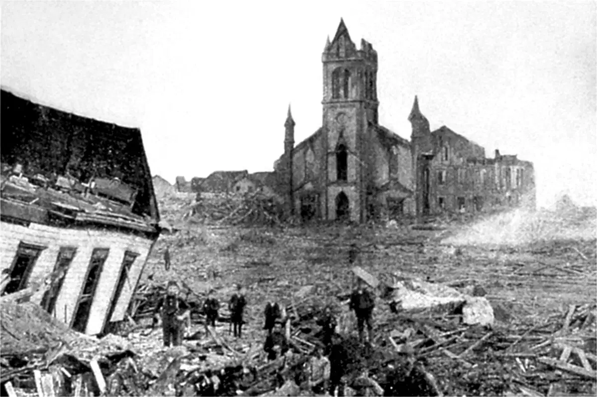
How did the people of Galveston react after a hurricane destroyed their city?
a)
they built a seawall around the city
b)
they pumped sand and elevated their city higher than sealevel
c)
they built their houses up on stilts, making them higher than ground level
d)
All of the above
6.

What do all the regions in Texas have in common?
a)
They all have gold as part of their economy
b)
They all have natural disasters, including hurricanes in the Mountains and Basins
c)
They all have the same amount of rain in every region
d)
They all have the same economy of oil and gas and agriculture
7.

This region borders two both the Caprock and Balcones escarpments-
a)
Coastal Regions
b)
North Central Plains
c)
Great Plains Region
d)
Mountains and Basins
8.

This river borders three total regions-
a)
Pecos River
b)
Nueces River
c)
Canadian River
d)
Rio Grande River
9.

Despite this region getting the least amount of rainfall, one of their natural disasters can include mud and landslides-
a)
Coastal Region
b)
North Central Plains
c)
Mountains and Basins
d)
Great Plains
10.

These two regions are known for being hot, flat, windy, and have natural disasters like drought, tornadoes, and blizzards-
a)
Coastal Region and North Central Plains
b)
North Central Plains and Great Plains
c)
Mountains and Basins and Great Plains
d)
Great Plains and Coastal Plains
11.
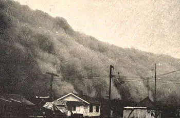
A combination of geography, drought, and the economy in this region helped lead to the Dust Bowl in the 1930's-
a)
Coastal Region
b)
North Central Plains
c)
Mountains and Basins
d)
Great Plains
12.
The cities of Midland and Odessa are located in this region, known for producing over $150 Billion in oil every year-
a)
Coastal Region
b)
Permian Basin
c)
Mountains and Basins
d)
Caprock Escarpment
13.

Causes of the Dust Bowl included all of the following factors EXCEPT-
a)
The geography of the region (windy and flat)
b)
A extended drought in the Coastal Plains of Texas that didn't allow the soil to settle
c)
Over-farming by farmers to sell crops to soldiers during the war
d)
A decade long drought with less than average rainfall in the Great Plains
14.
What is a natural disaster?
a)
A disaster that is man-made, like an oil spill
b)
A disaster that occurs naturally, like earthquakes
15.

What natural disaster do all four regions of Texas have in common?
a)
Tornadoes
b)
Blizzards
c)
Drought
d)
Hurricanes
16.
This region covers 1/3 of Texas, and is known for having hurricanes-
a)
Coastal Region
b)
North Central Plains
c)
Mountains and Basins
d)
Great Plains
17.
This type of map shows cities, states, borders, countries, and even school boundries
a)
Themeatic
b)
Physicial
c)
Political
18.
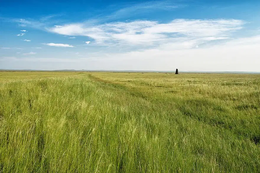
Which of the following is NOT part of the Great Plains regions-
a)
Permian Basin
b)
El Paso
c)
Dust Bowl
d)
Pecos River, and the Balcones and Caprock Escarpment
19.
Which city is NOT part of the Coastal region-
a)
Dallas
b)
Laredo
c)
Corpus Christi
d)
Brownsville
20.
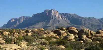
Which geographical feature is NOT part of the Mountains and Basins region-
a)
Pecos River
b)
Big Bend National Park
c)
Davis Mountains
d)
Permian Basin
21.

What is the name of the city and state found at 33°N latitude, 112°W longitude coordinates?
a)
Miami, Florida
b)
Phoenix, Arizona
c)
Fargo, North Dakota
d)
Niagara Falls, New York
22.
This type of map shows geographical features like mountains, lakes, and rivers-
a)
Themeatic
b)
Physical
c)
Political
23.
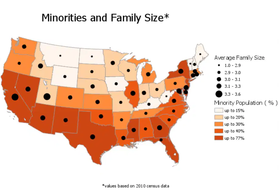
This type of map, like in the photo, is very specific about a certain topic-
a)
Themeatic
b)
Physicial
c)
Political
24.
10306 River Bank Drive would be an example of which theme of Geography?
a)
Movement
b)
Region
c)
Location
d)
Place
e)
Human Environment Interaction
25.
Tornado sirens, basements, seawalls, homes on stitls, and letting the ground settle for farming are all exmamples of which theme of geography?
a)
Movement
b)
Region
c)
Location
d)
Place
e)
Human Environment Interaction
26.

Identify the river that is directy north of the Rio Grande. This river will take you to Corpus Christi.
a)
Pecos River
b)
Nueces River
c)
Red River
d)
Canadian River
27.

This river separates Texas from Oklahoma (also known for as the big football game between the two schools)
a)
Pecos River
b)
Nueces River
c)
Red River
d)
Canadian River
28.
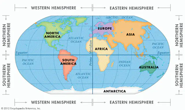
Which Hemisphere are both North and South America found in?
a)
Eastern hemisphere
b)
Western hemisphere
c)
Northern hemisphere
d)
Southern hemisphere
29.

What river forms the boundary between Texas and Mexico?
a)
Red River
b)
Rio Grande River
c)
Lake Travis
d)
Colorado River
30.
Which city can be found in the Coastal Plains?
a)
San Francisco
b)
Astoria
c)
Arendale
d)
San Antonio
31.
The Red River acts a natural border between
a)
Texas and New Mexico
b)
Texas and Mexico
c)
Texas and Oklahoma
d)
Texas and Louisiana
32.
This region is home to Big Bend National Park.
a)
Coastal Plains
b)
Mountains & Basins
c)
Great Plains
d)
Central Plains
33.

Day to day variations of the atmosphere's condition is called
a)
Weather
b)
Meteorologist
c)
Forecast
d)
Climate
34.

The meteorlogist said that it will be hot and sunny this weekend.
a)
Weather
b)
Climate
35.

Today is much colder than yesterday!
a)
Weather
b)
Climate
100 %

