
Physical Maps Presentations
This comprehensive presentation explains physical maps through structured lesson slides and visual learning activities designed for geography education. Students will explore topographical features, elevation representation, and map reading skills through clear instructional content and engaging visual examples.
15 questions
Political vs Physical Maps
Presentation
•
5th Grade
15 questions
Physical and Political Maps
Presentation
•
5th Grade

15 questions
Physical and Political Maps
Presentation
•
4th - 5th Grade

13 questions
Types of Maps
Presentation
•
4th - 6th Grade
15 questions
Political vs Physical Maps
Presentation
•
4th - 5th Grade

22 questions
Types of Maps
Presentation
•
5th Grade
10 questions
Maps
Presentation
•
5th - 8th Grade
32 questions
map skills
Presentation
•
5th Grade
27 questions
Maps!
Presentation
•
4th - 5th Grade
49 questions
Map Skills Lesson - U1L2
Presentation
•
5th Grade
21 questions
Basic Map Skills
Presentation
•
5th - 9th Grade
Browse by grade
Explore Physical Maps Presentations
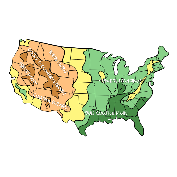
Physical maps serve as fundamental educational tools that help students visualize and understand Earth's natural features, landforms, and topographical characteristics. Wayground's comprehensive collection of physical map presentations provides structured instruction through detailed concept explanations and visual learning opportunities that bring geographical features to life in the classroom. These presentations systematically guide students through the interpretation of elevation changes, mountain ranges, river systems, and continental formations while developing essential map-reading skills and spatial reasoning abilities. Through carefully designed visual elements and progressive concept explanation, students learn to distinguish between different types of terrain representations, understand topographical symbols, and analyze how physical features influence human settlement patterns and regional characteristics. Wayground's extensive library draws from millions of teacher-created presentation resources, offering educators robust search and filtering capabilities to locate materials that align with specific geographical standards and curriculum requirements. The platform's differentiation tools allow teachers to customize physical map presentations for diverse learning needs, supporting both remediation for students who need additional practice with basic map concepts and enrichment opportunities for advanced learners ready to explore complex topographical analysis. These digital-first presentations can be seamlessly integrated into lesson planning, used for skill reinforcement activities, or deployed as assessment preparation tools, while the platform's flexible delivery formats accommodate various classroom technologies and teaching preferences. Teachers benefit from standards-aligned content that supports comprehensive geographical instruction while maintaining the adaptability necessary for effective differentiated learning environments.
Accessibility
Features
Wayground Super
School & District
Wayground for Business
Create a quiz
Create a presentation
Wayground AI
Subjects
Mathematics
Social Studies
Science
Physics
Chemistry
Biology
About
Our Story
Wayground Blog
Media Kit
Careers
Support
F.A.Q.
Help & Support
Privacy Policy
Terms of Service
Teacher Resources
2026 Wayground


Get our app

