
5th Grade Physical Maps Presentations
This Grade 5 presentation explains physical maps through structured lesson slides and visual learning activities. Students will discover how physical maps show natural features like mountains, rivers, and landforms using colors, symbols, and elevation markers.
15 questions
Political vs Physical Maps
Presentation
•
5th Grade
15 questions
Physical and Political Maps
Presentation
•
5th Grade

15 questions
Physical and Political Maps
Presentation
•
4th - 5th Grade

13 questions
Types of Maps
Presentation
•
4th - 6th Grade
15 questions
Political vs Physical Maps
Presentation
•
4th - 5th Grade

22 questions
Types of Maps
Presentation
•
5th Grade
10 questions
Maps
Presentation
•
5th - 8th Grade
32 questions
map skills
Presentation
•
5th Grade
27 questions
Maps!
Presentation
•
4th - 5th Grade
49 questions
Map Skills Lesson - U1L2
Presentation
•
5th Grade
21 questions
Basic Map Skills
Presentation
•
5th - 9th Grade
Browse by grade
Explore 5th Grade Physical Maps Presentations
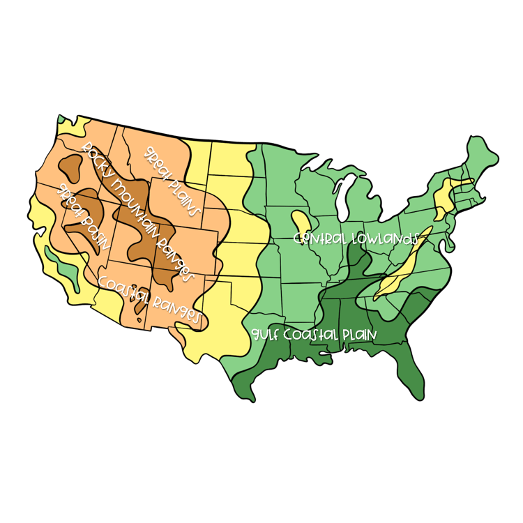
Physical maps serve as fundamental tools for Grade 5 students to develop spatial thinking and geographic literacy through structured visual learning. Wayground's comprehensive collection of physical map presentations delivers concept explanation through carefully designed slides that help students identify and understand landforms, elevation patterns, water bodies, and topographical features. These educational presentations utilize visual learning strategies to make complex geographic concepts accessible, allowing fifth-grade learners to explore mountain ranges, valleys, plains, and coastal regions through clear illustrations and structured instruction. Students develop critical map-reading skills as they learn to interpret symbols, legends, and color-coding systems that represent different physical features and elevation levels across various landscapes. Wayground's extensive library draws from millions of teacher-created resources, providing educators with robust search and filtering capabilities to locate physical map presentations aligned with Grade 5 geography standards. Teachers can customize these digital resources to match diverse learning needs, incorporating differentiation strategies that support both remediation for struggling students and enrichment opportunities for advanced learners. The platform's flexible delivery formats enable seamless integration into classroom instruction, whether through whole-group presentations, small-group exploration, or individual student review sessions. These comprehensive tools support lesson planning by offering ready-to-use content while allowing educators to reinforce essential geographic skills through repeated exposure to physical map concepts, ultimately building students' confidence in interpreting and analyzing Earth's physical features.
Accessibility
Features
Wayground Super
School & District
Wayground for Business
Create a quiz
Create a presentation
Wayground AI
Subjects
Mathematics
Social Studies
Science
Physics
Chemistry
Biology
About
Our Story
Wayground Blog
Media Kit
Careers
Support
F.A.Q.
Help & Support
Privacy Policy
Terms of Service
Teacher Resources
2026 Wayground


Get our app

