Explore Wayground's free Canada geography worksheets and printables that help students master Canadian provinces, capitals, landmarks, and physical features through engaging practice problems with comprehensive answer keys.
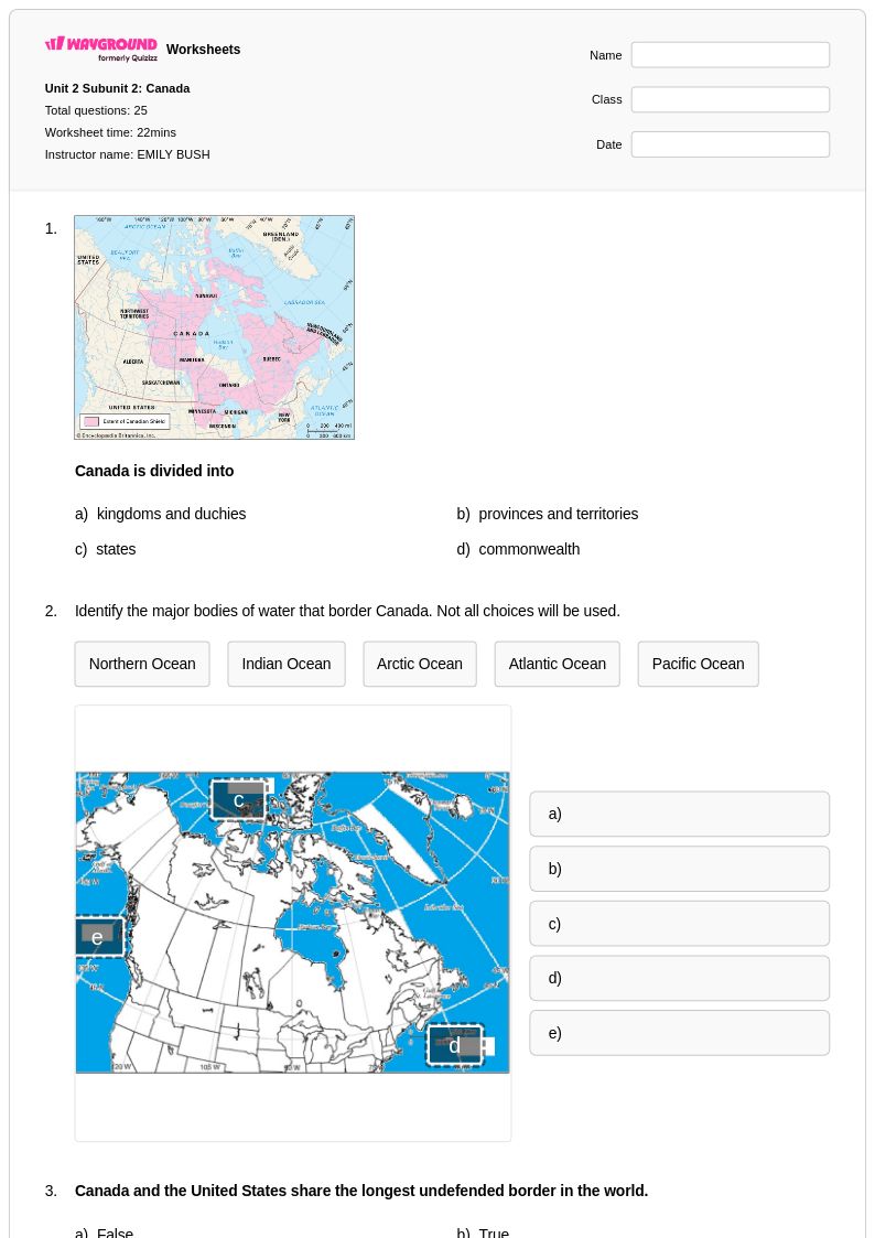
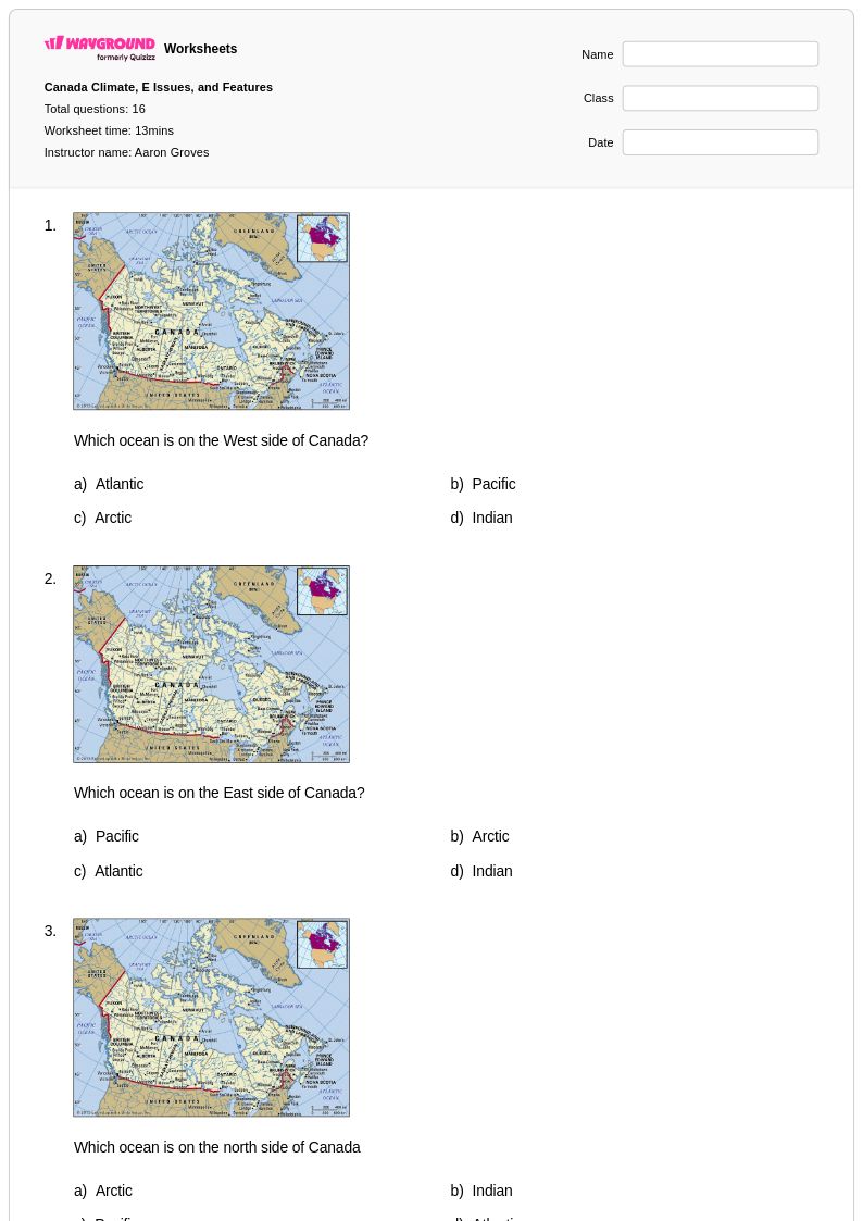
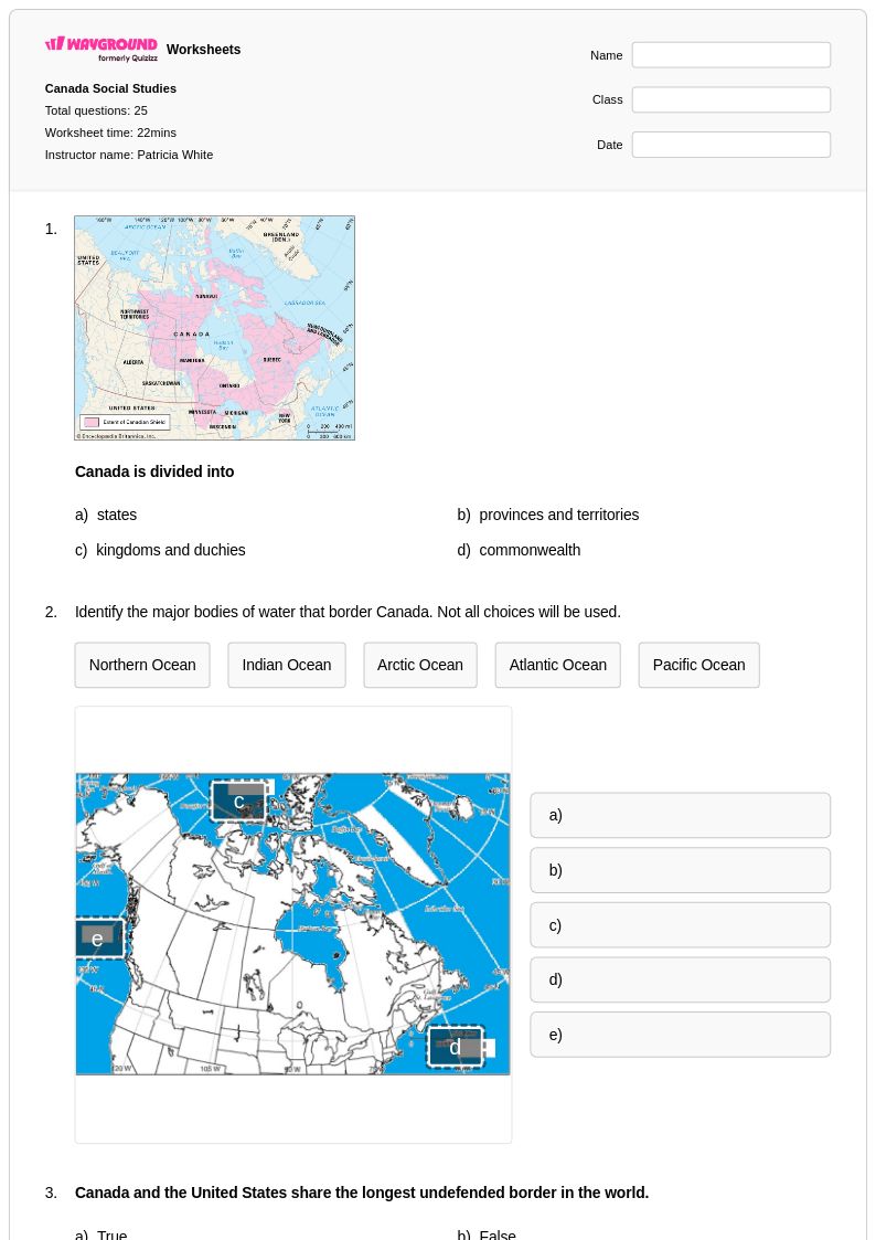
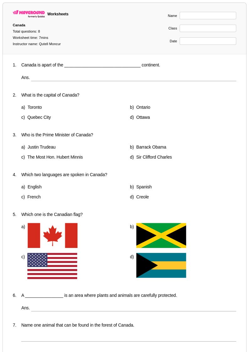
Canada worksheets available through Wayground (formerly Quizizz) provide comprehensive coverage of Canadian geography, history, culture, and government systems for students across multiple grade levels. These educational resources strengthen critical thinking skills through detailed explorations of Canada's ten provinces and three territories, major cities, natural landmarks, and diverse cultural heritage. Students engage with practice problems that examine everything from the Rocky Mountains and Great Lakes system to Quebec's francophone culture and Indigenous peoples' contributions to Canadian society. Each worksheet collection includes answer keys and is available as free printables in convenient PDF format, allowing educators to seamlessly integrate Canadian studies into their social studies curriculum while building students' knowledge of North America's second-largest country.
Wayground (formerly Quizizz) supports educators with millions of teacher-created Canada worksheet resources that feature robust search and filtering capabilities, enabling quick access to materials covering specific provinces, historical periods, or cultural topics. The platform's standards alignment ensures that Canadian geography and social studies content meets curriculum requirements, while differentiation tools allow teachers to customize worksheets for diverse learning needs and skill levels. These flexible resources are available in both printable PDF and digital formats, making them ideal for classroom instruction, homework assignments, remediation support, and enrichment activities. Teachers can efficiently plan comprehensive units on Canadian themes, from the Canadian Shield's geological significance to the country's parliamentary system, while providing targeted skill practice that helps students develop deeper understanding of Canada's role in global contexts.
FAQs
How do I teach Canadian geography to elementary and middle school students?
Start by grounding students in Canada's physical regions before introducing political boundaries. Use labeled maps to help students locate the ten provinces, three territories, and major physical features like the Rocky Mountains, Canadian Shield, and Great Lakes system. Connecting physical geography to cultural regions, such as Quebec's francophone identity or Indigenous peoples' traditional territories, gives students a more integrated understanding of the country rather than isolated facts.
What exercises help students practice identifying Canadian provinces and capitals?
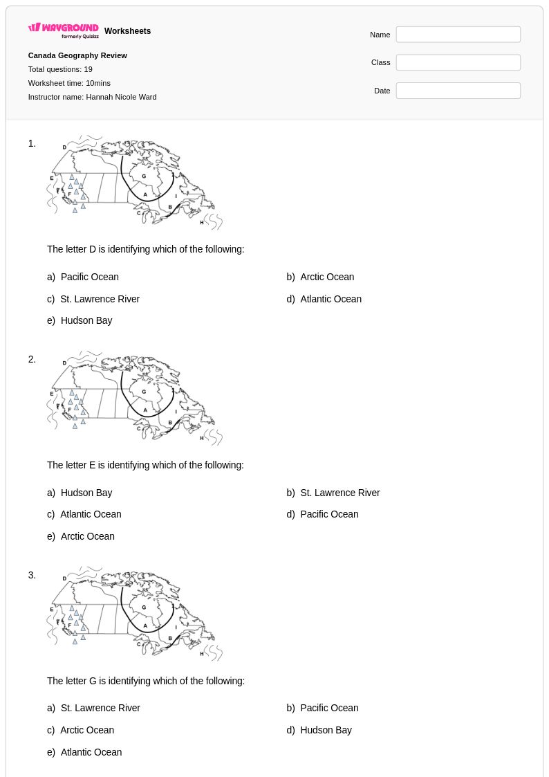
Blank map labeling, matching activities, and fill-in-the-blank exercises are among the most effective formats for practicing provinces and capitals because they require active recall rather than passive recognition. Repeating these exercises across multiple formats, such as moving from labeled reference maps to fully blank maps, helps students build retention over time. Practice problems that ask students to connect provinces to their capitals, regional geography, or cultural characteristics add depth beyond simple memorization.
What common mistakes do students make when learning about Canada's provinces and territories?
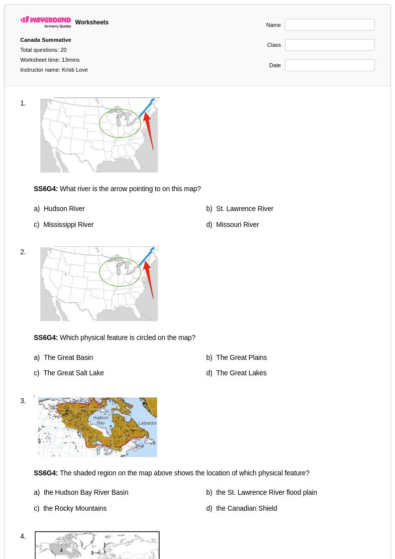
Students frequently confuse the provinces with the territories, not understanding that territories are governed differently from provinces under Canada's federal system. Another common error is misplacing western provinces, particularly conflating Alberta and British Columbia, or assuming all provinces border the ocean. Students also regularly underestimate Canada's geographic scale, which leads to misconceptions about the relationship between provinces and major landmarks like the Rockies or Great Lakes.
How do I use Canada worksheets to support a social studies unit on North America?
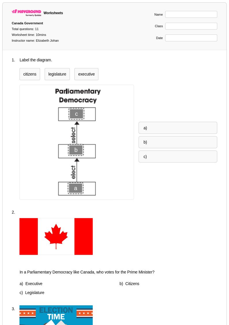
Canada worksheets work well as a focused sub-unit within a broader North America curriculum, helping students compare Canada's physical geography, government structure, and cultural regions to those of the United States and Mexico. Worksheets that cover Canada's parliamentary system, Indigenous heritage, and bilingual culture prompt higher-order thinking about how geography shapes national identity. Using a mix of map-based and text-based worksheets gives students multiple entry points into the content.
How do Wayground's Canada worksheets accommodate students with different learning needs?
Wayground's digital Canada worksheets support a range of accommodations that teachers can assign at the individual student level. Options include Read Aloud for students who need audio support, reduced answer choices to lower cognitive load for struggling learners, and extended time for students who need it. These settings are saved per student and carry over across future sessions, so teachers don't need to reconfigure them each time.
How can I use Wayground's Canada worksheets in both print and digital classroom settings?
Wayground's Canada worksheets are available as printable PDFs for traditional classroom use and in digital formats for technology-integrated environments, including the option to host them as a quiz directly on Wayground. This flexibility means the same content can be used for paper-based independent work, projected whole-class instruction, or assigned as a self-paced digital activity. Teachers can also use the answer keys included with each worksheet to streamline grading in either format.