
หัวข้อแนะนำสำหรับคุณ
- 50 States
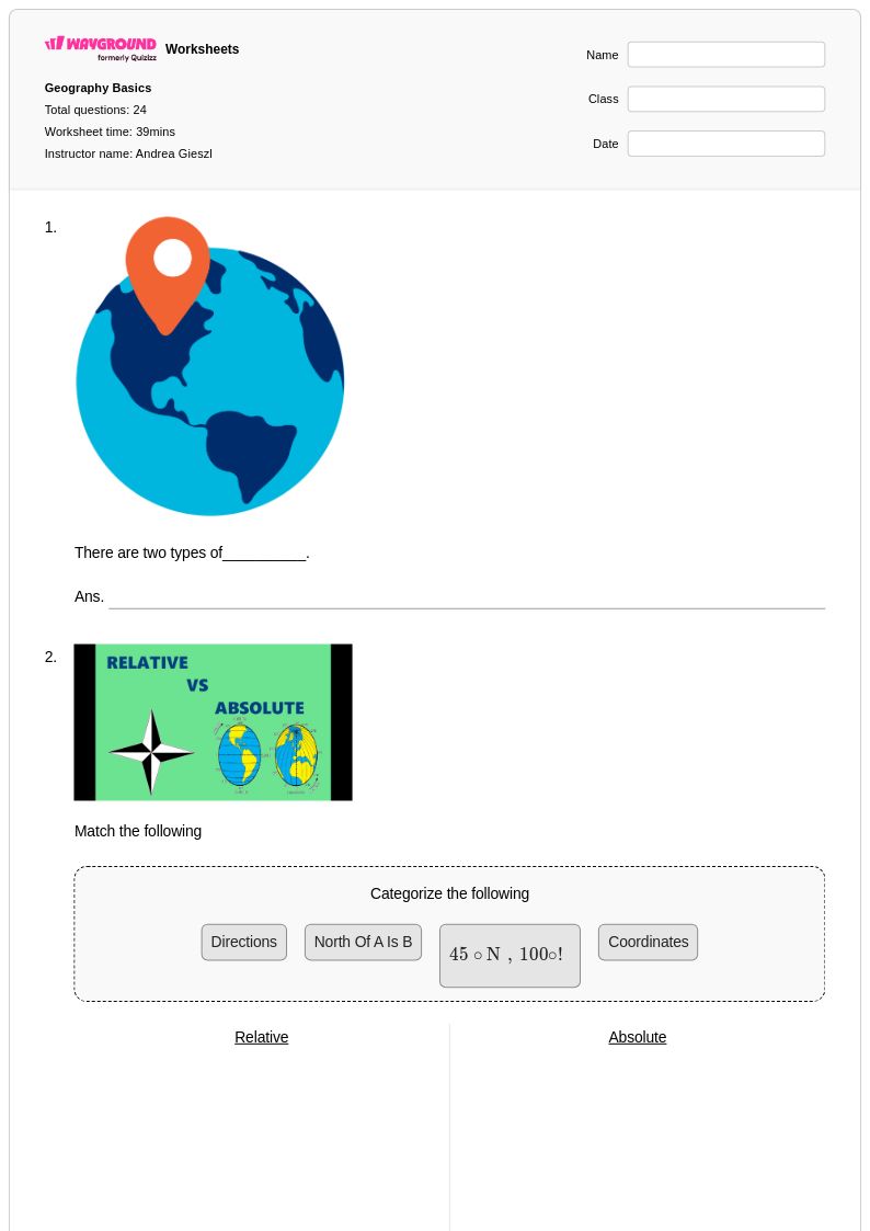
- Absolute and Relative Location
- Absolute Location
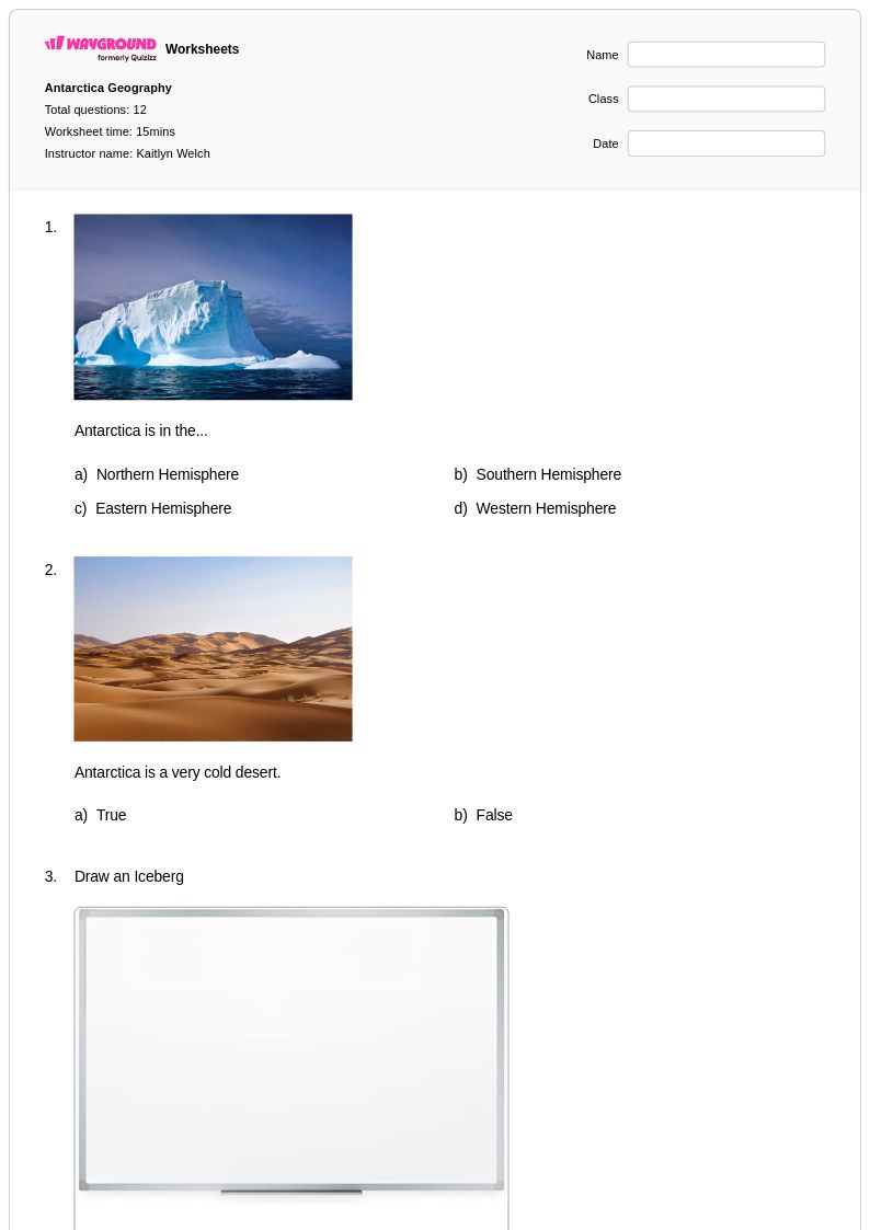
- Antarctica
- Asia
- Atmospheric Circulation and Weather Systems
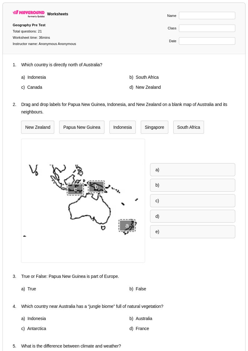
- Australia
- Bodies of Water
- Boundary Exploration
- Canada
- Capital Cities
- Cardinal and Intermediate Directions
- Cardinal Directions
- Climate Zones
- Climograph
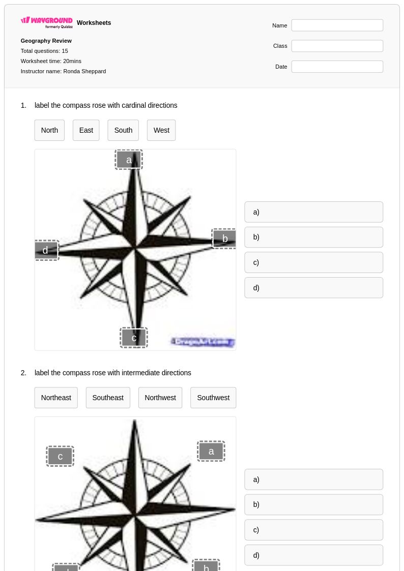
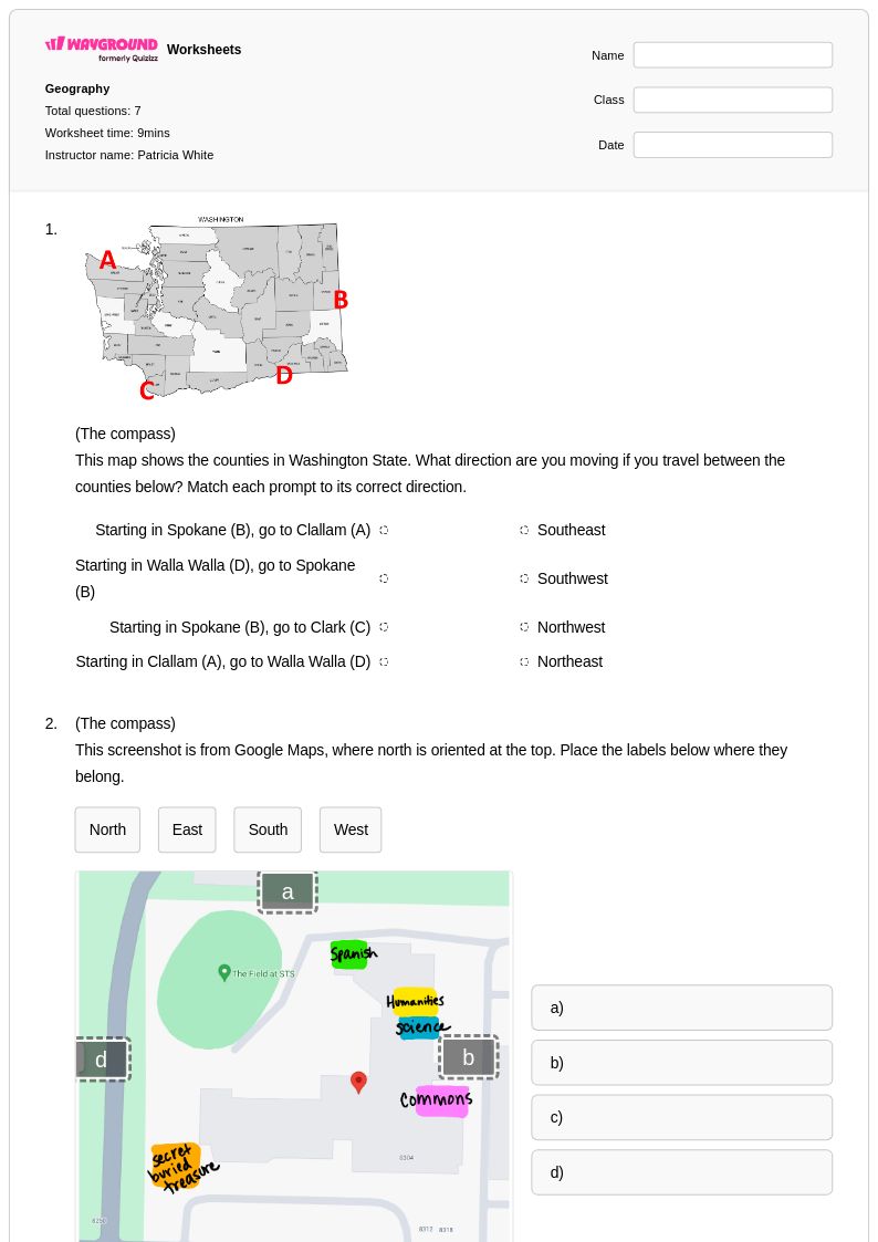
- Compass Rose
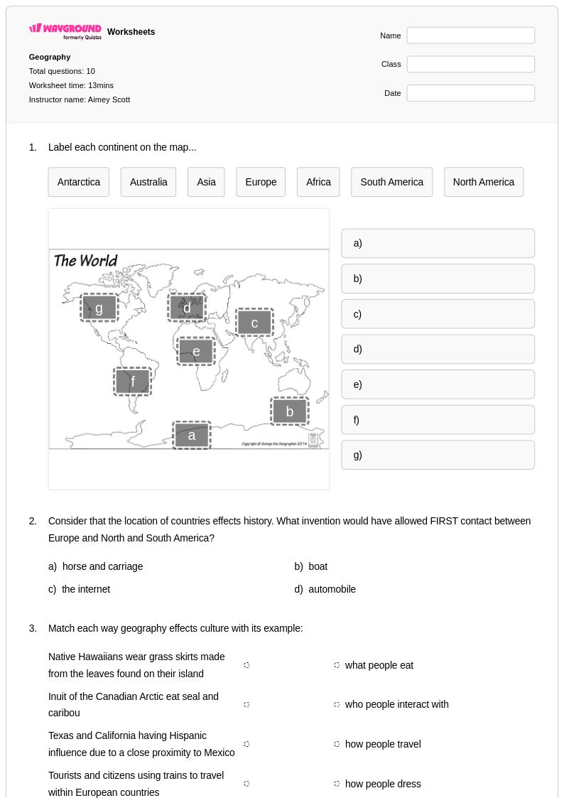
- Continents
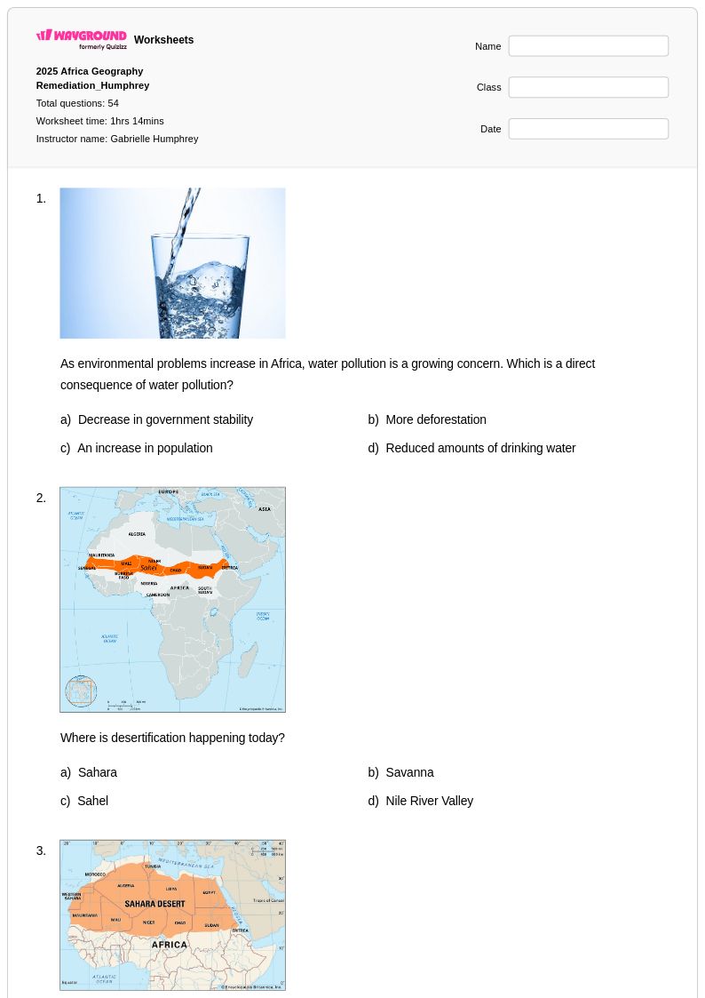
- Countries in Africa
- Countries in Asia
- Countries in Europe
- Countries in South America
- Elevation Maps
- France
- Geographical Boundaries
- Geographical Regions
- Human Population
- Landforms
- Landmarks
- Latitude and Longitude
- Map Components
- Map Elements
- Map Grid
- Map Projections
- Map Scale
- Map Scaling
- Mapping Skills
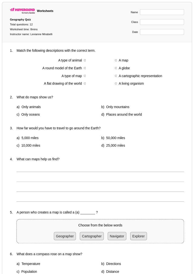
- Maps
- Maps and Globes
- Meridians and Parallels
- Mexico
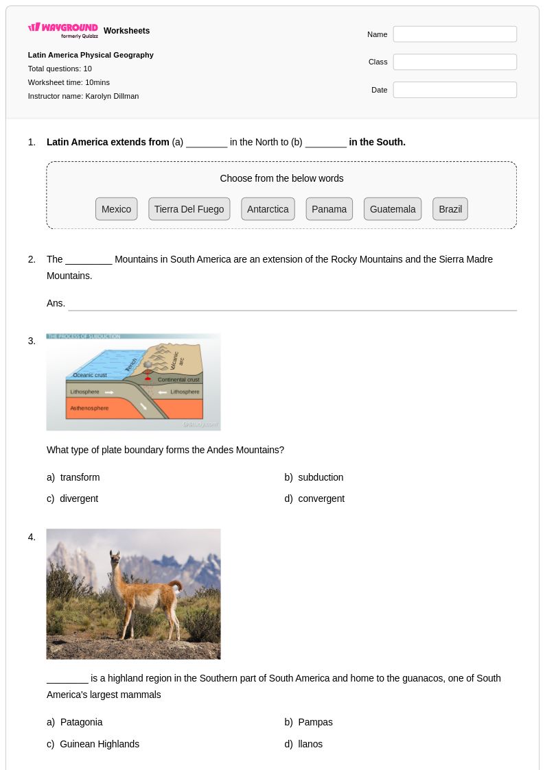
- Minerals and Rocks
- Mountains
- Movements of Ocean Water
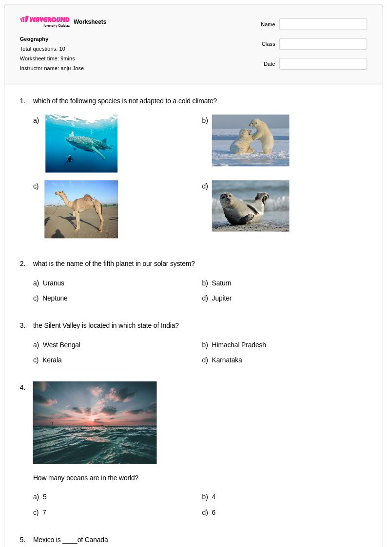
- Name of Oceans
- North America Historical Maps
- Northeast Region
- Northeast States
- Oceania
- Panama Canal
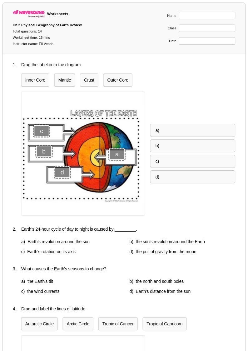
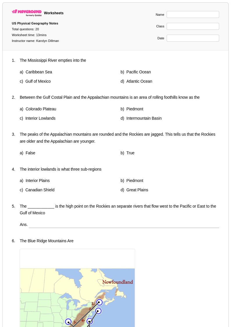
- Physical Features
- Physical Maps
- Political Maps
- Population Age Structure
- Population Density
- Population Graphs
- Population Pyramid
- Population Studies
- Reading a Map
- Regions of Georgia
- Regions of Texas
- Regions of the United States
- Rivers
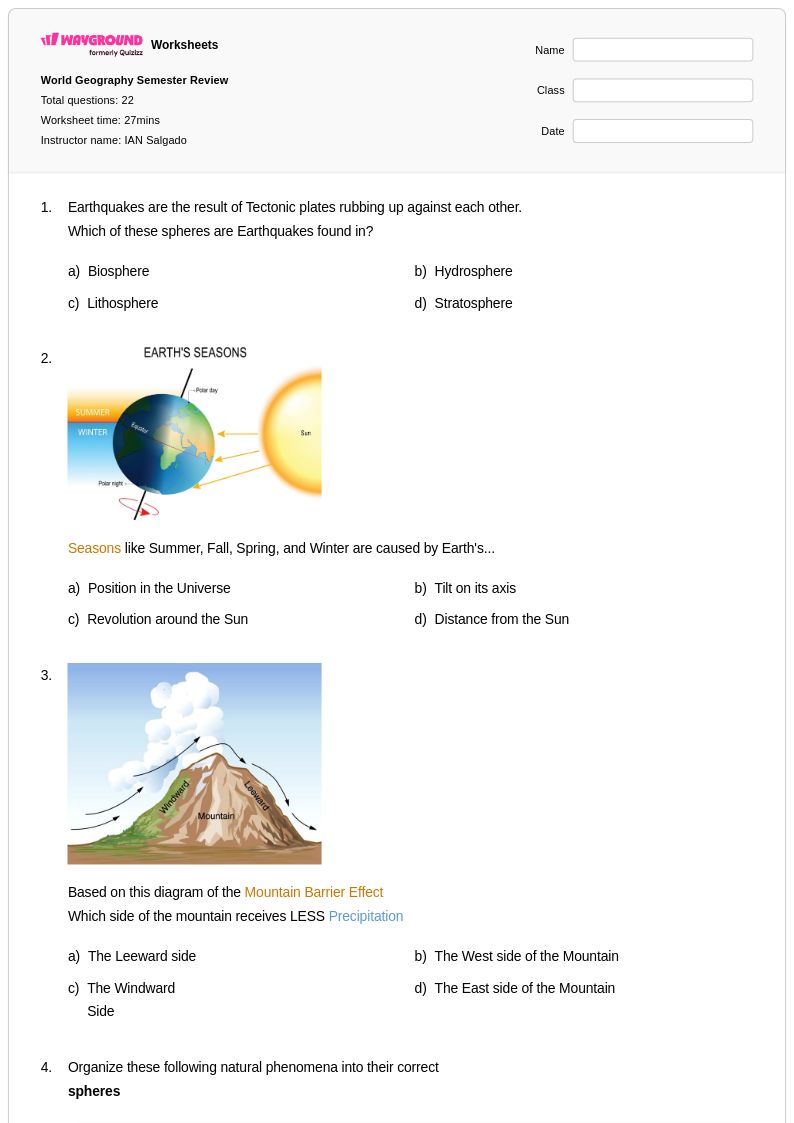
- Seasons
- Soils
- State Abbreviations
- State Facts
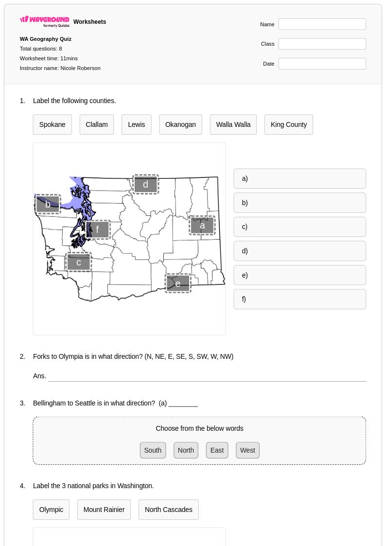
- State Maps
- States and Capitals
- Time Zones
- Topographic Map Reading
- Topographic Maps
- Types of Maps
- United States Map
- US States
- Virginia Regions
- World Climate and Climate Change
- World Map
18 คิว
7th
10 คิว
5th
15 คิว
6th
10 คิว
7th
21 คิว
4th
24 คิว
1st - 5th
12 คิว
3rd
10 คิว
8th
15 คิว
5th
14 คิว
6th - 8th
7 คิว
7th
10 คิว
8th
10 คิว
9th - 12th
12 คิว
6th - 7th
20 คิว
8th
8 คิว
7th
10 คิว
2nd
25 คิว
7th
16 คิว
3rd
6 คิว
7th
22 คิว
9th
13 คิว
3rd
56 คิว
7th
สำรวจแผ่นงานตามเกรด
สำรวจแผ่นงาน Geography ตามหัวข้อ
- 50 States
- Absolute and Relative Location
- Absolute Location
- Antarctica
- Asia
- Atmospheric Circulation and Weather Systems
- Australia
- Bodies of Water
- Boundary Exploration
- Canada
- Capital Cities
- Cardinal and Intermediate Directions
- Cardinal Directions
- Climate Zones
- Climograph
- Compass Rose
- Continents
- Countries in Africa
- Countries in Asia
- Countries in Europe
สำรวจแผ่นงานตามหัวเรื่อง
Explore printable Geography worksheets
Geography worksheets available through Wayground (formerly Quizizz) provide comprehensive resources for developing essential spatial thinking and world knowledge skills across all educational levels. These expertly crafted materials cover fundamental geographic concepts including physical features, climate patterns, cultural regions, population distribution, and human-environment interactions. Students engage with practice problems that strengthen map reading abilities, coordinate system understanding, and analytical skills needed to interpret demographic data and environmental patterns. Each worksheet collection includes detailed answer keys and is available as free printable pdf resources, making it easy for educators to implement immediate skill practice and assessment in their geography instruction.
Wayground (formerly Quizizz) supports geography educators with millions of teacher-created worksheet resources that feature robust search and filtering capabilities aligned to state and national geography standards. The platform's differentiation tools allow teachers to customize content complexity and focus areas, ensuring appropriate challenge levels for diverse learners while maintaining academic rigor. These geography worksheet collections are available in both printable pdf formats and interactive digital versions, providing flexibility for classroom instruction, homework assignments, and independent study. Teachers can efficiently plan comprehensive geography units, provide targeted remediation for struggling students, offer enrichment opportunities for advanced learners, and implement regular skill practice sessions that build geographic literacy and critical thinking capabilities essential for understanding our interconnected world.
FAQs
How do I teach geography concepts like map skills and physical features to students?
What exercises help students practice map reading and geographic skills?
What are the most common mistakes students make when learning latitude, longitude, and coordinate systems?
How can I use geography worksheets to help students understand population data and demographic concepts?
How do I differentiate geography worksheets for students at different skill levels?
How do I use Wayground's geography worksheets in my classroom?