
16 Q
5th
14 Q
5th
18 Q
5th
71 Q
5th
15 Q
3rd - 5th
15 Q
5th
20 Q
5th
25 Q
5th
10 Q
5th
20 Q
5th
50 Q
4th - 6th
21 Q
5th - 6th
10 Q
2nd - 5th
10 Q
5th
12 Q
5th
12 Q
1st - Uni
25 Q
5th - Uni
10 Q
5th
11 Q
5th
25 Q
4th - Uni
17 Q
4th - Uni
16 Q
5th
16 Q
5th
27 Q
5th
Explore Other Subject Worksheets for class 5
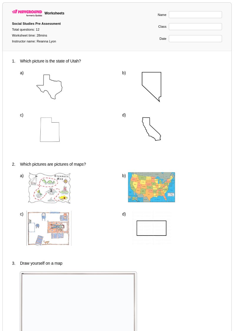
Explore printable State Maps worksheets for Class 5
State maps worksheets for Class 5 available through Wayground provide essential geography education resources that help students develop spatial awareness and geographic literacy skills. These comprehensive printables focus on teaching fifth-grade students how to identify state boundaries, locate major cities and landmarks, understand topographical features, and recognize regional characteristics across the United States. The worksheet collections include detailed practice problems that challenge students to label state capitals, trace state outlines, identify neighboring states, and analyze geographic patterns. Each worksheet comes with a corresponding answer key, making it easy for teachers to facilitate independent learning and provide immediate feedback. These free resources are designed as pdf downloads, ensuring consistent formatting and easy distribution for both classroom instruction and homework assignments.
Wayground's extensive library contains millions of teacher-created state maps worksheets specifically curated for Class 5 geography instruction, offering educators unprecedented access to high-quality educational materials. The platform's advanced search and filtering capabilities allow teachers to quickly locate worksheets that align with specific curriculum standards and learning objectives, whether they need basic state identification exercises or more complex regional analysis activities. Teachers can easily differentiate instruction by selecting from various difficulty levels and worksheet formats, while the flexible customization tools enable them to modify content to meet individual student needs. Available in both printable pdf format and interactive digital versions, these resources support diverse teaching approaches and learning environments. This comprehensive collection streamlines lesson planning while providing targeted materials for remediation, skill practice, and enrichment activities that strengthen students' understanding of American geography.
FAQs
How do I teach students to read and interpret state maps?
What exercises help students practice U.S. state geography?
What common mistakes do students make when working with state maps?
How can I differentiate state maps instruction for students at different skill levels?
How do I use Wayground's state maps worksheets in my classroom?