Explore our comprehensive collection of free United States Map worksheets and printables that help students master American geography through engaging practice problems, complete with answer keys for effective learning.
United States Map worksheets available through Wayground (formerly Quizizz) provide comprehensive geography practice that strengthens students' foundational knowledge of American geography and spatial reasoning skills. These carefully designed printables help learners master essential concepts including state identification, capital cities, major landforms, regional boundaries, and the geographic relationships between different areas of the country. Each worksheet collection includes detailed answer keys and offers free access to practice problems that range from basic state labeling exercises to more complex activities involving climate zones, population density, and economic regions. Students develop critical map-reading abilities while building confidence with both physical and political geography concepts through these structured pdf resources.
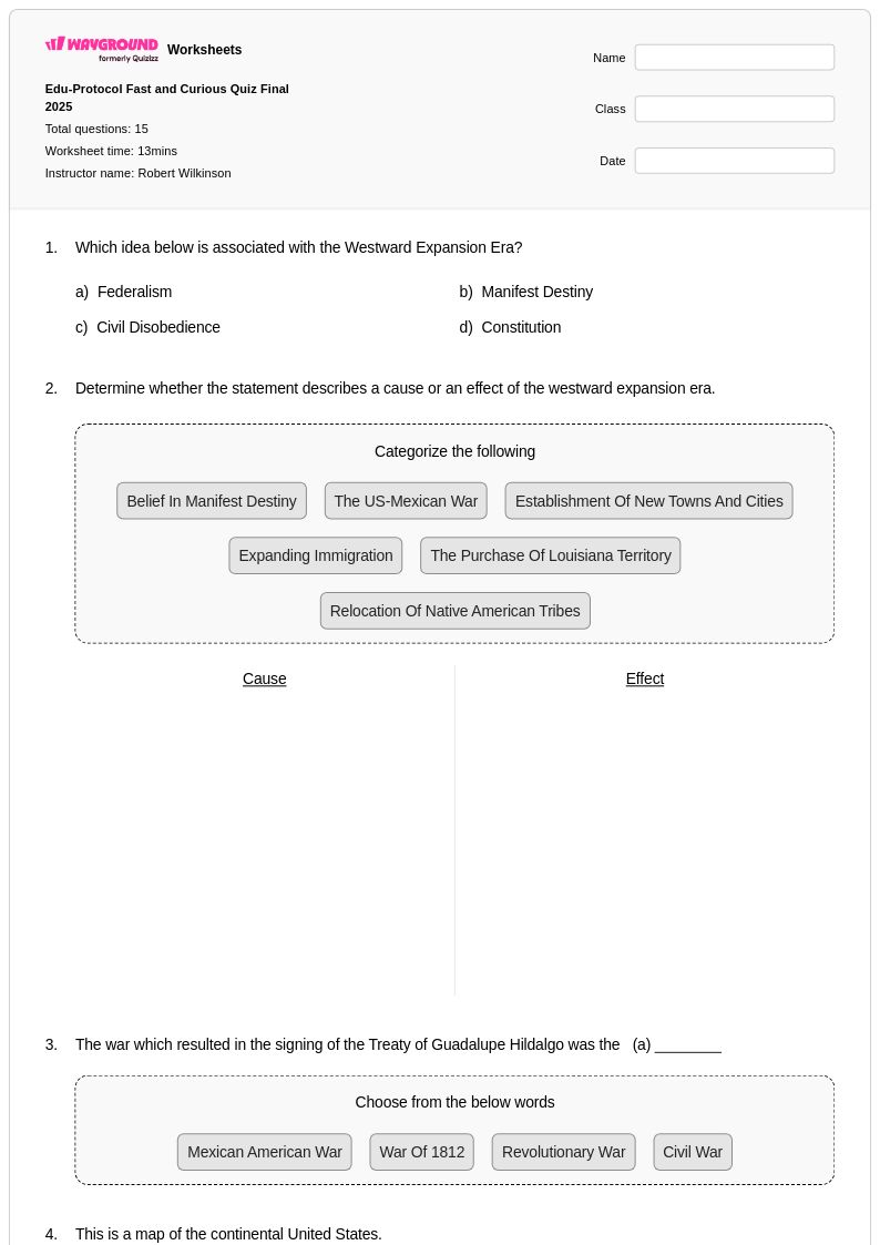
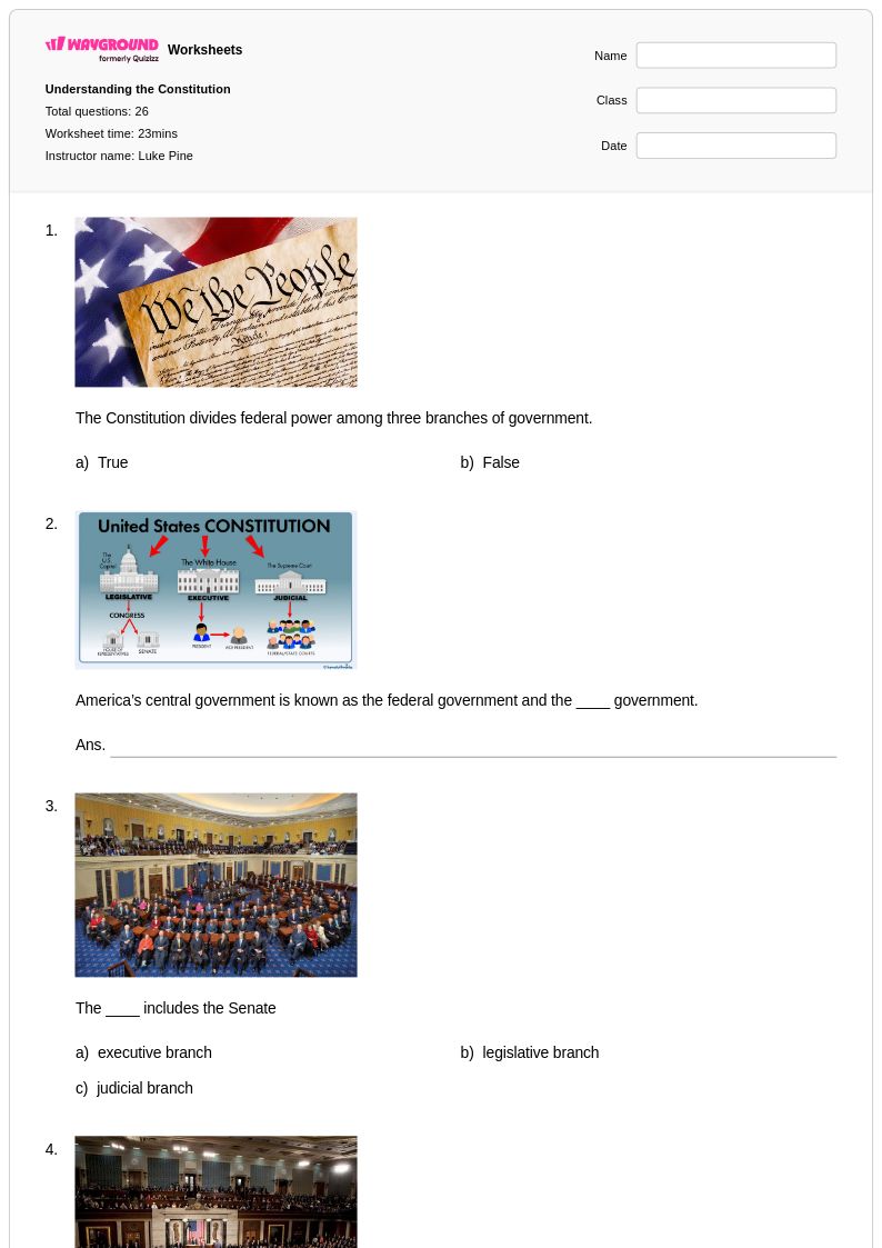
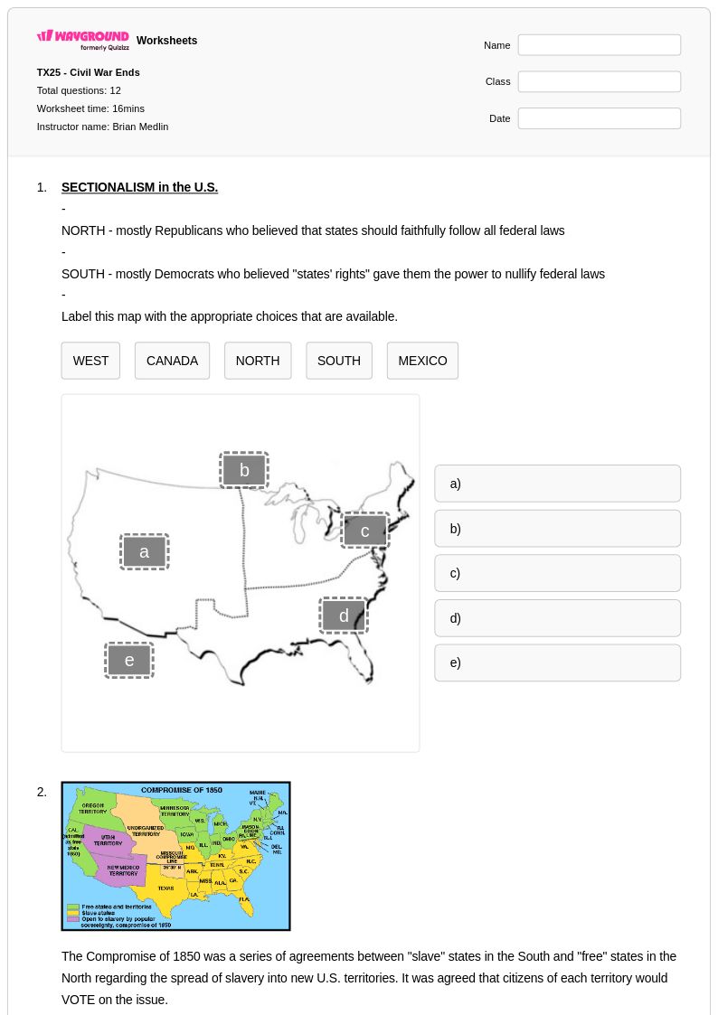
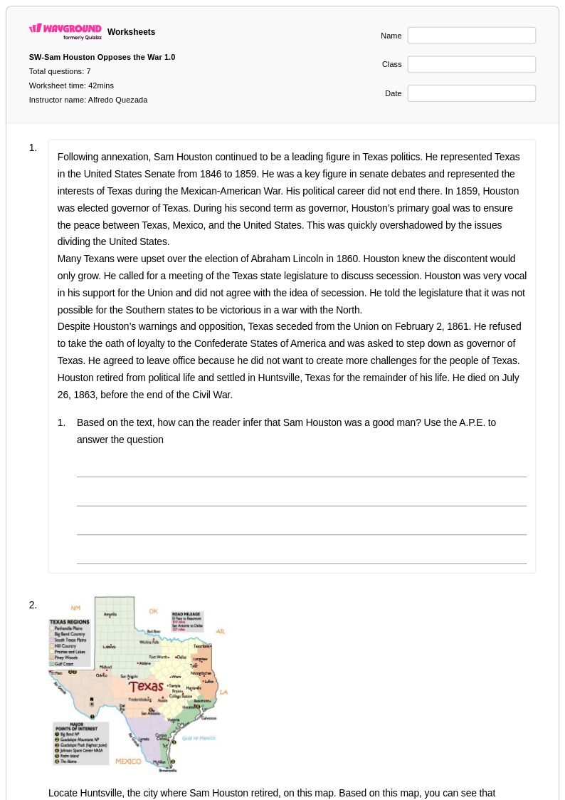
Wayground (formerly Quizizz) empowers educators with millions of teacher-created United States Map worksheet resources that feature robust search and filtering capabilities aligned with national geography standards. Teachers can easily differentiate instruction by accessing materials suited for various skill levels, from introductory state recognition activities to advanced geographic analysis exercises. The platform's flexible customization tools allow educators to modify existing worksheets or create entirely new assessments, while both printable and digital pdf formats ensure seamless integration into any classroom environment. These comprehensive collections support effective lesson planning and provide targeted resources for remediation, enrichment, and ongoing skill practice, enabling teachers to address diverse learning needs while maintaining rigorous geographic education standards.
FAQs
How do I teach students to read and interpret a United States map?
Start by introducing the political map, having students locate and label all 50 states before moving to capitals and regional groupings. Once students are comfortable with basic identification, layer in physical geography concepts such as major mountain ranges, river systems, and coastlines. Using blank outline maps for repeated practice is one of the most effective strategies for building long-term retention of state locations and geographic relationships.
What activities help students practice U.S. state identification and geography?
Blank map labeling exercises are the cornerstone of U.S. geography practice, requiring students to recall state names, capitals, and boundaries from memory. Supplement these with map-reading tasks that ask students to identify geographic regions, climate zones, or major landforms to build spatial reasoning alongside memorization. Rotating between political and physical map formats ensures students develop a well-rounded understanding of American geography.
What mistakes do students commonly make when learning U.S. geography?
Students frequently confuse states that share similar shapes or border one another, particularly in the Northeast where states are small and densely packed. Mixing up state capitals is also common, especially for states like Indiana (Indianapolis) and Illinois (Springfield), where students often default to the largest city instead. Another persistent error is conflating physical regions with political boundaries, such as assuming the Midwest and the Great Plains are identical regions.
How can I differentiate U.S. map instruction for students at different skill levels?
For students just beginning, focus on the contiguous 48 states using word banks and partially labeled maps to reduce cognitive load before removing scaffolds. More advanced students can work with unlabeled maps that require independent recall, or tackle tasks involving geographic analysis such as comparing population density across regions. On Wayground, teachers can apply accommodations such as reduced answer choices or read-aloud support to individual students, allowing differentiated practice within the same assignment without disrupting the rest of the class.
How do I use Wayground's United States Map worksheets in my classroom?
Wayground's United States Map worksheets are available as printable PDFs for traditional classroom use and in digital formats for technology-integrated environments, giving teachers flexibility regardless of their classroom setup. Teachers can also host worksheets as an interactive quiz directly on Wayground, making them suitable for in-class review sessions or independent student practice. Both formats include complete answer keys, so grading and feedback are straightforward whether students are working on paper or on a device.
How do I help students who struggle to remember the locations of U.S. states?
Repeated low-stakes retrieval practice, such as daily blank map quizzes covering a small set of states at a time, is far more effective than one-time exposure. Grouping states by region and teaching each cluster before combining them helps students build a mental framework rather than memorizing 50 isolated locations. Connecting states to cultural landmarks, historical events, or student-relevant context also strengthens geographic memory over time.