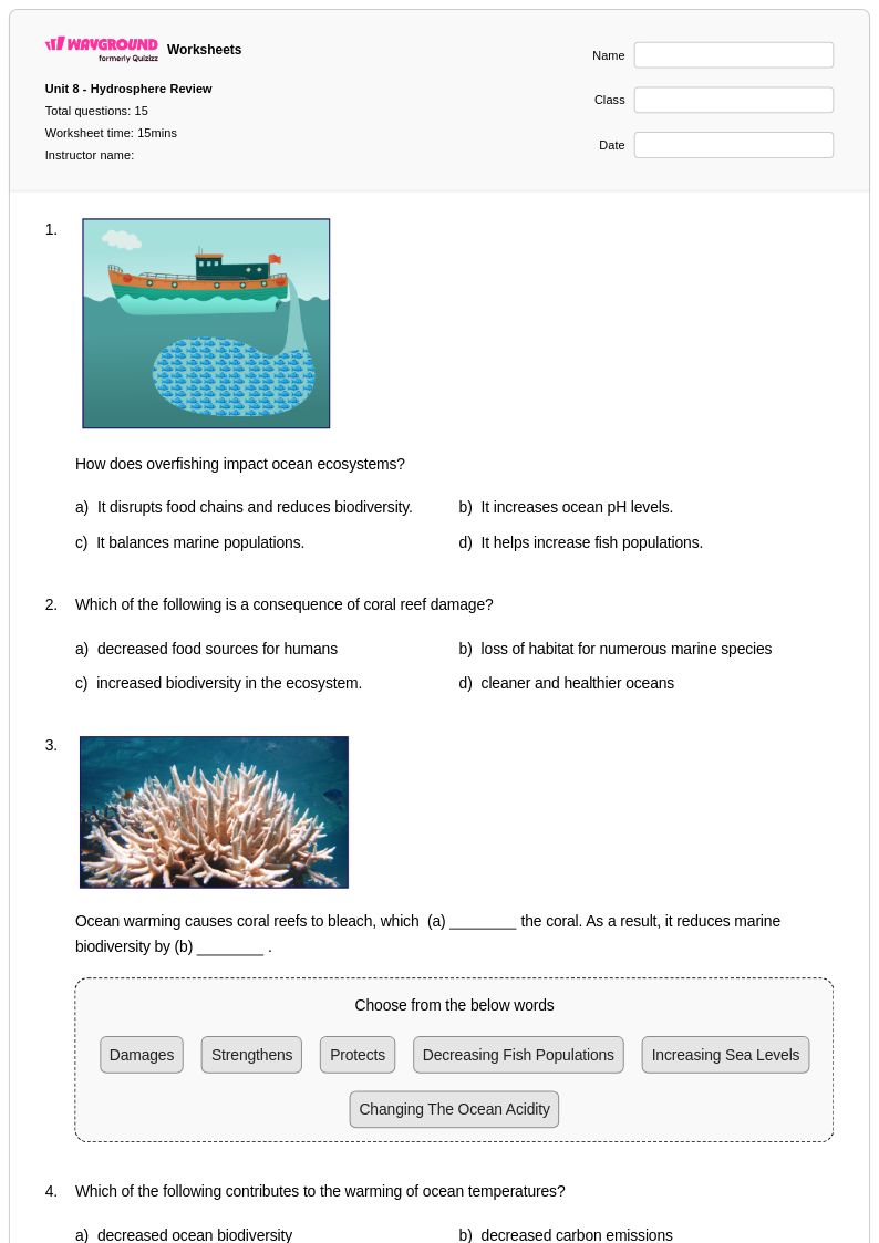
Year 7 watershed worksheets and printables help students explore how water flows through ecosystems, featuring free PDF practice problems with answer keys to master Earth and space science concepts.
Watershed worksheets for Year 7 students available through Wayground (formerly Quizizz) provide comprehensive practice in understanding how water moves through natural drainage systems and impacts local ecosystems. These educational resources strengthen critical thinking skills as students analyze topographic maps to identify watershed boundaries, trace the flow of water from precipitation to collection points, and examine how human activities affect water quality within drainage basins. The worksheets feature diverse practice problems that challenge seventh graders to connect concepts of surface runoff, groundwater recharge, and pollution sources while developing their ability to interpret scientific data and draw evidence-based conclusions. Teachers can access complete answer keys and printable pdf versions that support both classroom instruction and independent study, making these free resources invaluable for reinforcing complex earth science concepts through hands-on learning experiences.
Wayground (formerly Quizizz) empowers educators with millions of teacher-created watershed resources specifically designed for middle school earth and space science curricula. The platform's robust search and filtering capabilities allow teachers to quickly locate materials aligned with state and national science standards, while built-in differentiation tools enable customization for diverse learning needs and ability levels. These watershed worksheet collections are available in both digital and printable pdf formats, providing flexibility for traditional classroom environments, remote learning situations, and hybrid instructional models. Teachers utilize these comprehensive resources for targeted skill practice, remediation support for struggling learners, and enrichment activities for advanced students, ensuring that lesson planning becomes more efficient while maintaining high-quality instruction that meets the rigorous demands of Year 7 earth science education.
FAQs
How do I teach watershed concepts to students?
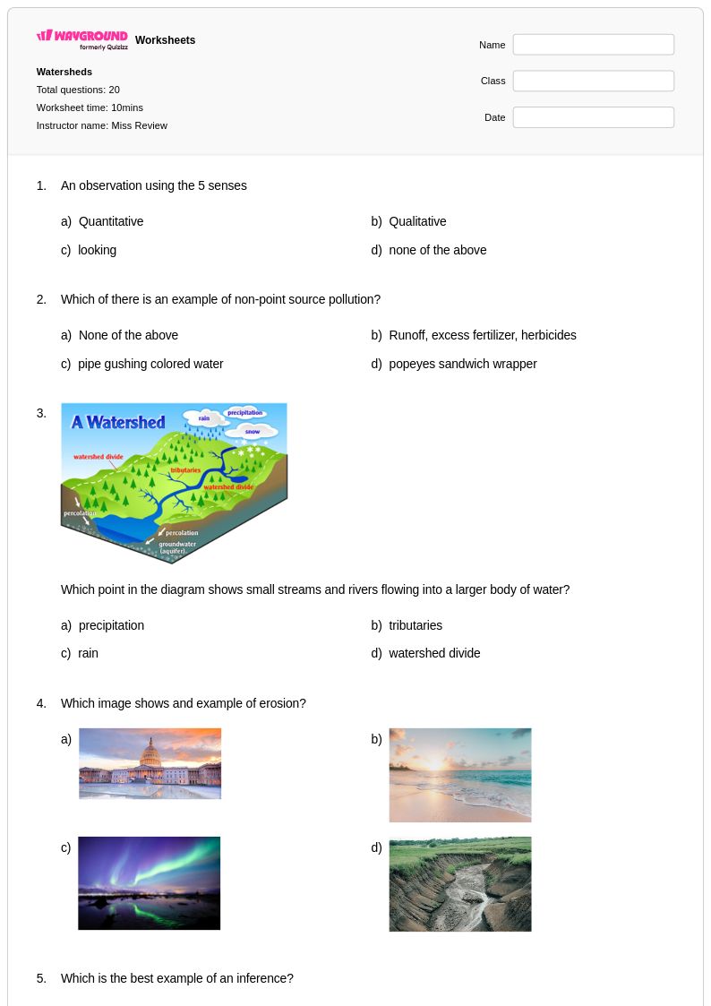
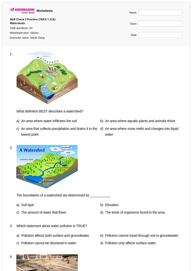
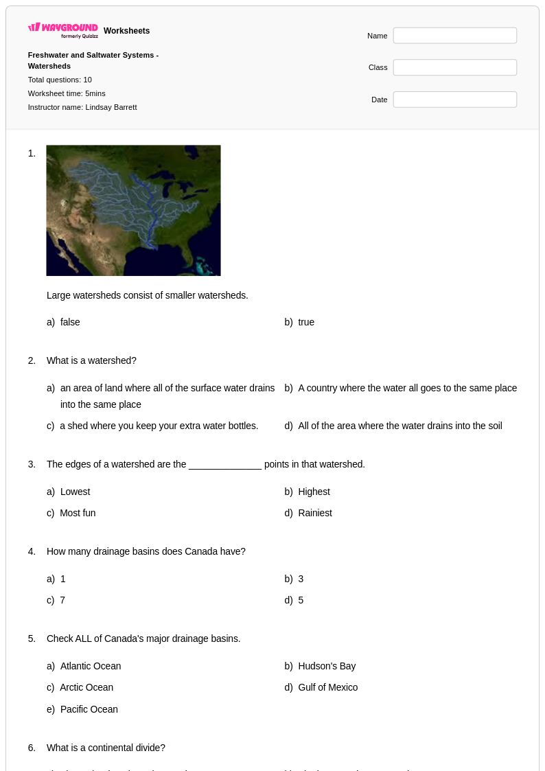
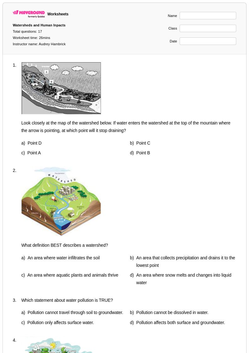
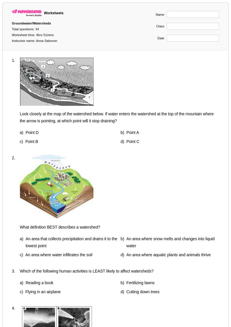
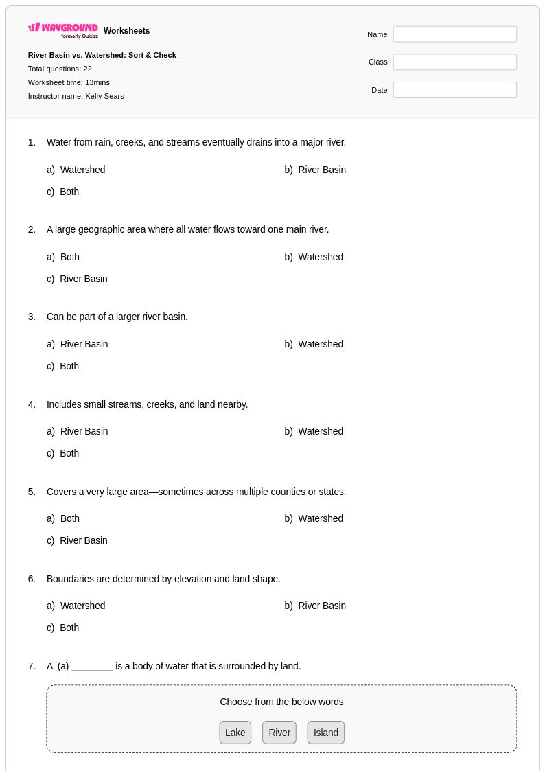
Start by grounding students in the physical geography of a watershed: any area of land that drains to a common point, shaped by ridgelines and topography. Use topographic maps to have students trace water flow directions and identify drainage basin boundaries before introducing human impacts. Connecting a local or regional watershed to students' drinking water or a nearby river gives the concept immediate relevance and improves retention.
What exercises help students practice identifying watershed boundaries and drainage patterns?
Topographic map interpretation exercises are the most effective practice tool for watershed concepts, requiring students to identify ridgelines, trace flow direction using elevation contours, and delineate basin boundaries. Worksheets that progress from basic watershed identification to pollution source tracking — distinguishing point source from non-point source pollution — build the analytical skills students need for assessments. Practice problems that ask students to connect surface runoff to groundwater recharge also reinforce the integrated nature of water systems.
What misconceptions do students commonly have about watersheds?
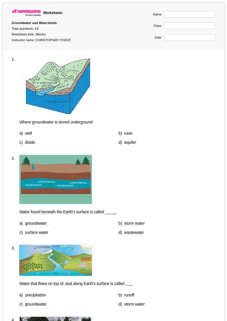
One of the most persistent misconceptions is that watershed boundaries follow political or visible physical lines rather than topographic ridgelines, leading students to incorrectly delineate drainage basins. Students also frequently confuse point source pollution (a discrete, identifiable outlet) with non-point source pollution (diffuse runoff from land surfaces), which undermines their ability to evaluate human impacts on water quality. A third common error is treating surface water and groundwater as separate, unconnected systems rather than understanding how groundwater recharge links them.
How do I differentiate watershed instruction for students at different skill levels?
For students who are struggling, focus first on the core vocabulary — watershed, drainage basin, divide, runoff — before introducing topographic map reading. For advanced students, add complexity by incorporating pollution source analysis, water quality data interpretation, or multi-watershed comparisons. On Wayground, teachers can apply accommodations such as reduced answer choices to lower cognitive load for individual students, or enable Read Aloud so students who need audio support can access question content independently, without disrupting the rest of the class.
How can I use Wayground's watershed worksheets in my classroom?
Wayground's watershed worksheets are available as printable PDFs for traditional classroom use and in digital formats for technology-integrated environments, making them flexible for lab days, homework, or sub plans. Teachers can also host the worksheets as a live or self-paced quiz directly on Wayground, which allows for real-time progress monitoring and instant feedback. The included answer keys make them practical for independent practice, formative assessment, or stations-based learning without requiring additional teacher prep.
How do watershed concepts connect to broader Earth Science standards?
Watersheds sit at the intersection of several Earth Science strands, including the water cycle, erosion and deposition, human impacts on ecosystems, and water quality. Understanding how a drainage basin functions requires students to apply knowledge of topography, precipitation, infiltration, and runoff simultaneously, which is why it is commonly assessed as an integrative concept in Earth and Space Science curricula. Instruction that links watershed health to real-world issues like agricultural runoff or urban stormwater management also connects to environmental science and Next Generation Science Standards performance expectations.