
 Worksheets
Earth Science - Semester 1
Total questions: 184
Worksheet time: 3hrs 16mins






120°W, 45°N

105°W, 47°N
100°W, 48°N



Longitudinal lines run
North and South
West and East
North and East
West and South


Gnomonic
Robinson
Mercator
Conic



Contour lines are
Imaginary lines that circle the Earth in a north and south direction
Imaginary lines that circle the Earth in an east and swest direction
the curved lines on a topographic map
the equator and prime meridian
Elevation is
the height above sea level
the curved lines on a topographic map
a small box that lists symbols and tells what they stand for
maps that show shape and elevation of the Earth's surface
Maps that show shape and elevation of the Earth's surface
physical map
topographic map
road map
historical map
The curved lines on a topographic map
contour lines
longitude lines
latitude lines
map scale


What is the elevation of point c?
800 ft
850 ft
1500 ft
1000 ft

Which side is steeper?
The left side of the hill
The right side of the hill







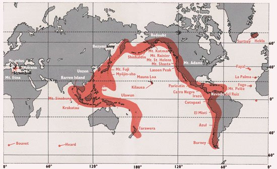


#1 is pointing to what part of the volcano?
Crater
Vent
Pipe
Ash

#6 is point to what part of the volcano?
Pyroclastic Material
Crater
Pipe
Vent




The processes in which water vapor (a gas) in the air turns into liquid water
Condensation
Evaporation
Precipitation
Transpiration

What is the process happening at #3
Evaporation
Precipitation
Condensation
Transpiration

What process is happening at #2
Evaporation
Condensation
Precipitation
Transpiration

Which part of the image of rocks will hold more water?
Right
Left
Center
What are examples of fresh water (there may be more than 1 correct answer)
Water in the atmosphere
Glaciers
Ocean water
Lake

This is when water evaporates through pores of a plant
Transpiration
Evaporation
Condensation
Hydrologic cycle
When rocks and soil become saturated, the ground water rises. This is called:
Spring
Geyser
Cave
Water Table
Which are examples of precipitation? (more than 1 correct answer)
rain
snow
wells
geysers
What types of soil can hold a LOT of water? (select all that apply)
Soil with few pores
Soil with lots of pores
Loosely packed soil
Tightly packed soil
Sediment is deposited as a river enters a lake because the
velocity of the river decreases
force of gravity decreases
volume of water increases
slope of the river increases
What factor(s) determine a river's ability to erode sediment?
Velocity
Gradient
Discharge
Stream Channel Shape
On a meander, the fastest flowing part of the river is...
the outside bend
the inside bend
the left hand side
the middle

